Photo By Laura Craig : High winds associated with severe thunderstorms uprooted this tree in Nellysford near the post office. Friday – June 28, 2019
Nelson County, Virginia
Severe Thunderstorms that moved through Nelson County late Friday afternoon caused numerous trees to come down in the high winds. Intense hail fell for a few minutes in Nellysford when the storms moved through.
Photo By Emily Butler : Peas sized hail covers the walkway at this home in Nellysford – Friday : June 28, 2019
Here’s where we have reports of trees down as of 6:15 PM Friday. Soe of these may have already been cleared.
-Near entrance to Stoney Creek and Route 151
-Hidden Creek Road off of Rodes Farm Drive : tree down on power line
-Route 151 north of Nellysford – Near Hatter Lake
-Route 151 in Roseland : Trees down at Hager Lane
-Report of mudslide on Route 6 (River Road) between Route 151 and US 29
We also have reports of power out in the Faber and other areas of Nelson.
Screen capture from CVEC outage map : Valid as of 6.28.19 – Click on image above for latest updates.
Photo courtesy of Wintergreen Fire & Rescue : A close up of a mobile warning system used this past Wednesday – June 26, 2019 to check audible quality of soon to be installed tornado alerts system at the resort.
Wintergreen
Nelson County, Virginia
Earlier this week Wintergreen Fire and Rescue began testing their tornado and multipurpose auduble warning system.
Above video courtesy of Wintergreen Fire & Rescue – Wednesday June 26, 2019
“We tested the smallest sirens, from beneath the tree canopy, and from only one location at a time. Ultimately we will broadcast simultaneously from up to five sites from above the tree canopy with larger sirens. Today we obtained data to help us understand what to procure and install,” WFD Chief Curtis Sheets said.
Chief Sheets also added that full implementation will take up to a year.
“The Virginia State Police Bureau of Criminal Investigation’s Appomattox Field Office is investigating a fatal fire in Augusta County. The fire, which occurred at a residence in the 100 block of Mount Torrey Road, was reported to Augusta County authorities at 11:08 a.m. Sunday (June 23). A resident of the house, Martha J. Craig, 59, was located inside the residence. She was deceased. No one else was inside the residence at the time of the fire.
Though the origin and cause of the fire are still under investigation, it does not appear to be suspicious in nature.
Photos courtesy of Buena Vista Police Department : Ellen Austin, mother of missing Chad Austin, talks to media this past Saturday – June 15, 2019 at a command post near Panther Falls in Amherst County, Virginia.
Near Panther Falls
Amherst County, Virginia
Release via Buena Vista, VA PD & Virginia State Police:
Approximately 80 public safety and search and rescue personnel spent the day conducting an extensive search of the Panther Falls area of Amherst County in an effort to locate a missing Buena Vista resident. Chad H. Austin, 30, was last seen Memorial Day (May 27) in the Panther Falls/Shady Mountain area by campers. His silver 2006 Hyundai Tiburon and his beloved mixed-breed dog, Gunner, were found abandoned about 12:30 p.m. the next day, May 28, on Panther Falls Road, east of where the Blue Ridge Parkway meets Route 60. Mr. Austin is 6 feet in height and weighs between 150 to 170 lbs. He has brown eyes and long brown hair, and was last seen wearing a gray tank top and long shorts, possibly beige in color.
Buena Vista, Virginia Police Chief Richard Hartman talks with media gathered Saturday during a search for missing Chad Austin who was last seen on Memorial Day 2019 in the Panther Falls/Shady Mountain area by campers.
“We are greatly appreciative of the many federal, state, local and private resources dedicated to Saturday’s search for Chad,” said Buena Vista Police Chief Richard Hartman. “This was an extremely organized, thorough search operation that covered some of this area’s most treacherous and challenging terrain. We are fortunate to have had such highly-trained, experienced search and canine teams conducting the operation.”
Participating in search operations since last week have been the Amherst County Sheriff’s Office, Virginia State Police, Virginia Department of Emergency Management (VDEM), Virginia Department of Game and Inland Fisheries (DGIF), U.S. Forest Service, Black Diamond Search and Rescue, Piedmont Search and Rescue, Blue Ridge Mountain Rescue, Search and Rescue Tracking Institute, Dogs East Search and Rescue, Shenandoah Mountain Rescue, Cambridgeshire Search and Rescue, and Mid-Atlantic Dogs. Also assisting with support operations during Saturday’s search were the American Red Cross, Rockbridge-Area Community Emergency Response Team (CERT), VMI Emergency Management, and Virginia Communications Cache – Montgomery.
Search & Rescue Teams Gather Saturday Morning During a Search Briefing at Command Post at Buena Vista Overlook. June 15, 2019
During the course of the investigation, the Buena Vista Police Department has received approximately 20 leads and is still encouraging the public to contact us with any information about Mr. Austin. He is well-known among the hiking and Appalachian Trail community.
Virginia State Police Trooper Roman Sachno III briefs his Search & Rescue Team before they begin search of Panther Falls Road in Amherst County, Virginia. June 15, 2019
“This is, and will remain, an active investigation until we can bring Chad home to his family. We are still urging anyone who may recall seeing Chad, his car or even his dog, Gunner, at any time over the Memorial Day weekend to please contact us. No detail is too minor as it may be the very information we need to find him,” said Chief Hartman.
Anyone with information about Mr. Austin is encouraged to call the Buena Vista Police Department at 540-261-6171 or the Virginia State Police at #77 on a cell phone or dial 911. His family has established a Facebook page @bring-chad-austin-home.
Photo Via BVPD : Chad Austin was last seen this past Memorial Day (May 29) by campers in the Panther Falls area, east of the Blue Ridge Parkway. He was wearing a gray tank top with long shorts below the knees, possibly beige in color.
Buena Vista,
Rockbridge County, Virginia
Verbatim release vis BVPD & VSP:
The Buena Vista Police Department expanded its search efforts Saturday (June 15) for a missing 30-year-old resident. With the assistance of the Virginia State Police, Virginia Department of Emergency Management (VDEM) and Amherst County Sheriff’s Office, an extensive search is underway near the Panther Falls area along Route 60 in Amherst County. Buena Vista Police also hope to hear from anyone who may have been passing through the Panther Falls area over the Memorial Day weekend and may recall having seen Chad H. Austin or his vehicle, a silver 2006 Hyundai Tiburon.
Mr. Austin was last seen this past Memorial Day (May 29) by campers in the Panther Falls area, east of the Blue Ridge Parkway. He was wearing a gray tank top with long shorts below the knees, possibly beige in color.
Mr. Austin was reported missing after his silver Hyundai Tiburon was found around 12:30 p.m. Tuesday (May 28, 2019) on Panther Falls Road in the Shady Mountain/Pedlar River area of Amherst County. The car was found abandoned about 2 miles down the turnoff for Panther Falls Road. His beloved, mixed-breed companion, a dog named Gunner, was locked inside the car.
Tuesday (May 28, 2019) on Panther Falls Road in the Shady Mountain/Pedlar River area of Amherst County. The car was found abandoned about 2 miles down the turnoff for Panther Falls Road. His beloved, mixed-breed companion, a dog named Gunner, was locked inside the car.
“This is extremely unusual for Chad to have gone this long without communicating with his family or close friends,” said Buena Vista Police Chief Richard Hartman. “It’s also very out-of-character for Chad to have left Gunner behind and put at risk by being left inside a locked vehicle. Chad’s family says the two have been inseparable since Chad got him as a puppy and would never willingly let any harm come of him or to any animal, for that matter.”
A search of the immediate area resulted in several keys and other personal items belonging to Mr. Austin being found about a ½ mile from the abandoned car.
“Chad was well-known among the hiking community in this region and along the Appalachian Trail for his charitable goodwill, as he would often help with rides and food, and help folks find places to stay,” said Chief Hartman. “We are asking anyone who may recall seeing Chad, his car or even his dog, Gunner, at any time over the Memorial Day weekend to please contact us. No detail is too minor as it may be the very information we need to bring him safely home to his family.”
A search of the immediate area resulted in several keys and other personal items belonging to Mr. Austin being found about a ½ mile from the abandoned car seen above.
Austin is 6 feet in height and weighs between 150 to 170 lbs. He has brown eyes and brown hair. His dog, Gunner, is now being cared for by Mr. Austin’s family.
Anyone with information about Mr. Austin is encouraged to call the Buena Vista Police Department at 540-261-6171 or the Virginia State Police at #77 on a cell phone or dial 911.
Photo By Brianna Hamblin via our media partners at CBS19 News in Charlottesville : Police block the area entering a rock quarry in Schuyler, Virginia on Tuesday evening – June 4, 2019. Rescue crews located a body of Thursday morning of the drown Hanover man.
Schuyler
Albemarle County, Virginia
As BRL has confirmed earlier Thursday, the body of missing 18 year old Henry Christian Morin of Doswell, Virginia was pulled from a water filled rock quarry in Schuyler, Virginia.
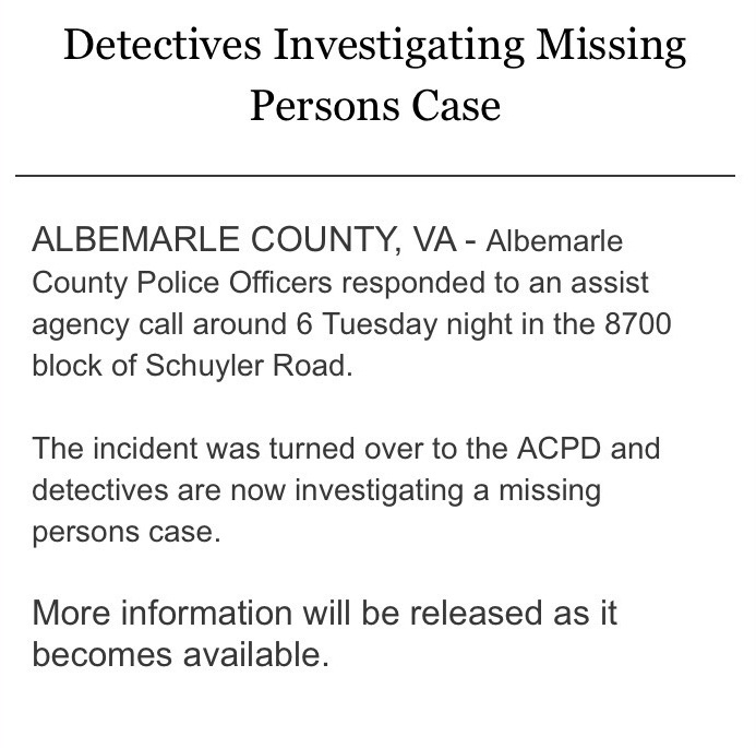
Release from ACPD at 1:15 PM :
ALBEMARLE COUNTY, VA –The Albemarle County Police Department (ACPD) can confirm that members of the Virginia State Police Search and Recovery Team have located the deceased body of missing 18-year-old Henry Christian Morin of Doswell, Virginia.
The missing teen was last seen swimming in a rock quarry near Schuyler on the afternoon of June 4.
The cause of death remains under investigation by the ACPD and the Office of the Chief Medical Examiner.
No further information will be provided at this time.
No explanation has been given by ACPD that might clarify as to why this is still being called a missing person’s case rather than a drowning or recovery operation.
At 5:52 PM ACPD also sent out the following message:
Good evening,
The search for Henry Christian Morin has been suspended for the rest of the day.
Efforts will resume on Thursday, June 6, 2019.
We will continue to bring you the latest information as it becomes available for release.
As a side note, Nelson Commonwealth Attorney Daniel Rutherford (who is not part of this particular investigation since it was on the Albemarle side) told us Wednesday afternoon that Nelson County Sheriff David Hill and his deputies have issued more than 70 citations for trespassing at the quarry since the beginning of Spring 2019.
Photo By Brianna Hamblin via our media partners at CBS19 News in Charlottesville : Police block the area entering a rock quarry in Schuyler, Virginia on Tuesday evening – June 4, 2019. Rescue crews were working to recover the body of an older teen who jumped into the quarry.
Schuyler
Albemarle County, Virginia
The investigation surrounding a teen who jumped into a rock quarry filled with water Tuesday evening continues. Numerous rescue agencies responded to the call around 6 PM Tuesday after several of the teen’s friends watched as he dove into the water from high above. He never resurfaced after the dive. That’s when rescue was called. After searching well into the night crews were unable to recover the body.
The drowning occurred just barely into Albemarle County side of Schuyler. In the predawn hours Wednesday, Albemarle County Police released the following statement below.
The statement released from ACPD at 1:39 AM Wednesday morning. June 5, 2019
As of 12 noon Wednesday ACPD released the following information to our news partners at CBS19.
“Albemarle Police confirm the name of the missing teen is Henry Christian Morin, 18, from Doswell. They are still referring to him as a missing person”
BRL has been able to independently confirm the case is being treated as a drowning since several witnesses saw the young man jump in and never resurface.
We have also learned that local police and deputies have issued in excess of 70 citations or summons in the past several months for people illegally trespassing into the quarry in Schuyler.
“It all really started with Dollar General. I’m not blaming Dollar General, but facts are facts, knocking 4000.00 dollars of profit out of the store. And I wasn’t buying as much so my wholesaler took a 3000.00 discount away. That’s 7000.00 right there. Then insurance companies started charging these crazy fees to all pharmacists, called DIR fees. It’s costing me about 75,000.00 a year that I wasn’t paying two years ago. This store lost about 100,000.00 in 2018.”
Stoney Creek Pharmacy owner Bob Ladd talks with Verizon on Friday – May 31, 2019. He was having all calls forwarded to CVS in Waynesboro where prescriptions would be handled for customers of the Nellysford pharmacy.
With Bob closing Stoney Creek Pharmacy it brings the end of a era. One that lasted 3 decades.
“Had I come in here in the beginning and been able to, I didn’t even try, to negotiate a lower lease I might have made it. And not paid as much for the business. I might have made it. I didn’t see those as options and my pro forma, and I’ve done dozens of them, showed me paying all of my bills, paying myself, and having money left over. It didn’t happen.”
Stoney Creek Pharmacy was moved to its final location after the late Cheryl Tompkins bought and then moved it from the old Afton Family Medicine building back to Nellysford.
The late Cheryl Tompkins and some of the original crew at Stoney Creek Pharmacy in March of 2011 a few years after she purchased the long running pharmacy and moved it back to Nellysford, VA.
The late Cheryl Tompkins (an avid motorcycle rider) with a friend in front of the old Stoney Creek Pharmacy in Afton in June of 2005. The pharmacy moved back to Nellysford in 2006 after she purchased the operation. It closed permanently May 31, 2019.
“This business has been here 32 years, it’s moved three times, but we’ve accumulated a lot of stuff. It bothers me they won’t have jobs here. They are all going to have jobs if they want them I think. And I helped a couple move on. The other thing that bothers me with customers / patients is they will have go quite a distance now to get prescriptions filled. And it was that way, by-the-way, back in the mid 80s. It’s come full circle.”
Boxes were being taped up and moved out on Friday – May 31, 2019 as Stoney Creek Pharmacy closed for good.
A sign on the door at Stoney Creek Pharmacy tells customers where their prescriptions had been moved to the CVS in Waynesboro. Friday – May 31, 2019
“It bothers me the geriatric patients, depend on other people to get their prescriptions. It’s not a pleasant feeling, it’s worse than melancholy, I feel a bit of a failure, but I know I’m not. If I could have held out till November, I could have rented a smaller space. In the last 6 months I’ve borrowed 60,000.00 dollars here against this business to operate it.”
After taking the summer off Bob tells me he will decide what he’s going to do next fall and winter. He still owns and operates two other pharmacies in other locations.
It truly is the end of an era here. Happy Trails Bob, it was a long run.
Via NWS : A Severe Thunderstorm Watch as of 8:95 PM now canceled in South Central Virginia. Click on image above for the latest updates from NWS.
8:05 PM : Severe Thunderstorm Watch is cancelled details here.
URGENT - IMMEDIATE BROADCAST REQUESTED Severe Thunderstorm Watch Number 300 NWS Storm Prediction Center Norman OK 130 PM EDT Fri May 31 2019 The NWS Storm Prediction Center has issued a * Severe Thunderstorm Watch for portions of North Carolina Southern Virginia Far southern West Virginia Coastal Waters * Effective this Friday afternoon and evening from 130 PM until 1100 PM EDT. * Primary threats include... Scattered damaging wind gusts to 70 mph likely Scattered large hail and isolated very large hail events to 2 inches in diameter possible SUMMARY...Episodic severe storms are expected into this evening with several cells and multiple clusters spreading east. Damaging winds are the primary threat, but large hail is possible as well. The severe thunderstorm watch area is approximately along and 105 statute miles north and south of a line from 35 miles south southwest of Dublin VA to 55 miles east northeast of New Bern NC. For a complete depiction of the watch see the associated watch outline update (WOUS64 KWNS WOU0). PRECAUTIONARY/PREPAREDNESS ACTIONS... REMEMBER...A Severe Thunderstorm Watch means conditions are favorable for severe thunderstorms in and close to the watch area. Persons in these areas should be on the lookout for threatening weather conditions and listen for later statements and possible warnings. Severe thunderstorms can and occasionally do produce tornadoes.
SEVERE THUNDERSTORM WATCH OUTLINE UPDATE FOR WS 300 NWS STORM PREDICTION CENTER NORMAN OK 130 PM EDT FRI MAY 31 2019 SEVERE THUNDERSTORM WATCH 300 IS IN EFFECT UNTIL 1100 PM EDT FOR THE FOLLOWING LOCATIONS VA . VIRGINIA COUNTIES INCLUDED ARE ALLEGHANY AMELIA AMHERST APPOMATTOX BATH BEDFORD BLAND BOTETOURT BRUNSWICK BUCKINGHAM CAMPBELL CARROLL CHARLOTTE CRAIG CUMBERLAND DINWIDDIE FLOYD FRANKLIN GILES GRAYSON GREENSVILLE HALIFAX HENRY ISLE OF WIGHT LUNENBURG MECKLENBURG MONTGOMERY NOTTOWAY PATRICK PITTSYLVANIA PRINCE EDWARD PRINCE GEORGE PULASKI ROANOKE ROCKBRIDGE SMYTH SOUTHAMPTON SURRY SUSSEX TAZEWELL WYTHE VIRGINIA INDEPENDENT CITIES INCLUDED ARE BUENA VISTA CHESAPEAKE COVINGTON DANVILLE EMPORIA FRANKLIN GALAX HOPEWELL LEXINGTON LYNCHBURG MARTINSVILLE NORFOLK PETERSBURG PORTSMOUTH RADFORD ROANOKE SALEM SUFFOLK VIRGINIA BEACH
")


")