Home Blog Page 734

Nelson SE sections : Severe Thunderstorm Warning until 3:45 PM – CANCELLED

0

REFRESH Nelson County Life Magazine HERE for the latest updates:

Updated: 3:07 PM EDT
307 PM EDT Tue Aug 21 2007

…The Severe Thunderstorm Warning for Nelson County is cancelled…

The severe thunderstorm has moved out of the warned area…therefore
the Severe Thunderstorm Warning has been cancelled.

A Severe Thunderstorm Watch remains in effect until 9 PM EDT.

View local radar by clicking here

BULLETIN – EAS ACTIVATION REQUESTED
SEVERE THUNDERSTORM WARNING
NATIONAL WEATHER SERVICE BALTIMORE MD/WASHINGTON DC
253 PM EDT TUE AUG 21 2007

THE NATIONAL WEATHER SERVICE IN STERLING VIRGINIA HAS ISSUED A

* SEVERE THUNDERSTORM WARNING FOR…
NELSON COUNTY IN CENTRAL VIRGINIA

* UNTIL 345 PM EDT

* AT 249 PM EDT…NATIONAL WEATHER SERVICE DOPPLER RADAR INDICATED A
SEVERE THUNDERSTORM. THIS STORM WAS LOCATED NEAR SHIPMAN…AND
MOVING EAST AT 20 MPH.

* LOCATIONS IMPACTED INCLUDE…
RURAL SOUTHEASTERN NELSON COUNTY

HAIL TO THE SIZE OF PENNIES AND WIND GUSTS TO 60 MPH CAN BE EXPECTED
IN THE WARNED AREA. STAY INDOORS AND AWAY FROM WINDOWS UNTIL THE
STORM HAS PASSED.

Amherst : Lowesville : Severe Thunderstorm Warning until 2:45 PM

0

REFRESH Nelson County Life Magazine HERE for the latest updates:

View local radar by clicking here.

BULLETIN – IMMEDIATE BROADCAST REQUESTED
SEVERE THUNDERSTORM WARNING
NATIONAL WEATHER SERVICE BLACKSBURG VA
222 PM EDT TUE AUG 21 2007

THE NATIONAL WEATHER SERVICE IN BLACKSBURG HAS ISSUED A

* SEVERE THUNDERSTORM WARNING FOR…
NORTHEASTERN AMHERST COUNTY IN CENTRAL VIRGINIA

* UNTIL 245 PM EDT

* AT 217 PM EDT…NATIONAL WEATHER SERVICE DOPPLER RADAR INDICATED A
SEVERE THUNDERSTORM CAPABLE OF PRODUCING PENNY SIZE HAIL…AND
DAMAGING WINDS IN EXCESS OF 60 MPH. THIS STORM WAS LOCATED NEAR
FORKS OF BUFFALO…AND MOVING EAST AT 25 MPH.

* LOCATIONS IMPACTED INCLUDE…
FORKS OF BUFFALO…
LOWESVILLE…
CLIFFORD…
NEW GLASGOW…

IF YOU ARE CAUGHT OUTSIDE…SEEK SHELTER FROM THE WEATHER IN A STRONG
BUILDING. DAMAGING WIND…LARGE HAIL…VERY HEAVY RAIN…AND DEADLY
LIGHTNING ARE ALL POSSIBLE IN SEVERE THUNDERSTORMS. STAY INSIDE AWAY
FROM WINDOWS UNTIL THE STORM HAS PASSED.

Nelson & Surrounding : Severe Thunderstorm Watch until 9 PM EDT

1

REFRESH Nelson County Life Magazine HERE for the latest updates:

Scroll below map and watch text for specific county and city outline area.

URGENT – IMMEDIATE BROADCAST REQUESTED
SEVERE THUNDERSTORM WATCH NUMBER 629
NWS STORM PREDICTION CENTER NORMAN OK
215 PM EDT TUE AUG 21 2007

THE NWS STORM PREDICTION CENTER HAS ISSUED A
SEVERE THUNDERSTORM WATCH FOR PORTIONS OF

NORTHWEST NORTH CAROLINA
WESTERN VIRGINIA
A SMALL PART OF THE EASTERN WEST VIRGINIA PANHANDLE

EFFECTIVE THIS TUESDAY AFTERNOON AND EVENING FROM 215 PM UNTIL
900 PM EDT.

HAIL TO 1.5 INCHES IN DIAMETER…THUNDERSTORM WIND GUSTS TO 70
MPH…AND DANGEROUS LIGHTNING ARE POSSIBLE IN THESE AREAS.

THE SEVERE THUNDERSTORM WATCH AREA IS APPROXIMATELY ALONG AND 55
STATUTE MILES EAST AND WEST OF A LINE FROM STAUNTON VIRGINIA TO
15 MILES EAST SOUTHEAST OF HICKORY NORTH CAROLINA. FOR A
COMPLETE DEPICTION OF THE WATCH SEE THE ASSOCIATED WATCH OUTLINE
UPDATE (WOUS64 KWNS WOU9).

REMEMBER…A SEVERE THUNDERSTORM WATCH MEANS CONDITIONS ARE
FAVORABLE FOR SEVERE THUNDERSTORMS IN AND CLOSE TO THE WATCH
AREA. PERSONS IN THESE AREAS SHOULD BE ON THE LOOKOUT FOR
THREATENING WEATHER CONDITIONS AND LISTEN FOR LATER STATEMENTS
AND POSSIBLE WARNINGS. SEVERE THUNDERSTORMS CAN AND OCCASIONALLY
DO PRODUCE TORNADOES.

DISCUSSION…THUNDERSTORMS ARE DEVELOPING OVER THE MOUNTAINS AND
FOOTHILLS IN ADVANCE OF THE REMNANTS OF TS ERIN. STRONG SURFACE
HEATING AND STEEP LOW-LEVEL LAPSE RATES WILL FAVOR DAMAGING
DOWNBURST WINDS AS CONVECTION ORGANIZES INTO SEVERAL SHORT LINE
SEGMENTS THROUGH THE AFTERNOON INTO NC/VA.

County / city outline area of watch:

WATCH COUNTY NOTIFICATION FOR WATCH 629
NATIONAL WEATHER SERVICE BALTIMORE MD/WASHINGTON DC
212 PM EDT TUE AUG 21 2007

VAC003-015-079-091-125-165-540-660-790-820-WVC071-220100-
/O.NEW.KLWX.SV.A.0629.070821T1815Z-070822T0100Z/

THE NATIONAL WEATHER SERVICE HAS ISSUED SEVERE THUNDERSTORM WATCH
629 IN EFFECT UNTIL 9 PM EDT THIS EVENING FOR THE FOLLOWING AREAS

IN VIRGINIA THIS WATCH INCLUDES 6 COUNTIES

IN CENTRAL VIRGINIA

ALBEMARLE GREENE NELSON

IN WESTERN VIRGINIA

AUGUSTA HIGHLAND ROCKINGHAM

IN WEST VIRGINIA THIS WATCH INCLUDES 1 COUNTY

IN NORTHEAST WEST VIRGINIA

PENDLETON

IN VIRGINIA THIS WATCH INCLUDES 4 INDEPENDENT CITIES

IN CENTRAL VIRGINIA

CHARLOTTESVILLE

IN NORTHWEST VIRGINIA

CITY OF HARRISONBURG

IN WESTERN VIRGINIA

CITY OF STAUNTON CITY OF WAYNESBORO

THIS INCLUDES THE CITIES OF…CHARLOTTESVILLE…CHARLOTTESVILLE…
FRANKLIN…GREENFIELD…HARRISONBURG…HARRISONBURG…MONTEREY…
STANARDSVILLE…STAUNTON…STAUNTON…WAYNESBORO AND WAYNESBORO.

Tuesday Weather : Wintergreen, Nelson County & The BRP : Mostly Cloudy : Scatterted T-Storms

0

REFRESH Nelson County Life Magazine HERE for the latest updates:

Weathercast by Tommy Stafford, Nelson County Life Magazine
NEW! AUDIO VERSION OF TODAY’S FORECAST

Photography by Elaine Weems
Nelson County Life Magazine – Copyright 2007
Butterflies @ Rodes Farm
Nellysford, Virginia

Rhodes Butterflies“It’s that time of the summer…the Joe Pye weeds are blooming and attracting the the Tiger Swallowtails.
Thought you may like a photo.”

NCL’s own, Paul Purpura, captured a great shot of them early this month too. Never get tired of seeing them. Thanks Elaine!

Wow! What happened to the sunshine I predicted yesterday. Remember it’s a prediction! I touched on this a little bit in my Monday afternoon update But we had scenario set up that’s called damming. It’s very similar to Cold Air Damming in the winter. Cold air damming occurs when a shallow cold air mass is funneled across the earth’s surface due to topography. Cold air is dense and stable and thus it resists flowing over elevated terrain unless the cold air mass is deep or the forward momentum of the air mass is strong. (Thanks to www.theweatherpredicton.com) When that air mass is very moist like yesterday’s it essentially forms fog / clouds up against the Blue Ridge Mountains in this case. We had light NNE breezes Monday with ample moisture banking against the mountains. On the west side of the Blue Ridge they had partly cloudy to sometimes mostly clear skies for part of the day. We just could never get enough dynamics in place to get it cleared. As you can see from the temperature at TWNF on the mountain, they were actually warmer than most valley locations.

Below (courtesy weatherunderground.com) is a screen snapshot I took of the satellite image over our area around 2-3PM. The yellow dot is Afton in the NW corner of Nelson County. Look at the Blue Ridge Mountains in that shot along and near the yellow dot. On the east side of the range in the valley, clouds, to the west, partly cloudy. A perfect example.
damming sat shot Blue ridge

This time of year it means nothing more than clouds and cool temps. It generally occurs in the winter and can set up for terrible ice storms in these parts. Thankfully we have a few more months before that can happen! We didn’t get to see the sun, but it was nice for a change to have some cool weather for a day.

Tuesday could turn out to be much like Monday in parts of Central Virginia. A warm front is slowly meandering back to the north across our area. All day Monday we were on the north side of that front. Depending on how much progress it makes today depends on how much, if any, clearing we get. If it slides well north we may see some sun between scattered thunderstorms.

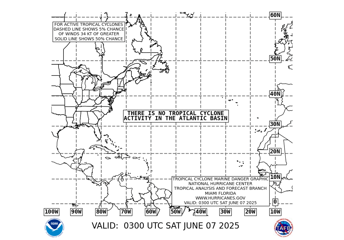
Today will be the last time I include Hurricane Dean in my morning cast unless he does something dramatic like making a right hook and heading for the Gulf Coast. Otherwise you can see below Dean is going west into Mexico.

Latest animated loop of the Atlantic and Dean:

Here’s the latest tracking map:

I am watching another area of disturbed weather way out in the Atlantic.


Right now this is nothing more than an area of low pressure, but it bears watching over the next several days. This could easily form into a tropical depression soon, I’ll keep you posted.

The numbers as of 11:59 PM EDT Monday night

*NCL-Nelson County Life Magazine : Greenfield / Afton
Mon High: 71.8° @ 12:43 AM (note: high temp was just after midnight)
0.14″ of rain

*NCL-Wintergreen Nature Foundation : Devil’s Knob
Mon High: 81.9 ° @ 2:24 PM (near high temperature for the immediate Nelson area)
0.10″ of rain

*NCL-Wintergreen Winery @ the foot of Wintergreen Mountain in Beech Grove
Mon High: 71.4° @ 5:05 PM
0.00″ of rain

*NCL-Delfosse Vineyard & Winery near Hickory Creek : Faber
Mon High: 71.6° @ 5:31 PM
0.08″ of rain

*NCL-Tiger Fuel – Lovingston
Mon High: 77.2° @ 4:20 PM
0.02″ of rain

*NCL-Mini Tara Vineyards – Arrington
Mon High: 82.2° @ 3:59 PM
0.00″ of rain

*Alternate: Non NCL site : Warminster-Wingina
Mon High: 78.9° @ 4:29 PM
0.00″ of rain

Here are other area rainfall totals via Nelson County Flood System Reporting stations.

A warm front continues to work its way northward through Virginia. As the day progresses southerly winds and more humidity will prevail. A series of disturbances will ride along the front providing chances for storms off and on today.
Current-Sat Surface Map

The National Forecast Map has the front in our vicinity until roughly Wednesday night or Thursday when it will wash out. Southern high pressure will take over and keep the remainder of the week quite hot and humid through the weekend.
Today’s Forecast Map

Local forecast
*Tuesday Partly to mostly cloudy. Showers with embedded thunderstorms across 70% of the area.
*High temps in Nellysford, Crozet & Colleen around 83°
*On the mountains above 2000 feet along the BRP, Montebello, Wintergreen, Three Ridges, Devil’s Knob, and Love, Mostly cloudy with showers and isolated thunderstorms.
Highs top out around 78°
Winds SW 5-10 MPH becoming northerly in the afternoon.

*Tuesday night Mostly cloudy a 50% chance of showers early, then additional showers after midnight.
*Lows valley around 65°
*On the mountains overnight low near 62°
*Winds N-5 MPH

Wednesday Mostly cloudy with widely scattered thunderstorms across 30% of the area.
*Highs valley around 85°
*On the mountains around 83°
Winds: N around 5 mph – becoming E around 5 mph in the afternoon.
*Wed night: Cloudy. Lows generally in the low 60’s valley and upper 60’s mountains.

Remainder of the week Look for partly sunny skies Thursday with hot temps back in the lower 90’s. The remainder of the week looks to be hot with minimal chances for rain and high temps in the low & mid 90’s valley and mid to upper 80’s mountains. Next chance for rain looks to be Sunday.

When severe weather or news breaks out, come here. We’ll have all of the latest watches, warnings, and coverage affecting Nelson County, Wintergreen, and nearby counties.

Have a great Tuesday!

Know your Nelson
-T-

Monday Weather : Wintergreen & Nelson County Virginia : Scattered Thunderstorms

0

REFRESH Nelson County Life Magazine HERE for the latest updates:

Update 2:48 PM EDT – Due to a phenomena called cold air damming, where moisture gets trapped up against the Blue Ridge Mountains, we’re having a hard time getting rid of the low cloud layer on the Rockfish side of the mountains. To the west skies are partly cloudy to mostly clear in many locations. We still have a shot at seeing some sunshine, but it’s having a very hard time clearing out the moisture. Due to those clouds, predicted high temps probably won’t make it. I’ll have more on cold air damming and a sat shot that shows it perfectly in my Tuesday weathercast.

-T-
Update 12:40 PM EDT: Sunshine will eventually work into the area later today. Clouds are hanging in across the area.. Light NE winds have kept temps down the first part of the day. We will begin warming as the clouds thin. Local satellite shows the clearing line very near the area, Staunton on the noon half hour was reporting partly sunny to mostly clear skies. That area will move our way over the next couple of hours.

One other mention. Severe weather may be in the future on Tuesday. Perhaps even an isolated tornado. Believe it or not the remnants of Tropical Depression Erin will kick abundant moisture up our way Tuesday. This will combine with other factors to create a possible severe weather scenario. I’ll talk more about this in Tuesday’s forecast tomorrow.

Have a great rest of the afternoon.
-T-

Weathercast by Tommy Stafford, Nelson County Life Magazine
NEW! AUDIO VERSION OF MONDAY’S FORECAST

Photography by Tommy Stafford
Nelson County Life Magazine – Copyright 2007
Happy 102nd Biirthday!
Roseland, Virginia

Happy 102

Several things to talk about this morning before we get off into the thick of the weather. First I just couldn’t pass up wishing Happy Birthday to a senior mentioned on the sign in front of Bethlehem Methodist in Roseland. Happy Birthday Ms. Cora Sexter! I don’t know Ms. Cora, but anyone that makes it 102 years in this world deserves recognition! I saw this Sunday driving back from Amherst along 151 in Roseland. Here’s to 103!

Secondly this morning NCL says hello to Mr. & Mrs Simmons and the rest of the folks up on the Blue Ridge Parkway in The Whetstone Ridge Subdivision Association. We got this really nice reader comment last week from them:

August 16, 2007 10:56:58 AM EDT
Mrs. & Mr. Simmons wrote:
Love the website!!! Interesting articles, great videos, and the audio weather is
awesome! Keep up the great work! I’m sending your link to everyone up
here at Whetstone Ridge Subdivision Association!
We are a small community located off the Blue Ridge Parkway (Rt 685) near mile marker 27 and the W & L Farm.
Again, we appreciate the weather reports since the weather for our higher elevation (3000 ft) can be drastically different.
Your website will be of great benefit to our mountain community and the members of our association.
Thanks Again

We thank you for passing along our website to everyone up there and appreciate you reading! You can see more of what people have to say about our site and all of the weather by going to the Reader Comments section NCL by clicking here.

And finally before getting into the weather, I want to say thanks to Elizabeth Fread at www.wildponytales.com. Elizabeth found our NCL site over the weekend after searching and finding our Weekend Weather post where Jeff Stone had submitted that great photo of The Chincoteague Ponies @ Assateague Island in the National Park. Elizabeth has started a great site in her middle school that highlights the ponies. She wrote us a very nice e-mail over the weekend and we promised her that we’d highlight her site here today. Check it out at the link above in the beginning of this paragraph. Excellent site!

Ok let’s wade off into the weather folks! What a beautiful weekend! Lower temperatures and lower humidities! Some folks even managed to pull out a bit of rain Sunday night. For the most part, weekend temperatures were in the low and mid 80’s Saturday and around 90 Sunday for the valley. On the mountains along the BRP they had a very pleasant 75° high Saturday and the lower 80’s on Sunday.

We’ll have fair chances for showers & thunderstorms through mid week as a frontal boundary hangs around the area with disturbances riding along that front. Some of the rain totals could be more than we have seen in a long time, upwards of two inches locally. But…don’t get overly excited, not everyone will get a blanket rainfall, some none, but the chances are a bit better this time around than the past month or so. I don’t see any real organized severe weather out there, but can totally rule it out. By mid-week chances for rain diminish and temperatures warm into the 90’s once again.

Right now Hurricane Dean continues westward in the gulf as it heads toward the after slamming Jamaica Sunday. Again, Unless something crazy happens this storm will not affect us. But like I say, it’s why it’s called a prediction! Stranger things have happened, but it looks to be headed way away at this point.

Latest animated loop of the Atlantic and Dean:

Here’s the latest tracking map:

The numbers as of 11:59 PM EDT Sunday night

*NCL-Nelson County Life Magazine : Greenfield / Afton
Sun High: 91.8° @ 3:39 PM
0.00″ of rain

*NCL-Wintergreen Nature Foundation : Devil’s Knob
Sun High: 82.0° @ 3:00 PM
0.02″ of rain

*NCL-Wintergreen Winery @ the foot of Wintergreen Mountain in Beech Grove
Sun High: 94.1° @ 3:47 PM
0.00″ of rain

*NCL-Delfosse Vineyard & Winery near Hickory Creek : Faber
Sun High: 91.8° @ 3:39 PM
0.02″ of rain

*NCL-Tiger Fuel – Lovingston
Sun High: 93.0° @ 5:04 PM
0.53″ of rain

*Alternate: Non NCL site : Warminster-Wingina
Thurs High: 95.1° @ 3:39 PM
0.00″ of rain
>

Here are other area rainfall totals via Nelson County Flood System Reporting stations.

A frontal boundary remains almost stationary to the north today with a slow sagging motion to the south. This will provide chances for scattered showers and storms.
Current-Sat Surface Map

The National Forecast Map has the front sagging southward while a series of disturbances ride along the front triggering showers and thunderstorms. The front eventually washes out by Wednesday night and Thursday allowing humid air and hot conditions to return.
Today’s Forecast Map

Local forecast
*Monday Partly sunny. Scattered thunderstorms across 50% of the area.
*High temps in Roseland, Lovingston & Greeenwood around 90°
*On the mountains above 2000 feet along the BRP, Wintergreen, Three Ridges, Devil’s Knob, and Love, Partly to mostly cloudy with scattered thunderstorms.
Highs top out around 79°
Winds W 5-10 MPH

*Monday night Mostly cloudy scattered thunderstorms across 30% of the area. Balmy feeling.
*Lows valley around 68°
*On the mountains overnight low near 60°
*Winds N-5 MPH

Tuesday Partly sunny with scattered thunderstorms across 40% of the area. Humid.
*Highs valley around 88°
*On the mountains around 80°
Winds: E-5 MPH
*Tuesday night: Mostly cloudy scattered thunderstorms across 40% of the area. Lows generally in the upper 60’s valley and lower 60’s mountains.

Remainder of the week Look for partly sunny skies continuing on Wednesday with scattered thunderstorms, diminishing by late evening. Highs around 90°. The remainder of the week looks to be hot with minimal chances for rain and high temps in the low 90’s valley and low to mid 80’s mountains.

When severe weather or news breaks out, come here. We’ll have all of the latest watches, warnings, and coverage affecting Nelson County, Wintergreen, and nearby counties.

Have a great Monday!

Know your Nelson
-T-

Nelson : Roseland : Special Weather Statement : 7:15 PM EDT (no longer a threat)

0

REFRESH Nelson County Life Magazine HERE for the latest updates:

You can view local radar by clicking here.

SPECIAL WEATHER STATEMENT
NATIONAL WEATHER SERVICE BALTIMORE MD/WASHINGTON DC
715 PM EDT SUN AUG 19 2007

VAZ036-200000-
NELSON VA-
715 PM EDT SUN AUG 19 2007

…STRONG THUNDERSTORMS TO AFFECT NELSON COUNTY…

AT 715 PM EDT…DOPPLER RADAR INDICATED A STRONG THUNDERSTORM 9 MILES
WEST OF ROSELAND…MOVING EAST AT 35 MPH.

THIS STORM WILL BE CAPABLE OF PRODUCING SMALL HAIL AND WIND GUSTS TO
40 MPH.

THE COMMUNITIES OF SHIPMAN…TYE RIVER…LOVINGSTON AND BRYANT WILL
BE AFFECTED BY THIS STORM.

Datebook : Wintergreen Nature Foundation Golf Classic : October 5th

1

14th Annual Golf Classic

Banner

What are you doing Columbus Day weekend? Coming to the 14th Annual Golf Classic and Silent Auction, Friday, October 5, 2007 at the Stoney Creek Golf Course. We’ve moved this event from Labor Day weekend so players can enjoy the newly remodeled Tuckahoe course. This annual event raises thousands of dollars every year to help underwrite the Foundation’s important work at Wintergreen and with school children from surrounding communities. To register please fill out the online form or call Jennifer at (434)325-7453.

This event is fun for property owners and guests. There will be hole-in-one contests on every par three so players have an opportunity to win a new car, sponsored by Volvo of Charlottesville, Elliott Chevrolet, Haynes Jeep Chrysler, McDonough Toyota, Snead Ford, and Staunton Hyundai. Players can also shoot for $1,000,000 in the Million Dollar Shoot-Out, sponsored by Shenandoah Valley Office Equipment. Prizes will be given to teams wi th the lowest net score on Shamokin, Monocan and Tuckahoe courses. And ladies if you put a team together with spouses or your best girlfriends there will be special prizes just for you!

Last year players had the chance to buy a Super Ticket, this ticket was so popular we are offering it again. By purchasing a Super Ticket when you register, you will receive 50/50 raffle tickets, mulligans and cocktail tickets for the Silent Auction Social Hour when you sign in at the tournament Friday morning.

Even if you are not a golfer come by the tent to bid on the beautiful items in the silent auction and join us for the awards ceremony dinner. This is the premier golf tournament at Wintergreen this year. Don’t miss it.

Come out to enjoy the sun and greens with great golf in good company!

Nellysford : Classic Car Show

0

REFRESH Nelson County Life Magazine HERE for the latest updates:

Photography by Tommy Stafford
Nelson County Life Magazine – Copyright 2007
Classic Car Show
Nellysford, Virginia

If you like old cars then Nellysford was the place to be Saturday! John & Sarah Holman of Stoney Creek & manager / owners of Valley Green Center, sponsored the event so folks could come out and take a peek at some of the nicest classic rides you can find.

Classic bikes
It wasn’t just about cars, there were all kinds of classics. Above center, John Holman checks out the two wheeled variety.

Antique plate
Yep, it meets the state requirements for the plates!

old & newer
Old car & not as old car….kinda

Thunderbird
Not the national bird, nor the kind this dog would retrieve, but still a very nice ride!

T-Bird Logo
This kind of bird!

Weekend Weather : Wintergreen & Nelson County, VA : Cooler Weekend & Dean Updates

2

REFRESH Nelson County Life Magazine HERE for the latest updates:

Hurricane Dean info below updated Saturday evening and Sunday morning.

Weathercast by Tommy Stafford, Nelson County Life Magazine

NEW! AUDIO VERSION OF THE WEEKEND FORECAST

Photography by Jeff Stone
For Nelson County Life Magazine – Copyright 2007
Eastern Shore – The Chincoteague Ponies
Assateague Island in the National Park

Chincoteague Ponies

What a great shot Jeff Stone of Wintergreen Winery in Beech Grove captured while on the Eastern Shore. No it’s not Nelson, but we always enjoy a great scene like this, and Jeff is Nelson, so there!

Whew, Thursday was a hot one, really hot. We cracked the 100 degree mark again hitting 102 here at the office in Greenfield. Many of the NCL-Weathernet stations hit 100 before the day was over. They even made it near 90 upon Devil’s Knob as well. Today will be warm but not the 100 + temps and this weekend will be much nicer with lower humidity. Chances for rain diminish over the weekend, returning again by late Sunday night and the first of the week.

Speaking of rain, we didn’t see much across the immediate area last night. Though severe weather did break out like we predicted in Thursday’s forecast. Major damage occurred just up I-64 toward Goochland and Louisa, as far east as Richmond. Many power lines and trees are down in some areas. – I can’t rule out some random thunderstorm activity today, but better chances will be south toward Piney River and Amherst. You can see the severe weather outline has shifted slightly south and east on Friday’s map.

The latest on Hurricane Dean. He continues to move westward in the Atlantic as it heads toward the gulf. Again, I am not concerned over this storm yet, let’s see what he does by Sunday. If there is any motion toward the mainland U.S. I will have a special update over the weekend. I don’t see this making any considerable change in direction before then.

Latest animated loop of the Atlantic and Dean:

Here’s the latest tracking map:

The numbers as of 11:59 PM EDT Thurs night

*NCL-Nelson County Life Magazine : Greenfield / Afton
Thurs High: 102.4 degrees @ 3:28 PM
0.02″ of rain

*NCL-Wintergreen Nature Foundation : Devil’s Knob
Thurs High: 87.6 degrees @ 2:00 PM
0.02″ of rain
>

*NCL-Wintergreen Winery @ the foot of Wintergreen Mountain in Beech Grove
Thurs High: 102.7 degrees @ 4:24 PM
0.00″ of rain
>

*NCL-Delfosse Vineyard & Winery near Hickory Creek : Faber
Thurs High: N/A degrees @ 0:00 PM {STATION OFFLINE AS OF THURSDAY EVENING}
0.00″ of rain
>

*NCL-Tiger Fuel – Lovingston
Thurs High: 100.2 degrees @ 4:27 PM
0.00″ of rain
>

*NCL-Mini Tara Vineyards : Arrington
Thurs High: N/A degrees @ 0:00 PM {STATION OFFLINE AS OF THURSDAY EVENING}
0.00″ of rain
>

*Alternate: Non NCL site : Warminster-Wingina
Thurs High: 102.1 degrees @ 5:00 PM
0.00″ of rain
>

Here are other area rainfall totals via Nelson County Flood System Reporting stations.

On the current surface map, a cold front continues to work through the area today. Scattered thunderstorms will still be possible but more likely later in the day to the south.
Current-Sat Surface Map

On the National Forecast Map, the front works toward the south, stalls for the weekend then moves back over the area as a warm front by the end of the weekend. Cooler high pressure will control the weather over the weekend.
Today’s Forecast Map

Local forecast
*Friday Partly sunny, slightly cooler. Scattered thunderstorms across 20% of the area, better chances south.
*High temps in Wingina, Rockfish & Lowesville 93.
*On the mountains above 2000 feet along the BRP, Wintergreen, Three Ridges, Devil’s Knob, and Love, Partly sunny scattered thunderstorms, better chances toward Montebello and the Amherst line.
Highs top out around 82 degrees.
Winds NNW 5-10 MPH increasing to 15 MPH Friday afternoon

*Friday night Partly cloudy with showers ending south. Mild.
*Lows valley around 60 degrees.
*On the mountains overnight low of 62 degrees.
*Winds NW 10-15

Saturday Mostly sunny and nice!
*Highs valley around 84
*On the mountains around 74 – Northerly winds. 10-15 MPH
*Saturday night partly cloudy with lows upper 50’s valley & low 50’s mountains.

Remainder of the weekend Partly sunny on Sunday still cooler with highs on around 82 in the valley and 71 on the mountains. Showers and thunderstorms return to the forecast by Sunday evening and night. They continue on Monday under mostly cloudy skies and temps in the mid and upper 80’s.

When severe weather or news breaks out, come here. We’ll have all of the latest watches, warnings, and coverage affecting Nelson County, Wintergreen, and nearby counties.

Have a great Weekend!

Know your Nelson
-T-

Datebook : Lovingston : Rapunzel’s Schedule of Events : September

0

REFRESH Nelson County Life Magazine HERE for the latest updates:

Rapunzel’s Coffee & Books
September 2007 Schedule of Events
Www.rapunzelscoffee.com 434.263.6660

9/1: Red River Roller Coaster (8pm/$5) oldtime/country/americana.
9/7: Jason Ring (8pm, no cover) singer-songwriter/Americana.
9/8: Mongrel (8pm, $5) acoustic rock.
9/14: Open Mic (8pm)
9/15: Molimo (8pm, $5) acoustic rock.
9/21: Pixy-Led with Emily White (8pm, no cover)
Americana/folk/singer-songwriting.
9/22: The Rick Olivaris Trio featuring Norbert Slama (8pm, $5) Jazz trio.
9/28: Blue Stone Sky (8pm, no cover) folk rock.
9/29: Deja Moo and Front Street (8pm, $5) oldtime/folk/folk-rock.

Open Jam every Wednesday, 7pm.
Belly Dance classes Tues. & Wed., 6:30pm.

- Advertisement -