Home Blog Page 722

Datebook : Lovingston : Rapunzel’s : Annual Songwriters Contest and more! : Oct 19 & 20th

0

Friday, October 19: Rapunzel’s is pleased to present our fifth annual
Songwriting Contest
. Some of the area’s best established and up-and-coming
singer-songwriters will be presenting their material for consideration, and it’s
always a great show. The music typically ranges from folk to old time to Americana,
with a few surprises thrown in. The show starts at 8pm/$5.

Saturday, October 20:
Mary Gordon Hall takes the stage with several fellow
songwriters and musicians (including Greg Trafidlo and Mike Pearell) for an
evening of delightful original music. All three of these artists are
tried-and-true, and it’s sure to be a great show. The music starts at 8pm/$5.

Rapunzel’s Coffee & Books
434-263-6660
www.rapunzelscoffee.com

Thursday Weather : Wintergreen, BRP, & Nelson County, VA : Becoming Cloudy & Windy With Showers By Evening

0

REFRESH Nelson County Life Magazine HERE for the latest updates:

Weathercast by Tommy Stafford, Nelson County Life Magazine

AUDIO VERSION OF FORECAST (some PC users may need to click play button twice)

Photography by Tommy Stafford
For www.NelsonCountyLife.com : © 2007
Fall Colors on the BRP
Near Love, Virginia

BRP-23

Wednesday was another warm one in Virginia. Though we saw some thin clouds move in by dark, the bulk of the day was dry and warm. If we don’t get rain sometime today before midnight, we will break a record in portions of NOVA near DC for the most consecutive days without rainfall. The old record dates back to 1871 – 137 years ago! That’s almost as old as me! I do think we’ll actually see some rain in the area somewhere before midnight tonight. Conditions are changing and becoming better for rain, particularly as we head into tonight and Friday.

As hot and dry as it is, Fall is trying to make some kind of appearance especially up on the BRP where there is some color…. if the leaves aren’t simply dropping off from being so dry. Hopefully we’ll see some rain over the next 48 hours to at least end fall on a positive note as we head toward winter in the coming weeks.

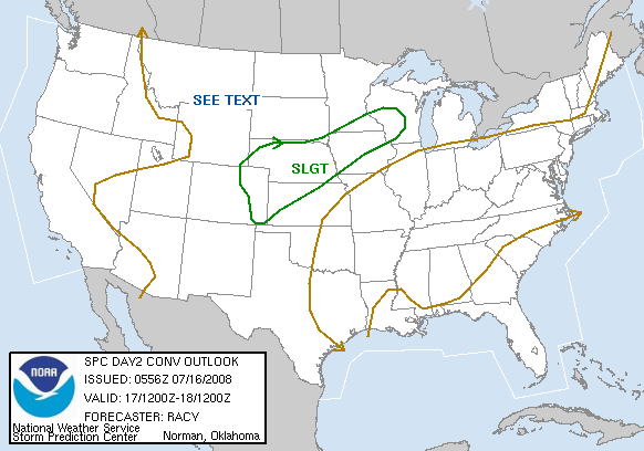
The Storm Prediction Center continues to show the potential for severe weather on Friday. A warm front will push through area as a cold front works toward us, that could set the stage for a severe weather outbreak in the Atlantic region on Friday. Here’s a little of what the storm prediction center is saying:

WRN SLOPES OF THE APPALACHIANS TO THE ATLANTIC COAST…
WIDESPREAD SHOWERS AND THUNDERSTORMS — FROM THE GREAT LAKES SWD TO
THE GULF OF MEXICO — ARE FORECAST TO BE ONGOING AT THE START OF THE
PERIOD…ALONG AND AHEAD OF SURFACE FRONT. EXTENSIVE CLOUD COVER
AND PRECIPITATION SHOULD LIMIT POTENTIAL FOR AIRMASS DESTABILIZATION
THROUGH THE DAY…DESPITE MOIST BOUNDARY LAYER.

WHILE LACK OF INSTABILITY SHOULD ACT TO LIMIT STORM INTENSITY TO
SOME DEGREE… WITH SHEAR ACTING TO
ENHANCE/SUSTAIN ORGANIZED STORMS — INCLUDING SMALL-SCALE LINES/BOWS (fast moving lines of storms with strong winds)
AND SOME SUPERCELLS…EXPECT FAIRLY WIDESPREAD SEVERE WEATHER
COVERAGE. MAIN SEVERE THREAT WILL LIKELY BE DAMAGING WINDS…THOUGH
A COUPLE OF TORNADOES WILL ALSO BE POSSIBLE. HAIL SHOULD BE A
LESSER THREAT IN GENERAL ……….

And for those of you keeping score at home, The numbers as of 11:59 PM EDT last night

*NCL-Nelson County Life Magazine : Greenfield / Afton, VA
Wednesday High: 83.8°
0.00″ of rain

*NCL-Wintergreen Nature Foundation : Devil’s Knob, VA
Wednesday High: 79.0°
0.00″ of rain

*NCL-Wintergreen Winery @ the foot of Wintergreen Mountain in Beech Grove, VA
Wednesday High: 84.0°
0.00″ of rain

*NEW*NCL-Hatcreek Farm on Horseshoe Mountain : Wednesday High: 81.0°
0.00″ of rain

*NCL-Delfosse Winery & Vineyard : Faber, VA
Wednesday High: 84.0°
0.00″ of rain

*NCL-Tiger Fuel – Lovingston, VA
Wednesday High: 83.1°
0.00″ of rain

*NCL-Mini Tara Vineyards : Arrington, VA
Wednesday High: 85.1°
0.00″ of rain

Today’s Forecast Map

On the National Forecast Map, high pressure that’s been controlling our weather for the past week has moved to the east out into the Atlantic. A warm front will move north through the area over the next several hours with a cold front sweeping through Friday evening. The clash of the two air masses may set off some severe weather with an isolated tornado possible, though better chances are north toward PA.

Local forecast
*Today Patchy morning fog, partly sunny early then becoming mostly cloudy by late afternoon. Scattered showers possible late.
*High temps in Woods Mill, Amherst, & Hickory Creek around 77°
*On the mountains above 2000 feet along the BRP, Montebello, Wintergreen, Devil’s Knob, and Love, Partly sunny early, increasing clouds, showers late.
Highs top out around 73°
Winds: S 5-10 MPH

*Tonight Mostly cloudy scattered showers then thunderstorms after midnight across 40% of the area. Fog developing before morning.
*Lows valley near: 58°
*On the mountains: 55°
*Winds: S 5-10 MPH with higher gusts to 20 by morning

Tomorrow Showers & thunderstorms across 60% of the area. Some possibly severe.
* Valley: 78°
*On the mountains – near 68°
Winds: S 5-10 MPH
*Tomorrow night: Evening showers & thunderstorms tapering off by morning – Lows near 53° valley – 47° mountains.
Winds: S 8-12 MPH

The weekend Lingering showers Saturday morning then becoming partly sunny. Breezy! – Daytime highs low 70’s° valley – on the mountains cloudy, damp & cool highs in the mid 50’s – Overnight lows – around 46° valley & mountains.

Sunday Sunny & mild. Daytime highs upper 70’s valley – around 70° mountains.

Whenever or wherever severe weather or news breaks out, we’ll have the latest watches, warnings, and coverage affecting Nelson County, Wintergreen, and nearby counties.

Have a great Thursday!

Know your Nelson.COM
-T-

Wednesday Weather : Wintergreen, BRP, & Nelson County, VA : Warm today showers approaching by Thursday?

0

REFRESH Nelson County Life Magazine HERE for the latest updates:

Weathercast by Tommy Stafford, Nelson County Life Magazine

AUDIO VERSION OF FORECAST (some PC users may need to click play button twice)

Photography by Elaine Weems
For www.NelsonCountyLife.com : © 2007
Hyacinth, Eichhornia crassipes, near Back Bay
Sandbridge, Virginia

water hyacinth

This morning beautiful weather photo comes to us from Elaine and Henri Weems of Rodes Farm here in Nelson. They were recently on a trip and captured this beautiful picture! They say:

“Elaine took this photo of a water hyacinth, Eichhornia crassipes, near Back Bay U.S. Fish & Wildlife Area at Sandbridge, Virginia. Water hyacinths are very pretty but extremely invasive water plants common to North America, Asia, Australia and Africa.”

We always enjoy getting pics from Elaine and Henri and know they are loyal audiocast listners each morning!

Tuesday was another nice day to be outdoors working. Pleasant, sometimes warm temperatures made it feel more Summer like rather than Fall. According to NWS discussions, the first half of October has been the warmest on record thus far, ahead of 1990 readings by about 2 degrees. Though a critical situation regarding rain, it’s important to keep these kinds of weather events in perspective and know the cycle can and will change over time. We’ll see rain, maybe as soon as Thursday, but certainly as we work into the winter months. Though right about now would be just fine!

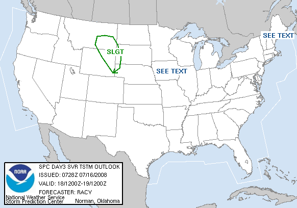
Changes do appear to be shaping up for some rain by the end of the week. Earlier I was skeptical. So far most forecasters and models agree that rain and thunderstorms are in the forecast. This is not a huge rain event, but we could see 1 and 2 inch amounts in some areas of Central Virginia. Thursday begins the process perhaps even with a clap of thunder from time to time late in the day, by Friday more organized severe weather is even a possibility as we will be in a warm and humid environment with an approaching cold front. The Storm Prediction Center has us depicted for severe weather in their longest range forecast as of late Tuesday night as seen below (D4) Has now listed us in their DAy 3 (Friday) outlook for possible severe weather. Audio will be updated later:

NWS STORM PREDICTION CENTER NORMAN OK
0222 AM CDT WED OCT 17 2007

VALID 191200Z – 201200Z

…THERE IS A SLGT RISK OF SVR TSTMS ACROSS A LARGE PORTION OF THE
ERN CONUS…

…SYNOPSIS…
LARGE UPPER TROUGH CONTINUES EWD AND ASSOCIATED COLD FRONT
APPROACHES — AND EVENTUALLY CLEARS — THE ATLANTIC COAST.

…ERN UPPER GREAT LAKES AND THE W SLOPES OF THE APPALACHIANS EWD TO
THE ATLANTIC COAST…

ANOTHER DAY OF FAIRLY WIDESPREAD AND POTENTIALLY LOCALLY-SIGNIFICANT
SEVERE WEATHER IS ANTICIPATED AS COLD FRONT CONTINUES EWD ACROSS THE
APPALACHIANS/ATLANTIC COAST STATES
. MOIST PRE-FRONTAL BOUNDARY
LAYER BUT LIMITED HEATING DUE TO ONGOING PRECIPITATION/CLOUD COVER
SUGGESTS MARGINAL DESTABILIZATION ACROSS THE RISK AREA. THIS SHOULD
SUSTAIN A LARGE PRE-FRONTAL BAND OF THUNDERSTORMS — COMPRISED OF
SMALLER LINES/CLUSTERS — FROM THE CANADIAN BORDER TO THE GULF OF
MEXICO.

WITH STRONG DEEP-LAYER WIND FIELD PERSISTING ACROSS THE WARM SECTOR
IN CONJUNCTION WITH THE UPPER TROUGH…SHEAR WILL ONCE AGAIN DRIVE
ORGANIZED/ROTATING STORMS. ALONG WITH STRONG/DAMAGING WINDS AND
HAIL…A FEW TORNADOES ARE ALSO EXPECTED — PARTICULARLY ACROSS THE
NORTHEAST WHERE BACKED/SELY BOUNDARY-LAYER FLOW IS ANTICIPATED INVOF
A WARM FRONT SHIFTING NEWD ACROSS THIS REGION. STORMS/SEVERE THREAT
WILL LIKELY CONTINUE THROUGH THE OVERNIGHT HOURS…AS STORMS
NEAR/MOVE OFF THE ATLANTIC COAST.

By Wednesday afternoon / evening we’ll have a better idea of severe weather possibilities. Right now the weather is predicted at the very end of the forecast period by the Storm Prediction Center, so it could significantly change over the next 24 hours.

And for those of you keeping score at home, The numbers as of 11:59 PM EDT last night

*NCL-Nelson County Life Magazine : Greenfield / Afton, VA
Tuesday High: 83.5°
0.00″ of rain

*NCL-Wintergreen Nature Foundation : Devil’s Knob, VA
Tuesday High: 79.5°
0.00″ of rain

*NCL-Wintergreen Winery @ the foot of Wintergreen Mountain in Beech Grove, VA
Tuesday High: 79.0°
0.00″ of rain

*NEW*NCL-Hatcreek Farm on Horseshoe Mountain : Tuesday High: 81.9°
0.00″ of rain

*NCL-Delfosse Winery & Vineyard : Faber, VA
Tuesday High: 82.6°
0.00″ of rain

*NCL-Tiger Fuel – Lovingston, VA
Tuesday High: 81.5°
0.00″ of rain

*NCL-Mini Tara Vineyards : Arrington, VA
Tuesday High: 77.7°
0.00″ of rain

Today’s Forecast Map

On the National Forecast Map, high pressure begins to weaken and move east toward the Atlantic. As it moves east we will get a more southerly flow by week’s end with moisture heading our way. The air will become more balmy and unstable increasing our chances for showers and thunderstorms by Thursday & Friday. Much cooler temperatures move in by next week.

Local forecast
*Today Partly sunny early with increasing clouds as the day wears on. Mild again.
*High temps in Nellysford, Ivy, & Colleen around 80°
*On the mountains above 2000 feet along the BRP, Montebello, Wintergreen, Devil’s Knob, and Love, Partly sunny early, increasing clouds late.
Highs top out around 74°
Winds: S 5-10 MPH

*Tonight Mostly cloudy with increasing humidity into Thursday morning.
*Lows valley near: 56°
*On the mountains: 54°
*Winds: S 5-10 MPH

Tomorrow Mostly cloudy with showers by afternoon across 40% of the area.
*Highs valley near 75°
*On the mountains – near 64°
Winds: S 12-14 MPH
*Tomorrow night: Mostly cloudy with scattered showers and thunderstorms – Lows near 60° valley – 53° mountains.
Winds: S 12-14 MPH

The remainder of the week Thunderstorms, some possibly severe on Friday. Daytime highs generally near 80° valley – on the mountains look for daytime highs in the upper 60’s nearing 70° – Overnight lows – near 60 valley & mid 50’s mountains.

The weekend
looks dry after lingering showers Saturday morning. Daytime highs mid 70’s valley – around 70° mountains. By early next week daytime highs cool to the lower 60’s by Tuesday.

Whenever or wherever severe weather or news breaks out, we’ll have the latest watches, warnings, and coverage affecting Nelson County, Wintergreen, and nearby counties.

Have a great Wednesday!

Know your Nelson.COM
-T-

Tyro : Pharsalia Creating Living Flower Arrangements with Layers of Bulbs

0

REFRESH Nelson County Life Magazine HERE for the latest updates:

Photography by Heidi Crandall
For NelsonCountyLife.com – ©2007
Layers of Bulbs at Pharsalia
Tyro, Virginia

Bulb-3

As we told you about in the current October issue of NCL (page 21) Brent Heath was coming to Pharsalia to tell everything he knows about planting bulbs. Tuesday he made his appearance there to tell all. Heidi Crandall was nice enough to snap a few pictures of the event. Don’t think they were planting any of the bulbs like we have shown on page 21!

Bulb-2
Above, Brent demonstrates how to get the most from planting bulbs.

Foxie-1
Here, Foxie Morgan, of Pharsalia and Brent Heath talk about what folks will be seeing in their hands on demonstrations.

Bulb-1

bulb-4

For more background on Brent Heath, see the complete story, on page 21 of the October 2007 NCL issue!

Tuesday Weather : Wintergreen, BRP, & Nelson County, VA : Warm, showers still on the horizon week’

0

REFRESH Nelson County Life Magazine HERE for the latest updates:

Weathercast by Tommy Stafford, Nelson County Life Magazine

AUDIO VERSION OF FORECAST (some PC users may need to click play button twice)

Photography by Tommy Stafford
www.NelsonCountyLife.com : © 2007
William Layton Honored by Historical Society
Lovingston, Virginia

Bernie & William
Above, William Layton of Tyro, is honored by Bernie McGinnis of the Nelson Historical Society for his winning of the largest pumpkin in the state. William is the cover story in the current October issue of NCL. You can read more about him here in our online edition. William gave one of the blue ribbons he won at the state fair to the historical society for preservation in the Oakland Museum.

YS - group
Above, Yvette, talks to the group about the story she prepared in NCL on William, Shelia, their kids. All of the pictures NCL took, published and unpublished, have also been donated as part of a permanent visual record.

Shelia camera
Here, a very proud wife, Shelia, videos William as he speaks to the historical society group.

Weatherwise Monday was pretty much a non event. We started off chilly. The overnight low here at NCL-Greenfield Afton was in the upper 30’s. As the day wore on, temps warmed up nicely. A high thin overcast we talked about yesterday formed, but not enough to block any sun, just kind of put a veil on things. Today and tomorrow look about the same temperature wise with afternoon highs near 80 in the valley. We’ll continue to see high thin clouds again today, even cloudy skies at times in the afternoon as an upper level disturbance nears the area. Models still show chances for rain forming by the end of the week, but they have for the past two weeks only to fall apart as it nears the Blue Ridge. This is still 3-4 days out, so I’ll continue to watch and see.

And for those of you keeping score at home, The numbers as of 11:59 PM EDT last night

*NCL-Nelson County Life Magazine : Greenfield / Afton, VA
Monday High: 76.8°
0.00″ of rain

*NCL-Wintergreen Nature Foundation : Devil’s Knob, VA
Monday High: 71.1°
0.00″ of rain

*NCL-Wintergreen Winery @ the foot of Wintergreen Mountain in Beech Grove, VA
Monday High: 79.5°
0.00″ of rain

*NEW*NCL-Hatcreek Farm on Horseshoe Mountain : Monday High: 76.5°
0.00″ of rain

*NCL-Delfosse Winery & Vineyard : Faber, VA
Monday High: 77.9°
0.00″ of rain

*NCL-Tiger Fuel – Lovingston, VA
Monday High: 77.4°
0.00″ of rain

*Covesville Store : Covesville, VA
Monday High: N/A°
0.00″ of rain

Today’s Forecast Map

On the National Forecast Map, high pressure again is the dominate feature today. Though a jet stream disturbance will thrown some clouds into the area from time to time today. Rain is in the forecast by week’s end if the system headed our way stays together.

Local forecast
*Today Partly sunny with thin high overcast becoming mostly cloudy on occasion by late afternoon. Pleasant.
*High temps in Lovingston, Crozet, & Faber around 77°
*On the mountains above 2000 feet along the BRP, Montebello, Wintergreen, Devil’s Knob, and Love, Partly sunny becoming mostly cloudy late.
Highs top out around 70°
Winds: SE 2-4 MPH

*Tonight Mostly cloudy and seasonal.
*Lows valley near: 51°
*On the mountains: 50°
*Winds: SW 3-5 MPH

Tomorrow Partly sunny & warm.
*Highs valley near 80°
*On the mountains – becoming mostly cloudy – near 67°
Winds: S 5-7 MPH
*Tomorrow night: Mostly cloudy – Lows near 50° valley & mountains.
Winds: S 5-10 MPH

The remainder of the week slight chances for rain Thursday through Saturday morning. Daytime highs generally low & mid 70’s valley – on the mountains look for daytime highs in the mid & upper 60’s nearing 70° – Overnight lows – generally low and mid 50’s valley & mountains.

Whenever or wherever severe weather or news breaks out, we’ll have the latest watches, warnings, and coverage affecting Nelson County, Wintergreen, and nearby counties.

Have a great Tuesday!

Know your Nelson.COM
-T-

Monday Weather : Wintergreen, BRP & Nelson County, VA : Mild, showers possible mid-week

0

REFRESH Nelson County Life Magazine HERE for the latest updates:

Weathercast by Tommy Stafford, Nelson County Life Magazine

AUDIO VERSION OF FORECAST (some PC users may need to click play button twice)

Photography by Tommy Stafford
www.NelsonCountyLife.com : © 2007
Trip to the Pumpkin Patch
Drumheller’s Orchard
Lovingston, Virginia

trailer patch

What a fantastic weekend we had in Central Virginia and Nelson County. The days were pleasant and fall like, the nights cool. We saw some upper 30’s for overnight lows during the weekend. It was a perfect time to be out pumpkin picking! Lots of kids went to Drumheller’s Orchard last week and over the weekend to do just that. You can see more coverage here along with video! And sadly, it was the last weekend for the Nelson Farmers’ market in Nellysford (video here). This past Saturday wrapped up the market for 2007. Mmmmm, what to do with my Saturday morning’s now! Not to worry they will be back in 2008!

Though the weather is pleasant and it feels like Autumn, we are in severe need of rain. It’s becoming critical as noted by many of the water restriction signs you see up across the county. Ray Uttaro with Nelson Emergency Services issued this burn ban last week since conditions have become so dry. The National Weather Service mentions chances for rain by mid-week, I don’t personally give it much hope folks. Right now none of the three models I use to compare show much in the way of rain. But I will look this over more throughly later today. We need it and I’ll gladly be wrong on this any day if it means getting and rain.

And for those of you keeping score at home, The numbers as of 11:59 PM EDT last night

*NCL-Nelson County Life Magazine : Greenfield / Afton, VA
Sunday High: 74.5°
0.00″ of rain

*NCL-Wintergreen Nature Foundation : Devil’s Knob, VA
Sunday High: 61.9°
0.00″ of rain

*NCL-Wintergreen Winery @ the foot of Wintergreen Mountain in Beech Grove, VA
Sunday High: 74.7°
0.00″ of rain

*NEW*NCL-Hatcreek Farm on Horseshoe Mountain : Sunday High: 75.0°
0.00″ of rain

*NCL-Delfosse Winery & Vineyard : Faber, VA
Sunday High: 73.0°
0.00″ of rain

*NCL-Tiger Fuel – Lovingston, VA
Sunday High: N/A°
0.00″ of rain

*Covesville Store : Covesville, VA
Sunday High: N/A°
0.00″ of rain

Today’s Forecast Map

The National Forecast Map, as has been the case for weeks, shows high pressure controlling our weather over the next several days. There are tiny chances for showers around Thursday and possibly again Friday night, but I am not putting much stock in this currently.

Local forecast
*Today Morning clouds, then partly sunny with thin high overcast possible by late afternoon. Mild.
*High temps in Lovingston, Greenwood, & Roseland around 76°
*On the mountains above 2000 feet along the BRP, Montebello, Wintergreen, Devil’s Knob, and Love, Partly sunny & seasonal.
Highs top out around 68°
Winds: SE 3-5 MPH

*Tonight Partly cloudy and cool.
*Lows valley near: 47°
*On the mountains: 44°
*Winds: SW 2-4 MPH

Tomorrow Mostly sunny, slightly warmer.
*Highs valley near 80°
*On the mountains near 70°
Winds: S 2-4 MPH
*Tomorrow night: Becoming mostly cloudy & mild – Lows near 50° valley & 48° mountains.
Winds: S: Light

The remainder of the week looks partly sunny & seasonal with slight chances for rain Thursday then again Friday night. Daytime highs generally lower 70° valley – on the mountains look for daytime highs in the mid & upper 60’s – Overnight lows – around 50° in the valley – upper 40’s to near 50° mountains

Whenever or wherever severe weather or news breaks out, we’ll have the latest watches, warnings, and coverage affecting Nelson County, Wintergreen, and nearby counties.

Have a great Monday!

Know your Nelson.COM
-T-

Nellysford : So long Farmers’ Market for 2007 season : Video

0

REFRESH Nelson County Life Magazine HERE for the latest updates:

This Saturday was the last day for the 2007 Nelson Farmer’s Market in Nellysford. What a huge success! Congrats and we’ll see you back there in 2008!

Lovingston : Drumheller’s Orchard has great day of fun for kids! : Video

2

REFRESH Nelson County Life Magazine HERE for the latest updates:>

Scroll to bottom for video:

This is what Fall is all about in Virginia. Out in the orchards, pumpkin patches and the corn field mazes! Doris Drumheller, of Drumheller’s Orchard, knows how to have a day of fun for kids, many who have never been on the farm. Friday she had youngsters from all over the area coming by to pick their very own pumpkins and apples, along with a tour of their orchard operation. If you haven’t been out there, make it a point to go!

Photography by Tommy Stafford
www.NelsonCountyLife.com ©2007
Drumheller’s Orchard
Lovingston, Virginia

Trailer-1
Here, youngsters from The Covenant School in Charlottesville get instructions on where to go pick their very own pumpkin, and about the corn maze!

Kid-unloading
Above, one of the students jumps down from the trailer and heads to the corn field.

corn maze
In the maze!

The perfect pumpkin
The Perfect Pumpkin!

trip back
The trip back to the orchard.

doris group
Above Doris Drumheller leads the youngsters on a tour.

cold storage
Here the youngsters get a look inside the cold storage unit where the apples are kept.

apple bucket
Doris explains how the apples are picked using this special bucket.

- Advertisement -