
Home Blog Page 707

Wintergreen Weather : HAPPY NEW YEAR! : BRP & Nelson County, VA : Snow Showers, Windy, Turning Much Colder!

0

UPDATE Nelson County Life Magazine HERE

wtg logo
Click the image above for the ski and slope conditions at Wintergreen Resort.

DON’T WANT TO READ THE FORECAST? SIT BACK & LISTEN BY PRESSING THE PLAY BUTTON BELOW (some users may need to click play button twice)

Weathercast by Tommy Stafford, Nelson County Life Magazine

Photography By Ann Strober
For Nelson County Life Magazine ©2007
Approaching Front in Nellysford
Nellysford, Virginia

strober sky


Well, this is it folks. We all wave bye-bye to 2007! I guess we all contemplate a bit as we end one year and start another. I’ve been thinking about all of the new years that have come and gone in my time. Some of the best have simply been ringing in the new year with close friends at one another’s homes. 2008 is one of those New Years. I have been to several big productions before and just don’t find that very appealing most of the time. Can’t think of a better place to be than right here in Nelson to see another year begin.

The last day of 2007 went out on a beautiful note with warm temperatures and sunny skies. A nice ending to the year. Afternoon temperatures reached 55° for a high here at NCL-Nelson County Life Magazine in the Rockfish Valley. Upon the mountains at Wintergreen our NCL-Wintergreen Nature Foundation station recorded an afternoon high of 43° for the last day of the year. Keep that memory of the mild temps in your mind for a few days because it’s out of here for awhile.

The New Year will begin fairly quiet in the early morning hours, but as Tuesday wears on, hold on to your hat and grab the scarf, it’s going to get very windy and cold as we head into Wednesday. We’ll see some scattered snow showers across the area for the first day of the year, but this won’t be much to get excited over. What tiny bit we’ll see should happen in the mid-morning hours. We’ll see some of the coldest weather so far this season over the next few days. That’s excellent news for Wintergreen Resort. They’ll easily be able to make snow for several days to come. I can tell you it has been packed up there over the holiday. Skiing and snowboarding have been good. This has started off to be an excellent ski season, a stark contrast to last year when it was so warm. So far so good! You can check out the current slope conditions by clicking on the Wintergreen logo up above.

By the end of the week look for temperatures to moderate to the lower 50’s in the valley and upper 30’s to lower 40’s on the mountain for afternoon highs.

The National Current Surface Map via wunderground

Over the next 24 hours
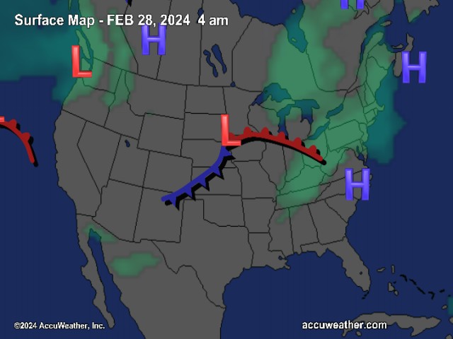
And for those of you keeping score at home check the detailed numbers at any of our reporting NCL-Weathernet Stations for real up to the minute live weather data and detailed information including highs, lows, wind speeds, rainfall and much, much more, simply use the handy drop down menu on the upper left hand side of your screen.

Your Nelson County Life custom area forecast including: The BRP, Lovingston, Nellysford, & Massies Mill.

New Year’s Day Mostly cloudy early morning with isolated showers and snow showers, then partly sunny. Becoming very windy!
* Highs Valley: 46-49° then slowly falling late afternoon
*On the mountains: 36-39° Scattered snow showers, then partly cloudy and windy.
*Winds: SW 10-15 MPH increasing to 15-25 and gusting to 35-40 MPH in the afternoon.

Tuesday night Partly cloudy early then mostly cloudy and blustery. Flurries possible. Windy!
* Lows Valley: 26-23° Wind chill near -5 by Wednesday morning
*On the mountains: 13-16° Mostly cloudy, very cold and windy with wind chills below 0° from time to time.
*Winds: W 15-25 MPH with gusts to 40 MPH

Wednesday Cloudy early morning then mostly sunny, continued windy and blustery.
* Highs Valley: 36-39° Wind chill near 5° above from time to time
*On the mountains: 28-31° Wind chill near 0° from time to time
*Winds: NW 15-25 MPH and gusty

The remainder of the week Look for temps to continue very cold on Thursday with valley highs around 35° and mountains around 24°. Overnight lows 15° in the valley and 10° on the mountains. Temps warm to the 50’s valley for the weekend and 40’s mountains. Right now the extended forecast looks dry.

Breaking News, Breaking Weather we’ll have it all here!

Be safe and have a great New Year’s! We’ll talk to you again on Wednesday!

Know your Nelson.COM

Wintergreen New Year’s Eve Weather : BRP & Nelson County, VA : BRP : Clearing Monday : Snow Showers Tonight : Much Colder Mid-Week

0

UPDATE Nelson County Life Magazine HERE

wtg logo
Click the image above for the ski and slope conditions at Wintergreen Resort.

Weathercast by Tommy Stafford, Nelson County Life Magazine

PRESS THE PLAY ARROW BELOW FOR AUDIO VERSION OF FORECAST (some users may need to click play button twice)


Sunday began cloudy with showers moving in by noon. Upon the mountains above 2000 feet it was freezing rain. Temperatures at our NCL-Wintergreen Nature Foundation site hovered at or slightly below freezing for most of the day which allowed any rain falling to freeze on contact. Luckily the roadways were above freezing which prevented problems traveling, but still slick in spots.

Rain will come to an end by 6AM Monday morning and clearing skies by mid-morning. The remainder of New Year’s Eve will be sunny and sometimes a bit breezy as westerly winds move in. By New Year’s Evening clouds move back in with scattered snow showers possible late in the mountains. We could see more scattered snow showers on New Year’s Day in the mountains. Isolated rain showers are possible in the valley.

By the first night of the new year, temperatures will be diving into the low 20’s for valley lows and the mid- teens on the mountains. Daytime highs on the mountains never get above freezing until late week. Mountain lows even getting around 10 degrees later in the week. Below it will be very cold as well with daytime highs in the mid 30’s to 40’s until week’s end when we reach temps near 50°.

The National Current Surface Map via wunderground

Over the next 24 hours

And for those of you keeping score at home check the detailed numbers at any of our reporting NCL-Weathernet Stations for real up to the minute live weather data and detailed information including highs, lows, wind speeds, rainfall and much, much more, simply use the handy drop down menu on the upper left hand side of your screen.

Your Nelson County Life custom area forecast including: Wintergreen, Greenwood, Shipman, & Lovigston

New Year’s Eve – DAYTIME Becoming mostly sunny & fair.
* Highs Valley: 50-53°
*On the mountains: 39-42°
*Winds: W 10-15 MPH

New Year’s Evening Mostly clear early, then mostly cloudy by 3 AM. Snow showers possible.
* Lows Valley: 33-35°
*On the mountains: 30-33° Snow showers possible.
*Winds: S 5-10 MPH

New Year’s Day Mostly cloudy early morning with isolated showers, then partly cloudy.
* Highs Valley: 46-49°
*On the mountains: 36-39° Scattered snow showers possible.
*Winds: W 10-15 MPH

The remainder of the week Look for temps diving to the low 20’s valley for nighttime lows on the first night of the new year, from 10-15 degrees on the mountains. Daytime highs will be in the mid 30’s Wed & Thurs in the valley : upper 20’s mountains. Temperatures warm slightly by the end of the week into next weekend.

Breaking News, Breaking Weather we’ll have it all here!

Be safe and have a great New Year’s Eve!

Know your Nelson.COM

Winter Weather Advisory : Augusta County : Until 6 AM EST : EXPIRED

0

URGENT – WINTER WEATHER MESSAGE
NATIONAL WEATHER SERVICE BALTIMORE MD/WASHINGTON DC
914 PM EST SUN DEC 30 2007

…WINTER WEATHER ADVISORY FOR ISOLATED WINTRY PRECIPITATION
OVERNIGHT…

.COLDER AIR MOVING INTO THE AREA IS CAUSING RAIN TO MIX WITH AND
CHANGE TO ISOLATED AREAS OF SNOW SLEET AND FREEZING RAIN.
TEMPERATURES ARE EXPECTED TO FALL BELOW FREEZING. BE ALERT FOR
SLICK SPOTS DEVELOPING ON ROADS.

MDZ003>006-501-502-VAZ021-025>031-042-WVZ050>055-501>504-311015-
/O.NEW.KLWX.WW.Y.0011.071231T0214Z-071231T1100Z/
WASHINGTON-FREDERICK MD-CARROLL-NORTHERN BALTIMORE-
EXTREME WESTERN ALLEGANY-CENTRAL AND EASTERN ALLEGANY-HIGHLAND-
AUGUSTA-ROCKINGHAM-SHENANDOAH-FREDERICK VA-PAGE-WARREN-CLARKE-
LOUDOUN-HAMPSHIRE-MORGAN-BERKELEY-JEFFERSON-PENDLETON-HARDY-
WESTERN GRANT-EASTERN GRANT-WESTERN MINERAL-EASTERN MINERAL-
INCLUDING THE CITIES OF…HAGERSTOWN…FREDERICK…WESTMINSTER…
FROSTBURG…CUMBERLAND…STAUNTON…WAYNESBORO...HARRISONBURG…
WINCHESTER…FRONT ROYAL…LEESBURG…MARTINSBURG…
CHARLES TOWN…BAYARD…PETERSBURG…EMORYVILLE…HARTMANSVILLE…
KEYSER…FORT ASHBY

THE NATIONAL WEATHER SERVICE IN STERLING VIRGINIA HAS ISSUED A
WINTER WEATHER ADVISORY…WHICH IS IN EFFECT UNTIL 6 AM EST
MONDAY.

LIGHT WINTRY PRECIPITATION WILL FALL ACROSS THE ADVISORY AREA
DURING THE OVERNIGHT HOURS…THEN WILL TAPER OFF. LITTLE
ACCUMULATION IS EXPECTED. HOWEVER…ROADS COULD TURN SLICK IN
SPOTS SINCE TEMPERATURES ARE EXPECTED TO FALL BELOW FREEZING. USE
CAUTION IF YOU ARE DRIVING LATE TONIGHT.

A WINTER WEATHER ADVISORY MEANS THAT PERIODS OF SNOW…SLEET…OR
FREEZING RAIN WILL CAUSE TRAVEL DIFFICULTIES. BE PREPARED FOR
SLIPPERY ROADS AND LIMITED VISIBILITIES…AND USE CAUTION WHILE
DRIVING.

Update : AT&T Wireless & Cell Service in Nellysford

0

REFRESH Nelson County Life Magazine HERE for the latest updates:

Photography by Tommy Stafford
Nelson County Life Magazine ©2007
New AT&T Wireless Site Behind the Wintergreen Fire Department
Nellysford, Virginia

Cell tower

As we first told you a couple of weeks ago, AT&T Wireless has been in the process of installing and bringing up a new wireless / cell site in the Stoney Creek area of Nellysford. Wintergreen Fire Chief, Curtis Sheets, told NCL that service would be available by the end of December 2007. NCL got a call from Richmond / Stoney Creek resident Bruce Flight on Sunday saying that he had full strength cell service in the Stoney Creek area. His phone is on AT&T Wireless and has previously not worked in that area.

Apparently they are bringing up the service on the last day or so of 2007 year as promised. If you have AT&T Wireless (formerly Cingular) give it a whirl and let us know what you’re results are so we can pass it on here! Use the contact us icon on the upper right of your screen to drop us a note!

Good news!

NCL

Special Weather Update : Light Freezing Rain Occuring Above 2000 Feet & Along The Blue Ridge Parkway : 1:30 PM EST

0

REFRESH Nelson County Life Magazine HERE for the latest updates:


With light precipitation moving into the area this afternoon, locations above 2000 feet continue to have temperatures at or just below the freezing mark. At 3500 feet from our reporting NCL-Wintergreen Nature Foundation station, the 1:30 PM EST temperature was 28.8°. We have reports of some exposed surfaces freezing and collecting ice. Roadways are in good shape at this time. Look for rain to increase and look for freezing rain at altitudes above 2000 feet to continues.

Temperatures will remain steady or slowly fall throughout the afternoon and early evening hours.

We will update as conditions warrant.

NCL

Wintergreen Weather : Sunday : Including BRP & Nelson County, VA : Rain : Wintry Mix Late : Clearing Mon : Very Cold Mid Week : Updated 10:00 AM EST

0

REFRESH Nelson County Life Magazine HERE for the latest updates:

Weathercast by Tommy Stafford

Regular Audio Version of Weathercast returns later Sunday and Monday.

Sunday snow 56
Predicted snowfall map area for Sunday, via www.accuweather.com

Saturday was a fairly calm day across Nelson County. We started mostly cloudy and ended with plenty of sun and temps in the upper 50’s for afternoon highs. That won’t be the case Sunday as a wintry system approaches Central Virginia promising a mix of rain, freezing rain. sleet, and snow. There is a chance for some accumulating snow winter precip in the mountains in places such as Wintergreen, Montebello, Love and other spots along the Blue Ridge Parkway.

We’ll started the day mostly cloudy with some patchy dense fog. As the day wears on, look for rain to spread into the area from the south. There’s chances for scattered showers around noon, but more steady and widespread rain enters the picture by afternoon & evening. As we enter Sunday night the rain may change and mix with freezing rain, sleet, and snow in the valley. On the mountains look for more snow and sleet. Latest models show there may be more freezing rain vs sleet or snow. At this point it doesn’t look as though this will be a significant major winter storm, but general winter advisories may be issued later today. There is the potential for some ice accumulation as temperatures dip below freezing tonight.

They exact type of wintry mix we’ll get will be very tricky with this system since temps will be very near or slightly above freezing. A degree or two would make all of the difference in this case between freezing rain, snow, sleet or freezing rain.

There is some general reference to the system in Sunday’s Hazardous Weather Outlook from NWS:

A STORM SYSTEM WILL BRING THE THREAT OF MIXED PRECIPITATION TO THE
REGION THIS AFTERNOON AND EVENING. ALTHOUGH THE PREDOMINANT
PRECIPITATION TYPE WILL BE RAIN…COMMUNITIES ALONG THE
PENNSYLVANIA BORDER AND IN THE POTOMAC HIGHLANDS MAY SEE THE
PRECIPITATION START MIXED WITH SNOW AND SLEET. IN ADDITION…
HIGHER ELEVATIONS IN THE POTOMAC HIGHLANDS AND ALONG THE BLUE
RIDGE MAY SEE FREEZING RAIN INSTEAD OF RAIN.
THE EXACT FREEZING
LEVEL WILL DEPEND UPON HOW TEMPERATURES WARM TODAY AND WHEN THE
PRECIPITATION STARTS THIS AFTERNOON…BUT IT IS LIKELY TO BE NEAR
1500 FEET. SOME ICE ACCUMULATION MAY BE POSSIBLE ABOVE THIS
HEIGHT. A WINTER WEATHER ADVISORY MAY BE REQUIRED IF THE THREAT
BECOMES MORE CERTAIN. AS THE STORM PULLS OFFSHORE TONIGHT
…THE
PRECIPITATION MAY MIX WITH A BRIEF PERIOD OF WET SNOW PRIOR TO
ENDING.


The National Current Surface Map via wunderground

Over the next 24 hours

Your Nelson County Life custom area forecast including: Wintergreen, Wingina, Tryo, & Taylor Creek

Sunday Mostly cloudy with rain in the afternoon across nearly 100% of the area.
* Highs Valley: 40-43°
*On the mountains: 37-40° Rain, freezing rain, sleet or wet snow possible late afternoon
*Winds: E 5-10 MPH

Sunday Night Cloudy with rain, freezing rain, sleet & snow over 90% of the area, ending after midnight and clearing. Slight accumulations in the valley.
* Lows Valley: 30-33°
*On the mountains: 28-31° Some significant ice accumulation possible along the Blue Ridge Parkway.
*Winds: N-5 MPH becoming W after midnight

Next week New Year’s Eve look for partly sunny skies and high in the lower 50’s valley, mid 40’s mountains.
New Year’s Day Mostly cloudy with highs in the upper 40’s valley and mid 40’s mountains.

Much colder weather moves in by Wednesday with daytime highs in the upper 30’s valley and mid 20’s mountains. Lows around 10-15 degrees valley & on the mountains. Temps moderate toward the end of thee week.

Breaking News, Breaking Weather we’ll have it all here!

Have a great Weekend & we’ll update as necessary throughout the day and night Sunday.

Know your Nelson.COM
-T-

Special Weather Update : Winter Weather Possible Sunday PM : Update : 5:30 PM EST

0

REFRESH Nelson County Life Magazine HERE for the latest updates:

A developing system may bring a mix of sleet, snow and freezing rain to the area on Sunday. Forecast models show the chance for the wintry mix moving into Nelson and Central Virginia around noon Sunday.

snowfall-sunday 3
Forecast map via www.accuweather.com

At this point it doesn’t look as though this will be a significant winter storm, but I expect advisories will be issued later tonight. There is the potential for a couple of inches of snow on the mountains by Monday morning.

They exact type of wintry mix we’ll get will be tricky with this system since temps will be very near or slightly above freezing. A degree or two would make all of the difference in this case between freezing rain or snow.

There is some general reference to the system in Saturday afternoon’s Hazardous Weather Outlook from NWS:

A STORM SYSTEM WILL BRING MIXED PRECIPITATION TO THE REGION
TOMORROW. PRECIPITATION IS EXPECTED TO SPREAD NORTHWARD FROM
CENTRAL VIRGINIA…TO THE PENNSYLVANIA STATE LINE TOMORROW
AFTERNOON. RAIN MIXED WITH SLEET IS EXPECTED ACROSS CENTRAL
VIRGINIA…WITH SNOW BEING THE PRIMARY PRECIPITATION TYPE FURTHER
NORTH ACROSS PARTS OF THE SHENANDOAH VALLEY…WEST VIRGINIA PAN
HANDLE…AND WESTERN AND CENTRAL MARYLAND. THE PRECIPITATION IS
EXPECTED TO TAPER OFF DURING THE SUNDAY EVENING HOURS.
ACCUMULATING SNOWFALL IS POSSIBLE NORTH OF WINCHESTER TO THE
PENNSYLVANIA STATE LINE.

A PROLONGED PERIOD OF LAKE EFFECT SNOWFALL IS EXPECTED TUESDAY
AND WEDNESDAY IN THE ALLEGHENY HIGHLANDS. SIGNIFICANT SNOW
ACCUMULATIONS ARE POSSIBLE.

Updates late tonight / early Sunday morning as the approaching system becomes more defined.

NCL

Wintergreen Weather : Weekend : BRP & Nelson County, VA : Partly Sunny : Wintry Mix Sunday : Updated 10:00 AM EST

0

REFRESH Nelson County Life Magazine HERE for the latest updates:

Winter Weather Possible on Sunday, click here for Special Weather Update.

Weathercast by Tommy Stafford, Nelson County Life Magazine

Photography by Tommy Stafford
Nelson County Life Magazine ©2007
Off The Lift At Wintergreen
Wintergreen Mountain, Virginia

WTG Lift


Friday started with a bit of sun, but clouds and eventually showers took over in the afternoon and continued Friday night. Here at NCL-Nelson County Life Magazine in the Rockfish Valley we already had about .47″of rain by 10:30 PM Friday night. On the mountain at our NCL-Wintergreen Nature Foundation site they’d already picked up .59″of rain by the same time. Head south to NCL-Hatcreek Farm on Horseshoe Mountain and they already had more than 1.00″in the bucket. Back at the foot of the mountain at NCL-Wintergreen Winery in Beech Grove, they had about .78″in the gauge. Be sure to click on the drop down menu on your upper left of this screen to get the latest totals and conditions from any of our NCL-Weathernet station

By Sunday afternoon we will likely see a mix of rain, snow and sleet.


The National Current Surface Map via wunderground

Over the next 24 hours

Your Nelson County Life custom area forecast including: Wintergreen, Wingina, Tryo, & Taylor Creek

Saturday Cloudy this morning with lingering showers then becoming partly sunny afternoon.
* Highs Valley: 56-59°
*On the mountains: 44-47°
*Winds: W-5 MPH

Saturday Night Partly cloudy early, then becoming mostly cloudy.
* Lows Valley: 31-34°
*On the mountains: 24-27°
*Winds: N-5 MPH

Sunday Mostly cloudy with rain, sleet, and snow possible in the afternoon.
* Highs Valley: 37-40°
*On the mountains: 36-39° Rain, sleet or wet snow possible late.
*Winds: NE-5 MPH

Sunday Night Cloudy with rain, sleet & snow early evening (Total accumulation of 2 inches possible) then clearing after midnight.
* Lows Valley: 29-32°
*On the mountains: 28-31°
*Winds: NW-5 MPH

Next week New Year’s Eve look for partly sunny skies and high in the upper 40’s valley, lower 40’s mountains.
New Year’s Day Partly sunny with highs in the mid 40’s valley and near 40 mountains.

Much colder weather moves in by Wednesday with daytime highs in the upper 30’s valley and around 30 mountains. Lows around 20° valley and 10-15 degrees on the mountains.

Breaking News, Breaking Weather we’ll have it all here!

Have a great Weekend!

Know your Nelson.COM
-T-

Wintergreen Mountain : Discovery Center Officially Opened Friday Afternoon

0

REFRESH Nelson County Life Magazine HERE for the latest updates

Photography by Tommy Stafford
Nelson County Life Magazine ©2007
Wintergreen Real Estate’s Discovery Center Opens
Wintergreen Mountain, Virginia

Ribbon Cutting

Above folks from Wintergreen Real Estate, make it official as the ribbon is cut to mark the opening of their new Discovery Center and Black Bear Cafe on Devil’s Knob near Wintergarden Spa. Friday afternoon a grand opening gave folks a chance to drop by and see the new facility and have a cup of coffee in the new cafe.

You can read more about Discover Center in our January 2008 issue on page 18. You can also click here where we first told you about the opening online.

dc-1

dc-2
Above, W.L., manager of The Black Bear Cafe, serves up one of the many varieties of coffee that’s available. Within a few days lots of soups, sandwiches, and breakfast items will be available. Black Bear Cafe will be open 7 days a week.

dc-4
The entrance lobby to Wintergreen Real Estate’s mountain office at Discovery Center.

Congrats to everyone at Wintergreen Real Estate on the opening.

Wintergreen Weather : Thursday : Including The BRP & Nelson County, VA : AM Clouds Then Sunny : Rain By The Weekend

0

REFRESH Nelson County Life Magazine HERE for the latest updates:

Weathercast by Tommy Stafford, Nelson County Life Magazine

PRESS THE PLAY ARROW BELOW FOR AUDIO VERSION OF FORECAST (some users may need to click play button twice)

Photography by Tommy Stafford
Nelson County Life Magazine ©2007
Sunset Over The Mountains
Afton, Virginia

winter sunset

The great thing about living in Nelson County in the shadows of the Blue Ridge is the wonderful views you have just about daily. Beautiful sunsets like this one toward Devil’s Knob from the valley. The last week of year is always a weird one to me. You can’t really get much done, nor do most folks, including me, want to do anything. You’re just kind of decompressing from Christmas and waiting for New Years!

Wednesday started out cloudy and cold, it stayed that way for most of the day until late afternoon when the sun finally started coming out and eventually warmed things up 46° here at NCL-Nelson County Life Magazine in the Rockfish Valley. Upon the mountain at NCL-Wintergreen Nature Foundation they reached a chilly high of only 34° degrees and were back below freezing before sunset yesterday. The rain that was in the area for most of the day stayed to our southeast and since the air here was so dry, none of it reached the ground for the most part. Though SE we did see some scattered showers.

Skiing & snow sports continue at Wintergreen Resort. Though they have not been able to make snow during some of the daylight hours, the temps have been cooperating at night, really a perfect mix! I spoke to our friend Bruce Flight from Richmond Wednesday afternoon. He was on the mountain with friends skiing and boarding. Bruce said it was pretty cold and windy, with lots of folks arriving. You can get the latest slope conditions from the resort by clicking right here.

Thursday will be a day of transition a day in the weather office. Though the day starts off with some clouds, we’ll see mostly sunny skies by afternoon. Thursday night clouds beging increasing in advance of a new system that promises rain Friday, a lull Saturday, and more rain Sunday. I cannot rule out some of the rain falling as a wintry mix up in the mountains over the weekend, but as I said earlier this week, not impressive right now. To the west in the Highlands and WV there is a better chance, but not impossible here, again we’ll have to watch closer as the weekend arrives. Right now it’s more of a rain event.

By next week as we head into the new year, look for colder temps settling into the region.

Regional Radar look via Wundergound.com


The National Current Surface Map via wunderground

Over the next 24 hours

And for those of you keeping score at home check the detailed numbers below at any of our reporting NCL-Weathernet Stations for real up to the minute live weather data and detailed information including highs, lows, wind speeds, rainfall and much, much more.

*NCL-Nelson County Life Magazine : Greenfield / Afton, VA

*NCL-Wintergreen Nature Foundation : Devil’s Knob, VA

*NCL-Wintergreen Winery @ the foot of Wintergreen Mountain in Beech Grove, VA

*NCL-Hatcreek Farm on Horseshoe Mountain : Roseland, VA

*NCL-Delfosse Winery & Vineyard : Faber, Va

*NCL-Tiger Fuel : Lovingston, VA

*NCL-Mini Tara Vineyards : Arrington, VA

*Covesville Store : Covesville, VA

Your Nelson County Life custom area forecast including: Afton, Crozet, Schuyler, & Love

Today Early morning clouds. Becoming mostly sunny by afternoon.
* Highs Valley: 52-55°
*On the mountains: 46-49°
*Winds: SW-5 MPH

Tonight Mostly clear early evening, becoming partly cloudy late night.
* Lows Valley: 31-34°
*On the mountains: 29-32°
*Winds: SW 5-10 MPH

Tomorrow Cloudy with rain developing.
* Highs Valley: 46-49°
*On the mountains: 40-43°
*Winds: SE 5-10 MPH

The weekend Saturday look for the rain to diminish briefly with partly sunny skies, before rain moves back in Sunday. Temps will be in the mid 50’s valley Saturday dropping to the lower 40’s valley for highs. On the mountains mid 40’s Saturday and upper 30’s Sunday – Night time lows generally low & mid 30’s valley, dropping to mid 20’s Sunday night.

Breaking News, Breaking Weather we’ll have it all here!

Have a great Thursday!

Know your Nelson.COM
-T-

- Advertisement -