REFRESH Nelson County Life Magazine HERE for the latest updates:

REFRESH Nelson County Life Magazine HERE for the latest updates:
Friday December 7th, 2007
5-8- PM
Six Nelson Wineries along with Blue Mountain Brewery will celebrate the holidays with special events and activities.
Click on the image below to see the complete details in a printable version.

REFRESH Nelson County Life Magazine HERE for the latest updates:
High Wind Advisory
212 PM EST Mon Dec 3 2007
…Wind Advisory is canceled…
The National Weather Service in Sterling Virginia has canceled
the Wind Advisory.
Wind gusts are expected to remain below advisory criteria for the
remainder of the afternoon and evening. However…breezy
conditions with wind gusts up to 35 mph are still possible until
early evening.
REFRESH Nelson County Life Magazine HERE for the latest updates:
The high wind advisory continues for Nelson County until 1 AM Tuesday morning. Just to our west in neighboring Augusta, a High Wind Warning is in effect.
NCL
URGENT – WEATHER MESSAGE
NATIONAL WEATHER SERVICE BALTIMORE MD/WASHINGTON DC
953 AM EST MON DEC 3 2007
NELSON
A WIND ADVISORY REMAINS IN EFFECT UNTIL 1 AM EST TUESDAY.
STRONG NORTHWEST WINDS OF 20 TO 30 MPH WITH GUSTS UP TO 50 MPH ARE
POSSIBLE TODAY INTO THIS EVENING. THESE WINDS MAY BE ENOUGH TO
DOWN TREE LIMBS AND POWER LINES. SCATTERED POWER OUTAGES MAY OCCUR.
A WIND ADVISORY MEANS THAT WIND GUSTS IN EXCESS OF 46 MPH ARE
EXPECTED. WINDS THIS STRONG CAN MAKE DRIVING DIFFICULT…
ESPECIALLY FOR HIGH PROFILE VEHICLES. USE EXTRA CAUTION.
REFRESH Nelson County Life Magazine HERE for the latest updates:
Weathercast by Tommy Stafford, Nelson County Life Magazine
AUDIO VERSION OF FORECAST (some users may need to click play button twice)
Photography by Tommy Stafford
Nelson County Life Magazine : © 2007
Coby Etchison at Valley Green Center
Nellysford, Virginia


Lots to talk about in the weather department this morning, but before we head off into that just want to give a plug to 12 year old Coby Etchison. He’s a 7th grader at Nelson County Middle School who’s been gathering up food for the past couple of weekends at the Valley Green Center in Nellysford. Coby’s trying to fill up 10 laundry baskets with food items between now and December 16th. He’s working with area churches to get the baskets to needy families in time for Christmas. Coby will be near the entrance of Joe Lee’s Grocery for the next two weekends until Sunday Dec 16th, so drop by and help him out. What a great cause he’s started! Kudos to Coby for what’s he doing this Christmas.
Did you hear the wind get up before daylight? Get accustomed to it, it’s going to be around through tonight when it will finally begins to settle down a little. There is a wind advisory in effect until 1 AM Tuesday morning. The worst winds will be upon the BRP and at places like Montebello and Wintergreen, but even in the valley it will be windy with some gusts to near 40-50 MPH at times. Early Sunday evening I noticed this paragraph in the Sterling / DC weather discussion put out by forecasters there. It was a special entry to television weathermen about the possibility of extremely high winds Monday morning:
**this is a supplemental afd (area forecast discussion) for TV mets***
Prvs shift fcstrs did an xlcnt job in setting up this potential wind
event. One thing that caught my eye is on BUFKIT – when the temperature
profile jumps quickly in a negative direction this is a sign that
damaging winds can occur. This is exactly what is seen on both the NAM
and GFS BUFKIT soundings – right around 7 am Monday morning. This in turn sounds
alarms for ME – I worked the middle shift on 11/13/03. A wind warning was
in effect for the western and northern zones…an advisory was in effect for the
rmdr of the County Warning Area. The wind was screaming when I left at 7 am. Grnd
truth that day included 150,000 homes in Nova west/o power…a tractor
trailer overturned on I-81…two people injured including a student
in Sterling Virginia waiting for the bus who was struck by a falling tree.TV mets – not sure what newcasts there are this evening given
football…but I am asking you to ask parents to watch out for their
children at the bus stop Monday morning. Thx.
All of the fancy terms used in there refer to computer models they use to help predict weather. In this case the forecaster is saying that his models agree and very, very high winds could occur.
Rain wise we had some respectable amounts across the area, but not an abundance. Most of the gauges had a half inch or less in them by midnight last night. Monday is a day of transition as the cold front that brought the rain – and what will be colder temps, moves east. By mid-week we have a shot at some light snow just about everywhere, with some better chances up above on the mountains. It will be very cold later this week with low temps in the teens in the mountains by Wednesday night.
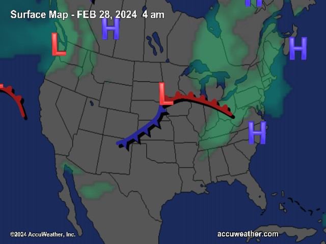
The National Current Surface Map via wunderground
![]()
Over the next 24 hours
Regional Radar look via Wundergound.com
![]()
And for those of you keeping score at home check the detailed numbers below at any of our reporting NCL-Weathernet Stations for real up to the minute live weather data and detailed information including highs, lows, wind speeds, rainfall and much, much more.
*NCL-Nelson County Life Magazine : Greenfield / Afton, VA
*NCL-Wintergreen Nature Foundation : Devil’s Knob, VA
*NCL-Wintergreen Winery @ the foot of Wintergreen Mountain in Beech Grove, VA
*NCL-Hatcreek Farm on Horseshoe Mountain : Roseland, VA
*NCL-Delfosse Winery & Vineyard : Faber, Va
*NCL-Tiger Fuel : Lovingston, VA
*NCL-Mini Tara Vineyards : Arrington, VA
*Covesville Store : Covesville, VA
Your Nelson County Life custom area forecast including: Nellysford, Piney River & Schuyler
*Today High Wind Advisory in effect until 1AM Tuesday morning. Lingering morning showers then sunny by afternoon, slowly falling temps late in the day.
*Highs Valley: 47-50° falling in the late afternoon
*On the mountains: 43-45°
Winds: W 15-25 MPH with gusts to 50 MPH from time to time (higher on mountains)
Tonight High Wind Advisory until 1AM, clear and cold.
* Lows Valley: 26-29°
*On the mountains: 21-24°
Winds: W 10-20 MPH with gusts up to 40 mph – decreasing to 5-10 MPH with gusts up to 20 MPH after midnight.
Tomorrow Mostly sunny & seasonal.
* Highs Valley: 49-52°
*On the mountains: 33-35°
Winds: W 10-15 MPH
Tomorrow night Partly cloudy early, then becoming mostly cloudy. Cold.
* Lows Valley: 25-28°
*On the mountains: 15-18°
Winds: W-5 MPH then L & V after midnight.
Looking ahead to Wednesday Snow in the mountains at Wintergreen and along the BRP. Light snow in the valley. Cloudy and cold. Highs in the valley 35-38° – on the mountains 26-29°
The remainder of the week looks cold with light snow chances continuing on the mountains Thursday – with partly sunny skies valley. Overnight lows in the 20’s valley and upper teens to around 20’s mountains.
Breaking news, breaking weather, whatever the case, we’ll have it here.
Have a great Monday & hang on to your hat!
Know your Nelson.COM
-T-
REFRESH Nelson County Life Magazine HERE for the latest updates:
URGENT – WEATHER MESSAGE
NATIONAL WEATHER SERVICE BALTIMORE MD/WASHINGTON DC
219 PM EST SUN DEC 2 2007
DCZ001-MDZ004>007-009>011-013-014-016>018-VAZ025-026-029>031-
036>042-052>054-WVZ053-030330-
/O.NEW.KLWX.WI.Y.0008.071203T1300Z-071204T0600Z/
DISTRICT OF COLUMBIA-FREDERICK MD-CARROLL-NORTHERN BALTIMORE-
HARFORD-MONTGOMERY-HOWARD-SOUTHERN BALTIMORE-PRINCE GEORGES-
ANNE ARUNDEL-CHARLES-ST. MARYS-CALVERT-AUGUSTA-ROCKINGHAM-PAGE-
WARREN-CLARKE-NELSON-ALBEMARLE-GREENE-MADISON-RAPPAHANNOCK-
FAUQUIER-LOUDOUN-PRINCE WILLIAM/MANASSAS/MANASSAS PARK-FAIRFAX-
ARLINGTON/FALLS CHURCH/ALEXANDRIA-JEFFERSON-
INCLUDING THE CITIES OF…WASHINGTON…FREDERICK…WESTMINSTER…
GAITHERSBURG…COLUMBIA…BALTIMORE…ANNAPOLIS…WALDORF…
ST MARYS CITY…STAUNTON…WAYNESBORO…HARRISONBURG…
FRONT ROYAL…CHARLOTTESVILLE…LEESBURG…MANASSAS…
MANASSAS PARK…FAIRFAX…ALEXANDRIA…FALLS CHURCH…
CHARLES TOWN
219 PM EST SUN DEC 2 2007
…WIND ADVISORY IN EFFECT FROM 8 AM MONDAY TO 1 AM EST TUESDAY…
THE NATIONAL WEATHER SERVICE IN STERLING VIRGINIA HAS ISSUED A WIND
ADVISORY…WHICH IS IN EFFECT FROM 8 AM MONDAY TO 1 AM EST TUESDAY.
A STRONG COLD FRONT WILL MOVE THROUGH THE REGION EARLY MONDAY.
STRONG NORTHWEST WINDS WILL DEVELOP BEHIND THIS FRONT. FREQUENT
GUSTS BETWEEN 45 AND 50 MPH ARE EXPECTED THROUGHOUT THE DAY AND
PERSIST INTO THE EVENING HOURS.
A WIND ADVISORY MEANS THAT WIND GUSTS IN EXCESS OF 46 MPH ARE
EXPECTED. WINDS THIS STRONG CAN MAKE DRIVING DIFFICULT…ESPECIALLY
FOR HIGH PROFILE VEHICLES. USE EXTRA CAUTION. SCATTERED POWER
OUTAGES COULD OCCUR.
REFRESH Nelson County Life Magazine HERE for the latest updates:
Weathercast by Tommy Stafford, Nelson County Life Magazine
AUDIO VERSION OF FORECAST (some users may need to click play button twice)
Photography by Ann Strober
For Nelson County Life Magazine : © 2007
Approaching Storm
Nellysford, Virginia

Saturday was a fairly sunny day with high thin clouds streaming in advance of our next weather maker. Overnight Saturday into Sunday expect clouds to form. We have a shot at some mixed precip mountains early Sunday if some of it makes it here from the midwest, but the best shot for rain is late Sunday. As the next system approaches warmer air will pump into the area allowing temps to warm enough for it to all change to rain. But again we can’t rule out some freezing rain upon the BRP and Wintergreen. I’ll be watching this over the next 24-36 hours as the system approaches. Right now the air is so dry (that’s the dewpoint) so whatever moisture that gets here will take awhile to start falling to the ground. It’s kind of like a sponge when it’s dry, takes a bit for it to get saturated.
By Sunday afternoon rain should begin falling over much of the area continuing into Sunday night. By Sunday night a developing low pressure area off of the coast combines to create some very high winds into the day Monday. Just to our west high wind watches have been posted. We may see them issued here sometime over the weekend. But regardless look for 35-40 MPH winds Sunday night into Monday before diminishing by Tuesday.
Next week cold temps hang in there with a chance again for possible mountain snow by midweek.
The National Current Surface Map via wunderground
![]()
Over the next 24 hours
Regional Radar look via Wundergound.com
![]()
And for those of you keeping score at home check the detailed numbers below at any of our reporting NCL-Weathernet Stations for real live weather data and detailed information including highs, lows, rainfall and much, much more.
*NCL-Nelson County Life Magazine : Greenfield / Afton, VA
*NCL-Wintergreen Nature Foundation : Devil’s Knob, VA
*NCL-Wintergreen Winery @ the foot of Wintergreen Mountain in Beech Grove, VA
*NCL-Hatcreek Farm on Horseshoe Mountain : Roseland, VA
*NCL-Delfosse Winery & Vineyard : Faber, Va
*NCL-Tiger Fuel : Lovingston, VA
*NCL-Mini Tara Vineyards : Arrington, VA
*Covesville Store : Covesville, VA
Your Nelson County Life custom weekend forecast including: Nellysford, Lovingston & Wintergreen Resort
*Saturday night Becoming cloudy late with light rain possible in the morning, possibly freezing rain & sleet mountains. – Low near 32° valley – around 29° mountains
Winds: Light E becoming S-5 MPH by daylight
Sunday Rain developing in the afternoon, winds increasing late afternoon into early evening.
* Highs Valley: 46-49°
*On the mountains: 43-45°
Winds: SW 10-15 MPH with higher gusts by afternoon
Sunday night Rain continuing, winds increasing becoming very windy overnight with gusts to near 40 MPH by morning.
* Lows Valley: 42-44°
*On the mountains: 33-35°
Winds: SW 15-25 MPH early with higher gusts overnight
Monday Showers ending, sunny by afternoon, very windy with falling temps in the afternoon.
* Highs Valley: 47-50°
*On the mountains: 36-39°
Winds: W 15-25 MPH with gusts to near 40 MPH
By Monday night skies remain clear with gusty winds from time to time and temps in the upper 20’s valley to lower 20’s mountains.
Chances for snow in the mountains returns by mid-week with cold temps for most of the week. Highs generally low and mid 40’s valley and low 30’s mountains. Overnight low very cold with mid to upper 20’s valley and around 20° mountains.
Breaking news, breaking weather, whatever the case, we’ll have it here.
Have a great rest of the Weekend!
Know your Nelson.COM
-T-
REFRESH Nelson County Life Magazine HERE for the latest updates:
Photography by Tommy Stafford
Nelson County Life Magazine ©2007
Betsy Smith : AirCare 5 Flight Nurse
Near & Above Nelson County, Virginia

In our December 2007 issue of NCL, Nelson’s own, Betsy Smith, is the Angel in the Sky on page 37. Betsy’s had an interesting career and many time that sound of a medical helicopter going over is her on the way to the scene or en route to a hospital.
Here’s lots more of the pics we couldn’t fit into her story.
NCL


REFRESH Nelson County Life Magazine HERE for the latest updates:
Weathercast by Tommy Stafford, Nelson County Life Magazine
AUDIO VERSION OF FORECAST (some users may need to click play button twice)
Photography by Tommy Stafford
Nelson County Life Magazine : © 2007
Montebello Store Makeover & Addition
Montebello, Virginia

Hey before we get started, a huge thanks to, our long time friend and web reader, Paul Luke up in Washington D.C. Paul works for the feds up there, but reads out site each day. Friday he discovered it said Friday but had Thursday’s cast up there. Those darn gremlins at it again! Somewhere back in my files I have a picture of Paul when he worked in television with me at a tornado…I’ll have dig that one up! But thanks again for noticing the error Paul, this should have it fixed!
The folks at The Montebello Store in, where else, Montebello, are moving right along with their renovations and additions to the old store dating way, way back. In the picture above you can see the new wrap around porch and the huge dining room added on to the right. They are just about finished on the outside, and work is coming right along on the inside. They’ll certainly be done in time for warm weather next year when folks flock back to that area to fish and stay a night or two in a cabin. I love Montebello, it’s one of the best spots in Nelson and the folks at the store are the best! If you have never made the drive up there, you need to go take a look!
The weekend looks pretty seasonal for this time of year with chances for rain by Sunday. I can’t rule out the precip starting out as mix of sleet or snow with rain, bust as warmer air moves in, look for the mix to change to all rain. The bigger story will be the much colder temperatures moving in by next week. It will be a week that should be good for making lots of snow at Wintergreen Resort.
We got an e-mail from John Taylor early Friday that said:
John Taylor wrote:
Snow guns were on all night and they are still on at 9:50 am. (the ski bowl is
just now starting to get direct sunlight on it). It’s beginning to look a lot
like … winter!
The National Current Surface Map via wunderground
![]()
Regional Radar look via Wundergound.com
![]()
And for those of you keeping score at home the numbers as of midnight last night.
*NCL-Nelson County Life Magazine : Greenfield / Afton, VA
This Morning’s Low: 27.1°
0.00″ of rain
*NCL-Wintergreen Nature Foundation : Devil’s Knob, VA
This Morning’s Low: 25.0°
0.00″ of rain
*NCL-Wintergreen Winery @ the foot of Wintergreen Mountain in Beech Grove, VA
This Morning’s Low: 25.2°
0.00″ of rain
NCL-Hatcreek Farm on Horseshoe Mountain : Roseland, VA
This Morning’s Low: 23.7°
0.00″ of rain
*NCL-Delfossee Winery & Vineyard : Faber, Va
This Morning’s Low: 32.9°
0.00″ of rain
*NCL-Tiger Fuel : Lovingston, VA
This Morning’s Low: 28.6°
0.00″ of rain
Your Nelson County Life custom weekend forecast including: Montebello, Lovingston & Wintergreen Resort
*Friday night Mostly clear & colder.
*Lows valley: near 25°
*On the mountains: around 20°
*Winds: SW 5-10 MPH becoming NW after midnight
Saturday Sunny in the morning, increasing clouds in the afternoon. Breezy from time to time.
* Valley: 47-50°
*On the mountains: 36-39°
Winds: N 10-15 MPH
*Saturday night Cloudy & cold, rain or sleet developing by daylight – Low near 32° valley – around 29° mountains
Winds: SE-5 MPH
Sunday Cloudy with scattered showers, possibly beginning as freezing rain in the mountains. (This bears watching closely over the weekend for mountain residents – we will be updating as data become more available)
* Valley: 46-49°
*On the mountains: 43-45°
Winds: S 10-15 MPH
Rain continues Sunday night with lows in the low 40’s valley and mid 30’s mountains.
By next week, colder air arrives with high in the mid 40’s valley and mid to upper 30’s mountains. Very high winds are likely on Monday
Breaking news, breaking weather, whatever the case, we’ll have it here.
Have a great Weekend!
Know your Nelson.COM
-T-
REFRESH Nelson County Life Magazine HERE for the latest updates:
Weathercast by Tommy Stafford, Nelson County Life Magazine
AUDIO VERSION OF FORECAST (some users may need to click play button twice)
Photography by Tommy Stafford
Nelson County Life Magazine : © 2007
Christmas time at The Blue Ridge Pig
Nellysford, Virginia

Strawberry has pulled out all of the stops and dressed up the pig on the roof for Christmas! The famous pig has a nice garland accenting his neck for that yuletide feeling! It’s always nice to see the landscape changing for Christmas and see how everyone decorates. That’s what makes Nelson so special! We had a smoked turkey croissant at Strawberry’s earlier this week! Great place and we love the crew there!
Today will be a milder day than Wednesday across Nelson and Central Virginia with most locations below 2000 feet making it into the 60’s for afternoon highs. It will be a breezy day with sometimes gusty SW winds, shifting W by late afternoon. Some areas saw very light sprinkles overnight as a system makes it’s way toward Virginia. By early evening the cold front should be east of the area allowing cooler temps to work in. By the weekend we could see some rain / snow showers in the area late Saturday night into Sunday morning as another system works toward Central Virginia. Temperatures will be pretty seasonal until we reach early next week when we start the trip back into the freezer.
The National Current Surface Map via wunderground
![]()
Over the next 24 hours
Regional Radar look via Wundergound.com
![]()
And for those of you keeping score at home the numbers as of midnight last night.
*NCL-Nelson County Life Magazine : Greenfield / Afton, VA
Wednesday High: 58.1°
0.00″ of rain
*NCL-Wintergreen Nature Foundation : Devil’s Knob, VA
Wednesday High: 53.8°
0.00″ of rain
*NCL-Wintergreen Winery @ the foot of Wintergreen Mountain in Beech Grove, VA
Wednesday High: 57.0°
0.00″ of rain
NCL-Hatcreek Farm on Horseshoe Mountain : Roseland, VA
Wednesday High: 55.9°
0.00″ of rain
*NCL-Delfossee Winery & Vineyard : Faber, Va
Wednesday High: 55.4°
0.00″ of rain
*NCL-Tiger Fuel : Lovingston, VA
Wednesday High: 55.2°
0.00″ of rain
*NCL-Mini Tara Vineyard : Arrington, VA
Wednesday High: N/A°
0.00″ of rain
Your Nelson County Life custom local forecast including: Spruce Creek, Tyro & Love
*Today Early morning clouds, then mostly sunny, windy by afternoon.
*Valley : High 63°
*On the mountains above 2000 feet along the AT, BRP, Montebello, Wintergreen, Devil’s Knob, and Love. Cloudy early then clearing and breezy.
Highs around 50°
Winds: SW 10-15 becoming W by afternoon with gusts to near 30 MPH
*Tonight Mostly clear & cold.
*Lows valley: near 28°
*On the mountains: around 22°
*Winds: W 5-10 MPH
Tomorrow Sunny & seasonal
* Valley: 52-54°
*On the mountains: 43-45°
Winds: S 2-4 MPH
*Tomorrow Night Clear & cold – Low near 28° valley – around 22° mountains
Winds: W-5 MPH
The weekendgenerally clear until Saturday night when clouds move in and a chance of rain & snow showers overnight. Rain is in the forecast Sunday & Sunday night. High temps range from the upper 40’s in the valley to lower 40’s in the mountains. Overnight lows – low & upper 30’s valley – in the low & upper 20’s mountains.
Breaking news, breaking weather, whatever the case, we’ll have it here.
Have a great Thursday!
Know your Nelson.COM
-T-
