Nellysford
Nelson County, VA For years we have been following the bunch down at Basic Necessities in Nellysford. It’s no secret, one of our favorites! Recently Kay Pflatz who founded the restaurant back in 1997 repurchased the restaurant back from Bev Lacey and Keith Dix who bought it from Kay about 10 years ago. Though Kay still worked there, she exited as an owner during that time.
Be sure to click on any of the photos below for a larger view and a walk down memory lane.
Above, our March 2014 printed story by Jennie T. Williams on the Nellysford restaurant that’s returned to the Basics. Click on the magazine spread to read the story online.
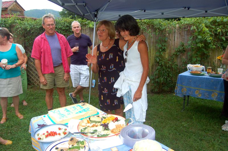
Cyndy Wilson (L) and her husband from Roseland were one of the last couples to eat in the old dining room of Basic Necessities before it was gutted and totally renovated just before Valentine’s Weekend. Click on image to enlarge.Just 3 days after starting the renovation construction crews completed the makeover of the restaurant’s dining room. It included new weatherproof windows, doors and walls with insulation. Click on image to enlarge.The finished product at Basic Necessities is nothing short of astonishing. New windows let in the light, yet still charming and quaint as ever.Blast from the past, Kay Pfaltz who recently bought back into the restaurant in Nellysford, is pictured with some of the crew working there back in May of 2007.Basic Necessities has long been a place where high schoolers and college students worked. Pictured here back in May 2007, Kelsey Vergin (now of Scottsville and now with Feast in downtown Charlottesville) along side Hayley Osborne of Faber. Hayley is still seen in Basic as a customer these days and is in the final stages of becoming a school teacher in the area.Sarah Leake Shelton was the manager of Basic Necessities for years when Bev owned the restaurant. Sarah started at there over a decade ago as a teen. She left several months ago and works today as a pastry chef at Boar’s Head in Charlottesville. A little birdie tells us she’s got a project cooking and we’ll be hearing lots more from her in the Nelson area in the coming weeks.Heidi Diehl Reed (Left) with Hayley Osborne (center) and Heidi’s husband Randy Reed (right). Heidi was one of the original employees of the restaurant as a youngster. Today she’s a new mom. She and Randy had a little girl in the past few months and continue living here in Nelson. This was at the 15 year anniversary of Basic back in July of 2012.Bev Lacey (left) and Kay Pfaltz during their 15 year anniversary party in July 2012. Bev & her husband Keith Dix recently sold the restaurant back to Kay and other business partners after a decade of ownership.Photo Courtesy of Kay Pfaltz : This is what Basic Necessities looked like long before it was the restaurant today. It was a home, a bakery, then Basic Necessities. This is around 1997 shortly before it became Basic. You can see Kay on the far left side of the porch looking toward the camera.Photo Courtesy of Kay Pfaltz : The very beginning. Original founders Kay Pfaltz (left) along with Judy Nelson on the right. This was in 1997 just as the restaurant was opening.
The charm is still there with a brand new update and lots more exciting things to come.
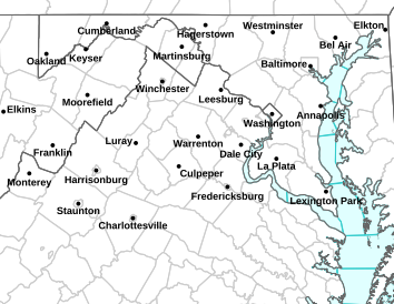
A Winter Weather Advisory is in effect for a large part of Central Virginia from midnight until 11AM Wednesday. Light icing is possible. Click on image above for the latest from NWS.
Winter Weather Statement
Statement as of 9:56 AM EDT on March 19, 2014
…Winter Weather Advisory is cancelled…
The National Weather Service in Baltimore MD/Washington has
cancelled the Winter Weather Advisory.
Temperatures are slowly rising above freezing across the central
Blue Ridge.
WINTER WEATHER ADVISORY IN EFFECT FROM MIDNIGHT TONIGHT TO 11 AM EDT WEDNESDAY URGENT – WINTER WEATHER MESSAGE
NATIONAL WEATHER SERVICE BALTIMORE MD/WASHINGTON DC
821 PM EDT TUE MAR 18 2014
WASHINGTON-FREDERICK MD-EXTREME WESTERN ALLEGANY-
CENTRAL AND EASTERN ALLEGANY-AUGUSTA-ROCKINGHAM-SHENANDOAH-
FREDERICK VA-PAGE-WARREN-CLARKE-NELSON-ALBEMARLE-GREENE-MADISON-
RAPPAHANNOCK-LOUDOUN-NORTHERN FAUQUIER-WESTERN HIGHLAND-
EASTERN HIGHLAND-HAMPSHIRE-MORGAN-BERKELEY-JEFFERSON-HARDY-
WESTERN GRANT-EASTERN GRANT-WESTERN MINERAL-EASTERN MINERAL-
WESTERN PENDLETON-EASTERN PENDLETON-
INCLUDING THE CITIES OF…HAGERSTOWN…FREDERICK…FROSTBURG…
CUMBERLAND…STAUNTON…WAYNESBORO…HARRISONBURG…WINCHESTER…
FRONT ROYAL…CHARLOTTESVILLE…WASHINGTON…LEESBURG…
WARRENTON…HIGHTOWN…MONTEREY…MARTINSBURG…CHARLES TOWN…
MOOREFIELD…BAYARD…MOUNT STORM…PETERSBURG…ELK GARDEN…
KEYSER…FORT ASHBY…CIRCLEVILLE…FRANKLIN
821 PM EDT TUE MAR 18 2014
…WINTER WEATHER ADVISORY REMAINS IN EFFECT FROM MIDNIGHT
TONIGHT TO 11 AM EDT WEDNESDAY…
* PRECIPITATION TYPE…LIGHT FREEZING RAIN AND FREEZING DRIZZLE.
* ACCUMULATIONS…A FEW HUNDREDTHS OF AN INCH OF ICE.
* TIMING…DEVELOPING OVERNIGHT…AND AFFECTING THE WEDNESDAY
MORNING COMMUTE. TEMPERATURES WILL RISE ABOVE FREEZING BEFORE
NOON.
* TEMPERATURES…IN THE LOWER 30S.
* WINDS…EAST 5 TO 10 MPH.
* IMPACTS…UNTREATED SURFACES WILL BECOME ICY AND SLIPPERY.
PRECAUTIONARY/PREPAREDNESS ACTIONS…
THIS WINTER WEATHER ADVISORY MEANS THAT PERIODS OF FREEZING RAIN
WILL CAUSE TRAVEL DIFFICULTIES. BE PREPARED FOR SLIPPERY ROADS
AND LIMITED VISIBILITIES…AND USE CAUTION WHILE DRIVING.
URGENT – WINTER WEATHER MESSAGE
NATIONAL WEATHER SERVICE BLACKSBURG VA
333 PM EDT TUE MAR 18 2014
ASHE-ALLEGHANY NC-SURRY-WATAUGA-WILKES-GILES-PULASKI-MONTGOMERY-
GRAYSON-CARROLL-FLOYD-CRAIG-ALLEGHANY VA-BATH-ROANOKE-BOTETOURT-
ROCKBRIDGE-PATRICK-FRANKLIN-BEDFORD-AMHERST-HENRY-PITTSYLVANIA-
CAMPBELL-
INCLUDING THE CITIES OF…WEST JEFFERSON…SPARTA…DOBSON…
BOONE…WILKESBORO…PEARISBURG…RADFORD…PULASKI…
BLACKSBURG…INDEPENDENCE…WHITETOP…TROUTDALE…VOLNEY…
GALAX…FLOYD…NEW CASTLE…CLIFTON FORGE…COVINGTON…
HOT SPRINGS…ROANOKE…SALEM…FINCASTLE…LEXINGTON…
BUENA VISTA…STUART…ROCKY MOUNT…BEDFORD…AMHERST…
MARTINSVILLE…DANVILLE…LYNCHBURG
333 PM EDT TUE MAR 18 2014
…WINTER WEATHER ADVISORY IN EFFECT FROM 9 PM THIS EVENING TO
11 AM EDT WEDNESDAY…
THE NATIONAL WEATHER SERVICE IN BLACKSBURG HAS ISSUED A WINTER
WEATHER ADVISORY FOR LIGHT FREEZING RAIN AND FREEZING DRIZZLE…WHICH
IS IN EFFECT FROM 9 PM THIS EVENING TO 11 AM EDT WEDNESDAY.
* LOCATIONS…ALONG AND JUST EAST OF THE BLUE RIDGE MOUNTAINS.
* HAZARD TYPES…FREEZING RAIN AND FREEZING DRIZZLE.
* ACCUMULATIONS…A LIGHT GLAZE OF ICE.
* TIMING…FREEZING RAIN AND FREEZING DRIZZLE IS EXPECTED TO
DEVELOP TONIGHT AND LINGER INTO WEDNESDAY MORNING.
* IMPACTS…LIGHT ICING MAY PRODUCE A SLIPPERY CONDITIONS ON
ELEVATED SURFACES AS WELL AS OVERPASSES.
* TEMPERATURES…IN THE UPPER 20S AND LOWER 30S.
PRECAUTIONARY/PREPAREDNESS ACTIONS…
A WINTER WEATHER ADVISORY MEANS THAT PERIODS OF FREEZING RAIN
WILL CAUSE TRAVEL DIFFICULTIES. BE PREPARED FOR SLIPPERY ROADS AND
LIMITED VISIBILITIES…AND USE CAUTION WHILE DRIVING.
Nelson County, VA
As predicted, winter returned to the area once again, with only days left on the calendar. Spring officially arrives Thursday afternoon March 20th. Roads began accumulating some snow around dark, with some accidents happening across the area.
Most of the Central Virginia Blue Ridge is under a Winter Storm Warning until 2PM Monday. Heavy snow is likely. Click on the image above for the absolute latest updates.
Winter Weather Statement
Statement as of 1:15 PM EDT on March 17, 2014
…Winter Storm Warning is cancelled…
The National Weather Service in Baltimore MD/Washington has
cancelled the Winter Storm Warning.
Snow has tapered off.
WINTER STORM WARNING REMAINS IN EFFECT UNTIL 2 PM EDT MONDAY URGENT – WINTER WEATHER MESSAGE
NATIONAL WEATHER SERVICE BALTIMORE MD/WASHINGTON DC
1114 AM EDT MON MAR 17 2014
AUGUSTA-ROCKINGHAM-NELSON-ALBEMARLE-GREENE-WESTERN HIGHLAND-
EASTERN HIGHLAND-WESTERN PENDLETON-EASTERN PENDLETON-
INCLUDING THE CITIES OF…STAUNTON…WAYNESBORO…HARRISONBURG…
CHARLOTTESVILLE…HIGHTOWN…MONTEREY…CIRCLEVILLE…FRANKLIN
1114 AM EDT MON MAR 17 2014
…WINTER STORM WARNING REMAINS IN EFFECT UNTIL 2 PM EDT THIS
AFTERNOON…
* PRECIPITATION TYPE…SNOW.
* ACCUMULATIONS…6 TO 12 INCHES…WITH THE HIGHER AMOUNTS ALONG
AND WEST OF THE BLUE RIDGE.
* TIMING…PATCHY SNOW WILL CONTINUE INTO THE AFTERNOON.
* TEMPERATURES…UPPER 20S AND LOWER 30S THIS AFTERNOON.
* WINDS…NORTHEAST 5 TO 10 MPH WITH GUSTS UP TO 20 MPH.
* IMPACTS…ROADS REMAIN SNOW COVERED AND SLIPPERY.
PRECAUTIONARY/PREPAREDNESS ACTIONS…
A WINTER STORM WARNING FOR HEAVY SNOW MEANS SEVERE WINTER WEATHER
CONDITIONS ARE EXPECTED. SIGNIFICANT AMOUNTS OF SNOW ARE FORECAST
THAT WILL MAKE TRAVEL DANGEROUS. ONLY TRAVEL IN AN EMERGENCY. IF
YOU MUST TRAVEL…KEEP AN EXTRA FLASHLIGHT… FOOD…AND WATER IN
YOUR VEHICLE IN CASE OF AN EMERGENCY.
VIa NWS: Either Winter Storm Warnings or Winter Storm watches have been issued for a large past of Virginia including the Central Virginia Blue Ridge on Sunday afternoon until Monday afternoon.
WINTER STORM WARNING IN EFFECT FROM 2 PM SUNDAY TO 2 PM EDT MONDAY URGENT – WINTER WEATHER MESSAGE
NATIONAL WEATHER SERVICE BALTIMORE MD/WASHINGTON DC
243 PM EDT SAT MAR 15 2014
AUGUSTA-ROCKINGHAM-NELSON-ALBEMARLE-GREENE-WESTERN HIGHLAND-
EASTERN HIGHLAND-WESTERN PENDLETON-EASTERN PENDLETON-
INCLUDING THE CITIES OF…STAUNTON…WAYNESBORO…HARRISONBURG…
CHARLOTTESVILLE…HIGHTOWN…MONTEREY…CIRCLEVILLE…FRANKLIN
243 PM EDT SAT MAR 15 2014
…WINTER STORM WARNING IN EFFECT FROM 2 PM SUNDAY TO 2 PM EDT
MONDAY…
THE NATIONAL WEATHER SERVICE IN BALTIMORE MD/WASHINGTON HAS
ISSUED A WINTER STORM WARNING FOR SNOW…WHICH IS IN EFFECT FROM 2
PM SUNDAY TO 2 PM EDT MONDAY.
* PRECIPITATION TYPE…SNOW
* ACCUMULATIONS…6 TO 12 INCHES WITH THE HIGHEST ACROSS THE
MOUNTAINS ABOVE 2000 FEET.
* TIMING…PRECIPITATION MAY START OFF AS RAIN OR RAIN AND SNOW
MIXED ACROSS THE VALLEYS SUNDAY AFTERNOON. ANY MIXED
PRECIPITATION WILL CHANGE TO ALL SNOW AFTER SUNSET WITH THE
HEAVIEST SNOW FALLING LATE SUNDAY EVENING INTO EARLY MONDAY
MORNING.
* TEMPERATURES…LOWER TO MIDDLE 40S EARLY SUNDAY
AFTERNOON…DROPPING INTO THE LOWER TO MIDDLE 20S SUNDAY NIGHT.
HIGHS MONDAY WILL BE IN THE LOWER 30S.
* WINDS…NORTHEAST AROUND 10 MPH WITH GUSTS UP TO 20 MPH.
* IMPACTS…ROADS WILL BECOME SNOW COVERED AND SLIPPERY. TRAVEL
WILL BECOME DANGEROUS…ESPECIALLY AFTER SUNSET SUNDAY WHEN
TEMPERATURES DROP BELOW FREEZING. DANGEROUS TRAVEL WILL CONTINUE
THROUGH THE MORNING RUSH MONDAY INTO MONDAY AFTERNOON.
PRECAUTIONARY/PREPAREDNESS ACTIONS…
A WINTER STORM WARNING FOR HEAVY SNOW MEANS SEVERE WINTER WEATHER
CONDITIONS ARE EXPECTED. SIGNIFICANT AMOUNTS OF SNOW ARE FORECAST
THAT WILL MAKE TRAVEL DANGEROUS. ONLY TRAVEL IN AN EMERGENCY. IF
YOU MUST TRAVEL…KEEP AN EXTRA FLASHLIGHT… FOOD…AND WATER IN
YOUR VEHICLE IN CASE OF AN EMERGENCY.
URGENT – WINTER WEATHER MESSAGE
NATIONAL WEATHER SERVICE BLACKSBURG VA
403 PM EDT SAT MAR 15 2014
…SIGNIFICANT SNOW ACCUMULATIONS LIKELY SUNDAY AFTERNOON THROUGH
MONDAY MORNING…
.A STRONG STORM SYSTEM WILL TRACK FROM THE SOUTHERN PLAINS TOWARD
THE MID-ATLANTIC REGION SUNDAY THROUGH MONDAY. MEANWHILE…COLD
CANADIAN AIR WILL SPREAD SOUTHWARD INTO THE REGION AT THE SAME
TIME. PRECIPITATION WILL OVERSPREAD THE REGION FROM THE SOUTH LATE
SUNDAY MORNING AND INTO THE AFTERNOON…THEN QUICKLY CHANGE OVER
TO SLEET AND SNOW FROM THE INTERSTATE 64 CORRIDOR SOUTHWARD DURING
THE AFTERNOON…REACHING THE VIRGINIA…NORTH CAROLINA BORDER
COUNTIES AFTER SUNSET. WINTER PRECIPITATION WILL CONTINUE
OVERNIGHT AND INTO MONDAY MORNING BEFORE TAPERING OFF FROM THE
SOUTHWEST AFTER DAYBREAK MONDAY. SIGNIFICANT ACCUMULATIONS OF
SNOW…UPWARDS OF 7-9 INCHES…ARE EXPECTED THROUGH THE
INTERSTATE 64 CORRIDOR BY MONDAY MORNING…WITH ACCUMULATIONS OF 3
TO 6 POSSIBLE THROUGH THE NEW RIVER AND ROANOKE VALLEYS…WITH UP
TO 1 INCH POSSIBLE TOWARD THE NORTH CAROLINA BORDER. THERE IS ALSO
THE POTENTIAL FOR ACCUMULATIONS OF SLEET…ESPECIALLY SOUTH OF
U.S. 460 AS WELL AS MINOR ACCUMULATIONS OF ICE.
CRAIG-ALLEGHANY VA-BATH-BOTETOURT-ROCKBRIDGE-AMHERST-BUCKINGHAM-
SUMMERS-MONROE-GREENBRIER-
INCLUDING THE CITIES OF…NEW CASTLE…CLIFTON FORGE…
COVINGTON…HOT SPRINGS…FINCASTLE…LEXINGTON…BUENA VISTA…
AMHERST…HINTON…HIX…UNION…LEWISBURG…QUINWOOD…DUO…
RAINELLE
403 PM EDT SAT MAR 15 2014
…WINTER STORM WARNING IN EFFECT FROM 2 PM SUNDAY TO 2 PM EDT
MONDAY…
THE NATIONAL WEATHER SERVICE IN BLACKSBURG HAS ISSUED A WINTER
STORM WARNING FOR HEAVY SNOW WHICH IS IN EFFECT FROM 2 PM SUNDAY
TO 2 PM EDT MONDAY.
* LOCATIONS…GENERALLY NORTH OF A LINE FROM HINTON…TO
LINDSIDE…TO NEW CASTLE…TO AMHERST.
* HAZARD TYPES…SNOW…WITH SOME SLEET.
* ACCUMULATIONS…SNOW ACCUMULATION OF 6 TO 9 INCHES…POSSIBLY
NEAR 10 INCHES NORTH OF INTERSTATE 64. SLEET ACCUMULATIONS LESS
THAN 1 INCH…MAINLY ACROSS THE SOUTHERN PART OF THE WARNING
AREA.
* TIMING…SUNDAY AFTERNOON AND SUNDAY NIGHT…ESPECIALLY BETWEEN
4 PM SUNDAY AND 4 AM MONDAY MORNING.
* IMPACTS…UNTREATED ROADS AND SURFACES WILL BECOME SNOW COVERED
AND HAZARDOUS. MANY ROADS MAY BECOME IMPASSABLE DURING PERIODS
OF HEAVY SNOW.
* WINDS…NORTHEAST 10 TO 15 MPH WITH GUSTS UP TO 25 MPH.
* TEMPERATURES…IN THE LOWER 30S…DROPPING INTO THE MID AND
UPPER 20S SUNDAY EVENING…THEN TO THE LOWER 20S BY MONDAY
MORNING.
PRECAUTIONARY/PREPAREDNESS ACTIONS…
A WINTER STORM WARNING FOR HEAVY SNOW MEANS SEVERE WINTER WEATHER
CONDITIONS ARE EXPECTED OR OCCURRING. SIGNIFICANT AMOUNTS OF SNOW
ARE FORECAST THAT WILL MAKE TRAVEL DANGEROUS. ONLY TRAVEL IN AN
EMERGENCY. IF YOU MUST TRAVEL…KEEP AN EXTRA FLASHLIGHT…FOOD…
AND WATER IN YOUR VEHICLE IN CASE OF AN EMERGENCY.
Near Shipman
Nelson County, VA Updated Sunday 3.16.14 11AM
Crews have contained the fire that was burning for hours and hours near Shipman on Peavine Mountain in Brownings Cove.
“Approximately 40 fire and rescue personnel from Nelson County made the scene, on Browning Cove Road in Shipman. It was a 40 acre brush fire that had been contained. The Virginia Department of Forestry to reinforced the fire line, fire personnel spread around the perimeter protecting homes. The initial call came in around 4 pm. The cause of the fire was reported as accidental. A power line running from the house to another outbuilding on the properly broke causing sparks that started the fire,”
Don Staver, Safety Officer with the Lovingston Volunteer Fire Department told us via our Facebook wall Saturday night.
Around midnight Saturday Don also told us,
“Virginia Department of Forestry releasing fire personnel from the fire on Browning Cove Road. Special thanks to Faber, Piney River, Gladstone and Lovingston Fire Companies and Roseland Rescue for their hard work. And a thank you to Rockfish Valley Fire for sending an engine to stand by at Lovingston Fire house while we we occupied at the brush fire. And to the Lovingston Fire Department Ladies Auxiliary for providing food and drinks to the fire crews on the scene. The time and effort you put forth was appreciated by all.”
Don went on to say it may be after the snow falls later Sunday before the fire is considered completely out.
Hard to believe with all of the snow we’ve recently had, and the possibility of as much as a foot again Sunday night, that forest fires would be such a problem across the area. It’s been a big problem for firemen over the past 2-3 days. Ultra dry conditions on the surface combined with very high winds have created several fires across the Blue Ridge. The most recent on Brownings Cove in eastern Nelson near Shipman.
“It’s a large fire. There are 4 companies and 2 forestry units with bulldozers and tractors on scene. The fire has taken one out building at this time. No other structures seem to be in danger. The fire is not controlled or contained, but crews working to do that now,”
Nelson Emergency Services Director Jaime Miller tells us around 6PM Saturday evening.
Fire crews are expected to be on the scene for several more hours working to bring the fire under control.
With the real possibility of accumulating snow returning to the Blue Ridge Sunday night, Wintergreen Resort has decided to toss out their previously announced Spring hours that starting winding down the season. Instead they are wide open until next weekend. Read on!
Via NWS: ENHANCED THREAT FOR THE SPREAD OF WILDFIRES THIS AFTERNOON on Friday – March 14, 2014
ENHANCED THREAT FOR THE SPREAD OF WILDFIRES THIS AFTERNOON SPECIAL WEATHER STATEMENT
NATIONAL WEATHER SERVICE BALTIMORE MD/WASHINGTON DC
837 AM EDT FRI MAR 14 2014
DISTRICT OF COLUMBIA-WASHINGTON-FREDERICK MD-CARROLL-
NORTHERN BALTIMORE-HARFORD-MONTGOMERY-HOWARD-SOUTHERN BALTIMORE-
PRINCE GEORGES-ANNE ARUNDEL-CHARLES-ST. MARYS-CALVERT-
CENTRAL AND EASTERN ALLEGANY-AUGUSTA-ROCKINGHAM-SHENANDOAH-
FREDERICK VA-PAGE-WARREN-CLARKE-NELSON-ALBEMARLE-GREENE-MADISON-
RAPPAHANNOCK-LOUDOUN-ORANGE-CULPEPER-
PRINCE WILLIAM/MANASSAS/MANASSAS PARK-FAIRFAX-
ARLINGTON/FALLS CHURCH/ALEXANDRIA-STAFFORD-SPOTSYLVANIA-
KING GEORGE-NORTHERN FAUQUIER-SOUTHERN FAUQUIER-EASTERN HIGHLAND-
HAMPSHIRE-MORGAN-BERKELEY-JEFFERSON-HARDY-EASTERN GRANT-
EASTERN MINERAL-EASTERN PENDLETON-
INCLUDING THE CITIES OF…WASHINGTON…HAGERSTOWN…FREDERICK…
WESTMINSTER…GAITHERSBURG…COLUMBIA…BALTIMORE…ANNAPOLIS…
WALDORF…ST MARYS CITY…CUMBERLAND…STAUNTON…WAYNESBORO…
HARRISONBURG…WINCHESTER…FRONT ROYAL…CHARLOTTESVILLE…
LEESBURG…CULPEPER…MANASSAS…MANASSAS PARK…FAIRFAX…
ALEXANDRIA…FALLS CHURCH…FREDERICKSBURG…WARRENTON…
MONTEREY…MARTINSBURG…CHARLES TOWN…MOOREFIELD…PETERSBURG…
KEYSER…FORT ASHBY…FRANKLIN
837 AM EDT FRI MAR 14 2014
…ENHANCED THREAT FOR THE SPREAD OF WILDFIRES THIS AFTERNOON…
SOUTHWEST WINDS WILL BE SUSTAINED AROUND 15 MPH WITH FREQUENT
GUSTS AROUND 25 MPH THIS AFTERNOON ACROSS MOST OF
MARYLAND…NORTHERN AND CENTRAL VIRGINIA…AND EASTERN WEST
VIRGINIA. THE RELATIVE HUMIDITY WILL DROP TO BETWEEN 15 AND 25
PERCENT ACROSS MOST LOCATIONS. THE COMBINATION OF GUSTY
WINDS…LOW RELATIVE HUMIDITY AND LOW FUEL MOISTURE WILL ENHANCE
THE THREAT FOR THE SPREAD OF WILDFIRES.
OPEN BURNING OF ANY TYPE IS CONSIDERED VERY HAZARDOUS THIS TIME
OF YEAR. ACCIDENTAL ESCAPED DEBRIS BURNS ARE THE NUMBER ONE CAUSE
OF WILDFIRES.
Wintergreen Resort
Nelson County, VA
No sooner than we’d announced the annual pond skimming set for the weekend of March 15th, the resort announced the festivities will be postponed until the weekend of March 22nd due to the threat of some possible winter weather Sunday into Monday:
Of course our BRL Mountain Photographer Paul Purpura will be there for all of the fun and splashing too!
And remember anytime you want to know the temperature and weather conditions on the mountain, check out our very own weather station we have maintained since 2007 with our friends over at The Nature Foundation at Wintergreen.