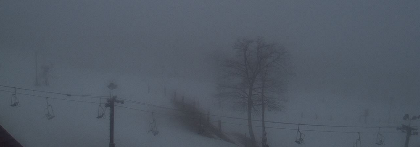
Screen capture via Wintergreen Resort’s Web Cam : This shot around noon Wednesday shows the foggy and rainy conditions at Wintergreen Resort – Wednesday – February 24, 2016
Wintergreen Resort
Nelson County, Virginia
“Due to the forecast of severe weather, the ski area will close at noon today, Wednesday, February 24. High winds with gusts up to 50 mph, thunderstorms and heavy rain are expected this afternoon into evening.”
⚠Urgent Message⚠Due to the forecast of severe weather, the ski area will close at noon today, Wednesday, February 24….
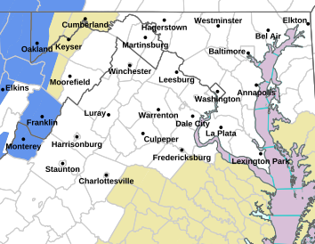
Via NWS : A FLOOD WATCH is in effect for almost all of Central Virginia and beyond from Wednesday morning through late Wednesday evening.
FLOOD WATCH
NATIONAL WEATHER SERVICE BALTIMORE MD/WASHINGTON DC
321 PM EST TUE FEB 23 2016
MDZ003-501-502-VAZ025>031-036>040-050-051-056-501>504-507-508-
WVZ050>053-055-501>506-240430-
/O.NEW.KLWX.FA.A.0003.160224T1100Z-160225T0600Z/
/00000.0.ER.000000T0000Z.000000T0000Z.000000T0000Z.OO/
WASHINGTON-EXTREME WESTERN ALLEGANY-CENTRAL AND EASTERN ALLEGANY-
AUGUSTA-ROCKINGHAM-SHENANDOAH-FREDERICK VA-PAGE-WARREN-CLARKE-
NELSON-ALBEMARLE-GREENE-MADISON-RAPPAHANNOCK-ORANGE-CULPEPER-
SPOTSYLVANIA-NORTHERN FAUQUIER-SOUTHERN FAUQUIER-WESTERN HIGHLAND-
EASTERN HIGHLAND-NORTHERN VA BLUE RIDGE-CENTRAL VA BLUE RIDGE-
HAMPSHIRE-MORGAN-BERKELEY-JEFFERSON-HARDY-WESTERN GRANT-
EASTERN GRANT-WESTERN MINERAL-EASTERN MINERAL-WESTERN PENDLETON-
EASTERN PENDLETON-
INCLUDING THE CITIES OF…HAGERSTOWN…FROSTBURG…CUMBERLAND…
STAUNTON…WAYNESBORO…STUARTS DRAFT…HARRISONBURG…
STRASBURG…WOODSTOCK…MOUNT JACKSON…NEW MARKET…WINCHESTER…
LURAY…SHENANDOAH…STANLEY…FRONT ROYAL…BERRYVILLE…
LOVINGSTON…CHARLOTTESVILLE…STANARDSVILLE…MADISON…
WASHINGTON…ORANGE…GORDONSVILLE…CULPEPER…FREDERICKSBURG…
WARRENTON…HIGHTOWN…MONTEREY…BIG MEADOWS…WINTERGREEN…
ROMNEY…PAW PAW…MARTINSBURG…CHARLES TOWN…SHEPHERDSTOWN…
MOOREFIELD…BAYARD…MOUNT STORM…PETERSBURG…ELK GARDEN…
KEYSER…FORT ASHBY…CIRCLEVILLE…FRANKLIN
321 PM EST TUE FEB 23 2016
…FLOOD WATCH IN EFFECT FROM WEDNESDAY MORNING THROUGH LATE
WEDNESDAY NIGHT…
THE NATIONAL WEATHER SERVICE IN STERLING VIRGINIA HAS ISSUED A
* FLOOD WATCH FOR PORTIONS OF MARYLAND…VIRGINIA AND NORTHEAST
WEST VIRGINIA…INCLUDING THE FOLLOWING AREAS…IN MARYLAND…
CENTRAL AND EASTERN ALLEGANY…EXTREME WESTERN ALLEGANY AND
WASHINGTON. IN VIRGINIA…ALBEMARLE…AUGUSTA…CENTRAL VA
BLUE RIDGE…CLARKE…CULPEPER…EASTERN HIGHLAND…FREDERICK
VA…GREENE…MADISON…NELSON…NORTHERN FAUQUIER…NORTHERN
VA BLUE RIDGE…ORANGE…PAGE…RAPPAHANNOCK…ROCKINGHAM…
SHENANDOAH…SOUTHERN FAUQUIER…SPOTSYLVANIA…WARREN AND
WESTERN HIGHLAND. IN NORTHEAST WEST VIRGINIA…BERKELEY…
EASTERN GRANT…EASTERN MINERAL…EASTERN PENDLETON…
HAMPSHIRE…HARDY…JEFFERSON…MORGAN…WESTERN GRANT…
WESTERN MINERAL AND WESTERN PENDLETON.
* FROM WEDNESDAY MORNING THROUGH LATE WEDNESDAY NIGHT
* STRONG LOW PRESSURE OVER LOUISIANA WILL TRACK NORTHEAST WEST OF
THE APPALACHIANS WEDNESDAY NIGHT. RAIN…HEAVY AT TIMES IS
EXPECTED TO DEVELOP WEDNESDAY AND PERSIST INTO THE EVENING.
WIDESPREAD RAINFALL AMOUNTS OF AN INCH ARE EXPECTED WITH HIGHER
TOTALS UP TO 3 INCHES POSSIBLE IN AREAS OF REPEATED ACTIVITY AND
IN THUNDERSTORMS.
* DUE TO SATURATED GROUND…RAINS WILL TURN INTO RUNOFF WITH
FLOODING OF SMALLER STREAMS AND CREEKS LIKELY. GENERAL
INUNDATION OF LOW-LYING AND FLOOD PRONE AREAS IS ALSO LIKELY.
PRECAUTIONARY/PREPAREDNESS ACTIONS…
A FLOOD WATCH MEANS THERE IS A POTENTIAL FOR FLOODING BASED ON
CURRENT FORECASTS.
YOU SHOULD MONITOR LATER FORECASTS AND BE ALERT FOR POSSIBLE
FLOOD WARNINGS. THOSE LIVING IN AREAS PRONE TO FLOODING SHOULD BE
PREPARED TO TAKE ACTION SHOULD FLOODING DEVELOP.
&&
$$
FLOOD WATCH
NATIONAL WEATHER SERVICE BLACKSBURG VA
246 PM EST TUE FEB 23 2016
…ADDED RAINFALL ON SATURATED GROUND INCREASES THREAT FOR
FLOODING OVERNIGHT INTO WEDNESDAY…
.A STRONG STORM SYSTEM WILL APPROACH THE REGION FROM THE SOUTHWEST
TONIGHT AND PASS JUST WEST OF THE AREA ON WEDNESDAY. HEAVIER BANDS
OF SHOWERS AND A FEW THUNDERSTORMS ARE EXPECTED AS THIS SYSTEM
MOVES THROUGH THE AREA WITH LOCALLY HEAVY RAINFALL POSSIBLE. THE
GROUND ACROSS THE REGION IS TOTALLY SATURATED FROM REPEATED RECENT
RAINFALL AND SNOWFALL EVENTS. ADDITIONAL EXPECTED RAINFALL WILL
RESULT IN NEAR TOTAL RUNOFF INTO AREA CREEKS…STREAMS…AND
RIVERS. SOME OF THESE RIVERS WILL LIKELY RISE TO FLOOD LEVELS OVER
THE NEXT COUPLE OF DAYS AS THE RUNOFF FROM THE RAINFALL ONTO
SATURATED GROUND CONTINUES. AREAS WHICH SEEM TO BE AT THE GREATEST
RISK ARE THE ROANOKE…DAN…JAMES…YADKIN…AND NEW RIVER
BASINS. IN ADDITION…GENERAL INUNDATION FLOODING OF LOW-LYING AND
POOR DRAINAGE AREAS…ESPECIALLY IN URBAN LOCATIONS…APPEARS
LIKELY. LOCALIZED FLASH FLOODING IS POSSIBLE WEDNESDAY IN ANY
AREAS OF STRONGER CONVECTION…MAINLY ALONG AND EAST OF THE BLUE
RIDGE.
NCZ006-VAZ007-009-010-046-047-058-059-WVZ042-043-508-240400-
/O.EXA.KRNK.FA.A.0002.000000T0000Z-160225T0000Z/
/00000.0.ER.000000T0000Z.000000T0000Z.000000T0000Z.OO/
CASWELL-TAZEWELL-SMYTH-BLAND-APPOMATTOX-BUCKINGHAM-HALIFAX-
CHARLOTTE-MERCER-SUMMERS-WESTERN GREENBRIER-
INCLUDING THE CITIES OF…YANCEYVILLE…TAZEWELL…MARION…
BLAND…APPOMATTOX…SOUTH BOSTON…KEYSVILLE…BLUEFIELD…
FLAT TOP…HINTON…HIX…QUINWOOD…DUO…RAINELLE
246 PM EST TUE FEB 23 2016
…FLOOD WATCH IN EFFECT THROUGH WEDNESDAY EVENING…
THE NATIONAL WEATHER SERVICE IN BLACKSBURG HAS EXPANDED THE
* FLOOD WATCH TO INCLUDE PORTIONS OF NORTH CENTRAL NORTH
CAROLINA…VIRGINIA AND SOUTHEAST WEST VIRGINIA…INCLUDING
THE FOLLOWING AREAS…IN NORTH CENTRAL NORTH CAROLINA…
CASWELL. IN VIRGINIA…APPOMATTOX…BLAND…BUCKINGHAM…
CHARLOTTE…HALIFAX…SMYTH AND TAZEWELL. IN SOUTHEAST WEST
VIRGINIA…MERCER…SUMMERS AND WESTERN GREENBRIER.
* THROUGH WEDNESDAY EVENING
* RAINFALL TOTALS OF 1.0 TO 2.0 INCHES WITH LOCALLY HIGHER
AMOUNTS ON TOTALLY SATURATED GROUND FROM RECENT RAINFALL AND
SNOW MELT.
* FLOODING OF SMALLER CREEKS AND STREAMS IS LIKELY. LARGER MAIN-
STEM RIVER FLOODING CAN ALSO BE EXPECTED AS THE EVENT
CONTINUES INTO WEDNESDAY. GENERAL INUNDATION OF LOW-LYING AND
FLOOD PRONE AREAS IS LIKELY. URBAN FLOODING IN POOR DRAINAGE
AREAS ALSO LIKELY.
PRECAUTIONARY/PREPAREDNESS ACTIONS…
A FLOOD WATCH MEANS THERE IS A POTENTIAL FOR FLOODING BASED ON
CURRENT FORECASTS. YOU SHOULD MONITOR LATER FORECASTS AND BE
ALERT FOR POSSIBLE FLOOD WARNINGS. THOSE LIVING IN AREAS PRONE TO
FLOODING SHOULD BE PREPARED TO TAKE ACTION SHOULD FLOODING.
FLOOD WATCH
NATIONAL WEATHER SERVICE BLACKSBURG VA
246 PM EST TUE FEB 23 2016
…ADDED RAINFALL ON SATURATED GROUND INCREASES THREAT FOR
FLOODING OVERNIGHT INTO WEDNESDAY…
.A STRONG STORM SYSTEM WILL APPROACH THE REGION FROM THE SOUTHWEST
TONIGHT AND PASS JUST WEST OF THE AREA ON WEDNESDAY. HEAVIER BANDS
OF SHOWERS AND A FEW THUNDERSTORMS ARE EXPECTED AS THIS SYSTEM
MOVES THROUGH THE AREA WITH LOCALLY HEAVY RAINFALL POSSIBLE. THE
GROUND ACROSS THE REGION IS TOTALLY SATURATED FROM REPEATED RECENT
RAINFALL AND SNOWFALL EVENTS. ADDITIONAL EXPECTED RAINFALL WILL
RESULT IN NEAR TOTAL RUNOFF INTO AREA CREEKS…STREAMS…AND
RIVERS. SOME OF THESE RIVERS WILL LIKELY RISE TO FLOOD LEVELS OVER
THE NEXT COUPLE OF DAYS AS THE RUNOFF FROM THE RAINFALL ONTO
SATURATED GROUND CONTINUES. AREAS WHICH SEEM TO BE AT THE GREATEST
RISK ARE THE ROANOKE…DAN…JAMES…YADKIN…AND NEW RIVER
BASINS. IN ADDITION…GENERAL INUNDATION FLOODING OF LOW-LYING AND
POOR DRAINAGE AREAS…ESPECIALLY IN URBAN LOCATIONS…APPEARS
LIKELY. LOCALIZED FLASH FLOODING IS POSSIBLE WEDNESDAY IN ANY
AREAS OF STRONGER CONVECTION…MAINLY ALONG AND EAST OF THE BLUE
RIDGE.
NCZ001>005-018>020-VAZ011>020-022>024-032>035-043>045-WVZ044-507-
240400-
/O.CON.KRNK.FA.A.0002.000000T0000Z-160225T0000Z/
/00000.0.ER.000000T0000Z.000000T0000Z.000000T0000Z.OO/
ASHE-ALLEGHANY NC-SURRY-STOKES-ROCKINGHAM-WATAUGA-WILKES-YADKIN-
GILES-WYTHE-PULASKI-MONTGOMERY-GRAYSON-CARROLL-FLOYD-CRAIG-
ALLEGHANY VA-BATH-ROANOKE-BOTETOURT-ROCKBRIDGE-PATRICK-FRANKLIN-
BEDFORD-AMHERST-HENRY-PITTSYLVANIA-CAMPBELL-MONROE-
EASTERN GREENBRIER-
INCLUDING THE CITIES OF…WEST JEFFERSON…SPARTA…DOBSON…
DANBURY…EDEN…BOONE…WILKESBORO…YADKINVILLE…PEARISBURG…
WYTHEVILLE…RADFORD…PULASKI…BLACKSBURG…INDEPENDENCE…
WHITETOP…TROUTDALE…VOLNEY…GALAX…FLOYD…NEW CASTLE…
CLIFTON FORGE…COVINGTON…HOT SPRINGS…ROANOKE…SALEM…
FINCASTLE…LEXINGTON…BUENA VISTA…STUART…ROCKY MOUNT…
BEDFORD…AMHERST…MARTINSVILLE…DANVILLE…LYNCHBURG…UNION…
LEWISBURG…WHITE SULPHUR SPRINGS…ALDERSON
246 PM EST TUE FEB 23 2016
…FLOOD WATCH REMAINS IN EFFECT THROUGH WEDNESDAY EVENING…
THE FLOOD WATCH CONTINUES FOR
* PORTIONS OF NORTH CAROLINA…VIRGINIA AND SOUTHEAST WEST
VIRGINIA…INCLUDING THE FOLLOWING AREAS…IN NORTH CAROLINA…
ALLEGHANY NC…ASHE…ROCKINGHAM…STOKES…SURRY…WATAUGA…
WILKES AND YADKIN. IN VIRGINIA…ALLEGHANY VA…AMHERST…
BATH…BEDFORD…BOTETOURT…CAMPBELL…CARROLL…CRAIG…
FLOYD…FRANKLIN…GILES…GRAYSON…HENRY…MONTGOMERY…
PATRICK…PITTSYLVANIA…PULASKI…ROANOKE…ROCKBRIDGE AND
WYTHE. IN SOUTHEAST WEST VIRGINIA…EASTERN GREENBRIER AND
MONROE.
* THROUGH WEDNESDAY EVENING
* RAINFALL TOTALS OF 1.5 TO 2.5 INCHES WITH LOCALLY HIGHER
AMOUNTS ON TOTALLY SATURATED GROUND FROM RECENT RAINFALL AND
SNOW MELT.
* FLOODING OF SMALLER CREEKS AND STREAMS IS LIKELY. LARGER MAIN-
STEM RIVER FLOODING CAN ALSO BE EXPECTED AS THE EVENT
CONTINUES INTO WEDNESDAY. GENERAL INUNDATION OF LOW-LYING AND
FLOOD PRONE AREAS IS LIKELY. URBAN FLOODING IN POOR DRAINAGE
AREAS ALSO LIKELY.
PRECAUTIONARY/PREPAREDNESS ACTIONS…
A FLOOD WATCH MEANS THERE IS A POTENTIAL FOR FLOODING BASED ON
CURRENT FORECASTS. YOU SHOULD MONITOR LATER FORECASTS AND BE
ALERT FOR POSSIBLE FLOOD WARNINGS. THOSE LIVING IN AREAS PRONE TO
FLOODING SHOULD BE PREPARED TO TAKE ACTION SHOULD FLOODING
DEVELOP.
Nellysford
Nelson County, Virginia
Sometime ago Kay Pfaltz, founder and co-owner of Basic Necessities in Nellysford took a group to Italy. One of places she took the group was Tili Winery & Vineyard outside of Assissi in Umbria, Italy. The regular weekly wine tasting group at Basic got a real treat when the owners of the organic Italian winery and olive oil establishment made a personal visit to the quaint restaurant in Nellysford, complete with samples!
The owners of Tili Winery & Vineyard from Italy made a visit to Basic Necessities recently to personally visit with the owners and patrons there.
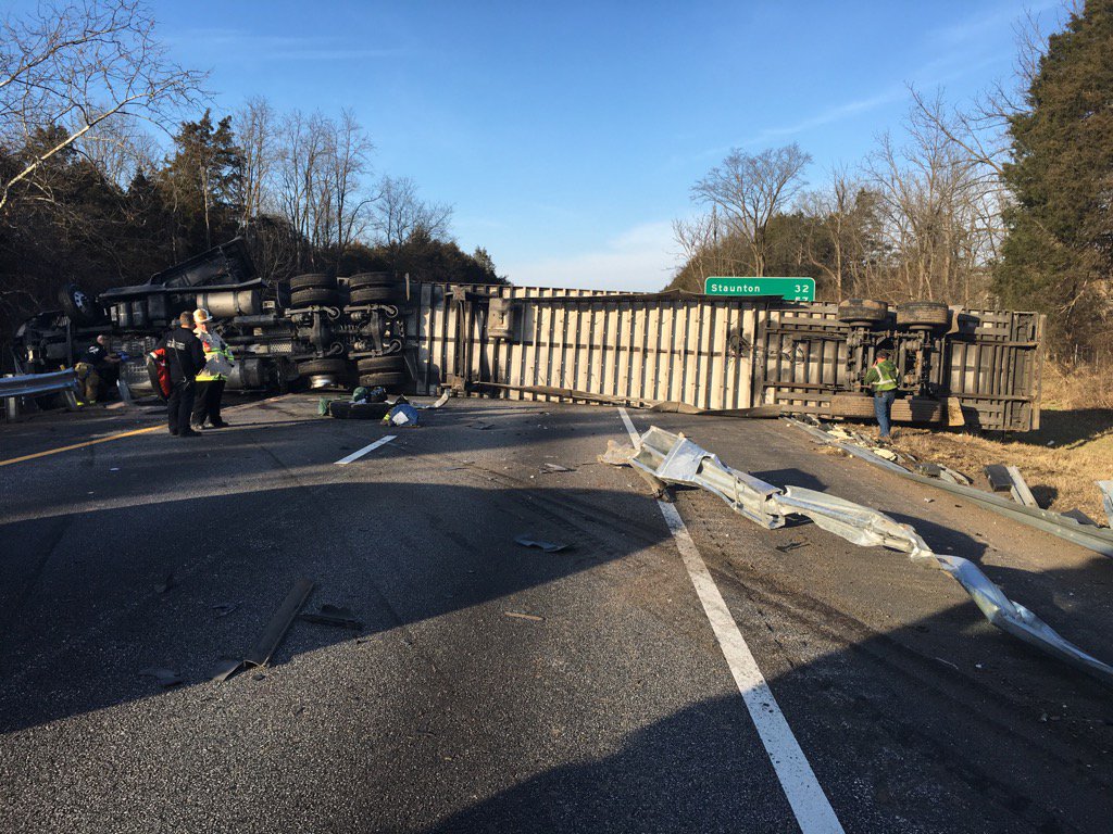
Photo courtesy of Robert Foresman – Rockbridge County Emergency Management Director : This crash on I-81 NB around the 192 MM was one of three tractor trailer incidents Thursday afternoon that halted traffic on Central Virginia Blue Ridge roads.
Central Virginia Blue Ridge
A succession of tractor trailer accidents shut down I-64 and later I-81. The first happened on Afton Mountain along I-64 Thursday morning.
Then later in the day another tractor trailer accident shut down I-81 northbound near around the 192.3 mile marker in Rockbridge County. As of late Thursday the cleanup was still underway.
Crews from Robert Young's towing and recovery cutting guard rail so the tuck can be moved. I-81 NB 192.5 pic.twitter.com/LJG29A9HsV
Finally later another trucker decided to take route 664 over Reid’s Gap near Wintergreen Resort. The truck got hung and as 7PM Thursday night the road was still blocked.
As expected a potent winter storm hit the area overnight Sunday into Monday dropping anywhere from 2-4 inches of snow in some areas with others receiving 5-6 inches. At Wintergreen resort around 7 inches of new snow fell during the day Monday.
Nelson Co, VA public schools CLOSED on Tuesday – February 16, 2016
As expected the Virginia State Police were covered up with traffic accidents across the area.
The snow is pretty much over, but a period of freezing rain is expected in the evening hours Monday, eventually changing to plain rain later in the night and on Tuesday. Heavy rain and some flooding is expected due to all of the snowpack already in place.
Tommy says much warmer weather is on the way with 60 degree readings by the weekend! – Click here to listen!
CVEC released the following statement Sunday afternoon.
Central Virginia Electric Cooperative (CVEC) is Preparing for a Valentine’s Day Storm
Lovingston, VA – Snow, ice and rain may visit central Virginia with potential for power outages.
With the forecasted arrival of a mixture of snow, followed by ice and rain, Central Virginia Electric Cooperative (CVEC) is preparing to respond to outages that could occur due to the winter weather. The greatest potential for outages will be during the snowfall followed by potential ice accumulation on trees growing outside of the 40-foot wide right-of-way and on the CVEC distribution lines.
Field crews and equipment are ready to go if necessary. Dispatchers and field supervisors are prepared to coordinate power restoration efforts. Member service representatives are available to answer member calls and enter outage tickets. CVEC is coordinating with sister electric cooperatives in Virginia that will provide assistance should outage restoration be necessary.
CVEC members may report outages by calling 800-367-2832 and then use the automated reporting system. Cooperative members may also visit www.mycvec.com on a computer or a smart phone to report an outage online or members may download the CVEC mobile app. Each reported loss of power will be entered into the CVEC Outage Management System, where it will be combined with other reported outages to allow dispatchers to identify fault locations and to send crews to where they will do the most good.
Outage updates will be available through the local media, on the CVEC Facebook page, via Twitter and at www.mycvec.com. The Cooperative website also features an outage map with the number of members affected within each substation service area and by county.
Co-op members are advised to take appropriate measures that include preparing for an outage and creating an outage kit. CVEC also requests that members turn off major appliances after a loss of power, in order to help with cold load pick up …the point when power is restored and there is a major burden on the distribution system.
For safety sake, anyone that encounters a downed-power line, stay clear, even if there is no obvious sparking. Do not attempt to cut trees on power lines. The tree may be conducting electricity. In addition, once cut, the power line may launch the tree in any direction. Please leave restoration work for trained linemen.
If the storm does result in significant power outages, CVEC crews will begin repairs along major lines closest to the local substation, then work their way out along the primary lines, clearing outages as they go, in order to restore service to as many members as soon as possible and to permit power to flow to the end of the distribution lines. Other personnel will be conducting damage assessments, while other crews may be dedicated to service restoration in local neighborhoods.
Headquartered in Lovingston, Central Virginia Electric Cooperative is a member-owned electric-distribution utility serving more than 35,000 meters in 14 counties across central Virginia. For more information, visit www.mycvec.com
As Tommy has been mentioning in his recent weathercasts, a Winter Storm and an accompanying warning, are headed for the Blue Ridge area of Central Virginia late night Sunday into Monday and early Tuesday. A mix of snow, sleet & freezing rain are likely before the system ends.
VDOT released the follow statement late Sunday morning.
WINTER WEATHER EXPECTED IN LYNCHBURG DISTRICT
VDOT prepared; motorists urged to use caution
LYNCHBURG- A mixed bag of precipitation is likely across the Commonwealth through Tuesday with freezing rain, rain and snow possible in the Lynchburg District of the Virginia Department of Transportation (VDOT). The Lynchburg District covers the counties of Amherst, Appomattox, Buckingham, Campbell, Charlotte, Cumberland, Halifax, Nelson, Pittsylvania and Prince Edward.
Lynchburg District crews have pre-treated major routes in the district and will report to work this evening to address any issues that may arise as snow begins during the overnight hours.
While motorists are encouraged to avoid travel during hazardous weather conditions, particularly during periods of icing, if travel becomes necessary, motorists should:
· Knowing road conditions in advance of any travel. Check local media or visit www.511virginia.org and call 511.
· Driving for the conditions: Slow down, ensure that windows and lights are clear of any snow/ice, avoid any sudden stops or turns and allow extra time for travel.
· Be very careful on bridges, overpasses, and other areas prone to icy conditions.
(END)
NOTE: Updates will be provided on VDOT’s Facebook account and/or the Lynchburg District’s Twitter account – @VaDOTLynchburg.
Photo submitted : Heather Goodwin announced Saturday that she too would be seeking to fill the shoes of Nelson’s exiting Commonwealth Attorney, Anthony Martin.
BRL received the announcement below from Heather Goodwin. She is a local practicing attorney at her firm, Goodwin Law Of Virginia. According to her release, if successful, she would be the first female ever to fill that role.
Longtime Nelson resident and local attorney, Heather H. Goodwin, announced Saturday that she too would be seeking to fill the shoes of Nelson’s exiting Commonwealth Attorney, Anthony Martin. Wife and mother of three, Goodwin moved to Nelson at the age of twelve and is a graduate of Nelson County High School. She completed her undergraduate at James Madison University in December of 1999 and entered Liberty University School of Law ten years later. After years of working in a professional business environment and volunteering with local organizations, Goodwin was not your typical law student. “I remember sitting across from the Dean of the law school trying to convince him that as a mother of three boys, all under the age of six, I could not only be a quality full time law student but that he should authorize my request to work a part-time job of 20 hours per week at the same time. I know he thought I was crazy.” Goodwin proved that she was in fact capable of the task graduating with honors as cum laude and earning distinction for her achievements in the institutions Lawyering Skills Program.
Goodwin began her legal career in one of the County’s longest standing firms, Eggleston & Thelen. In the fall of 2014 she opened an independent practice in Nelson with a satellite office in Amherst County. Embracing the idea of a rural general practice, Goodwin practices in the areas of criminal defense, civil litigation, estate litigation, representation of children in various proceedings and family law. “Practicing law in Nelson was always the plan,” Goodwin stated. “I began observing local judges and working in the Commonwealth Attorney’s office in both Nelson and Amherst years ago when a law student. I took the time to develop relationships with local law enforcement, probation officers and clerk’s staff, all of which has aided me in my years as a practicing attorney.”
Goodwin says she has contemplated a career in prosecution for some time but was struggling with the idea of discontinuing her service to the local community. “I view this elected position as a way to play an active role in the wellbeing of the residents of Nelson. As Commonwealth Attorney I will seek to protect the person and property of each citizen while maintaining a high level of professionalism and integrity. I am passionate about the law and about this community. It is that passion that will drive me to work hard to ensure that I am meeting the expectations of the citizens of Nelson. This will be the largest job interview of my life and if elected as Commonwealth Attorney I will serve every day knowing that I owe a duty to each resident of Nelson County.”
A WINTER STORM WARNING is in effect for most of the Central Virginia Blue Ridge area from until 10AM Tuesday – February 16, 2016. Additionally, a FLOOD WATCH has been issued for most of the from Tuesday morning until Tuesday evening.
EXPIRED – EXPIRED – EXPIRED – EXPIRED
WINTER STORM WARNING
URGENT – WINTER WEATHER MESSAGE
NATIONAL WEATHER SERVICE BALTIMORE MD/WASHINGTON DC
346 PM EST MON FEB 15 2016
AUGUSTA-ROCKINGHAM-SHENANDOAH-PAGE-WARREN-NELSON-ALBEMARLE-
WESTERN HIGHLAND-EASTERN HIGHLAND-NORTHERN VA BLUE RIDGE-
CENTRAL VA BLUE RIDGE-HARDY-WESTERN GRANT-EASTERN GRANT-
WESTERN PENDLETON-EASTERN PENDLETON-
346 PM EST MON FEB 15 2016
…WINTER STORM WARNING REMAINS IN EFFECT UNTIL 10 AM EST
TUESDAY…
* PRECIPITATION TYPE…SLEET AND FREEZING RAIN.
* ACCUMULATION…4 TO 8 INCHES OF SNOW AND SLEET. AROUND A
QUARTER INCH OF ICE FROM FREEZING RAIN.
* TIMING…SNOW AND SLEET WILL CHANGE OVER TO FREEZING RAIN EARLY
THIS EVENING. PRECIPITATION WILL GRADUALLY CHANGE TO RAIN EARLY
TUESDAY MORNING…BUT MAY LINGER IN SHELTERED VALLEYS.
* WINDS…SOUTH 5 TO 15 MPH WITH GUSTS UP TO 30 MPH.
* TEMPERATURES..RISING INTO THE UPPER 20S THIS EVENING…AND
REACHING THE MID 30S BY TUESDAY MORNING.
* IMPACTS…SNOW AND ICE WILL CAUSE SLIPPERY ROADS AND TRAVEL
WILL BE DIFFICULT.
PRECAUTIONARY/PREPAREDNESS ACTIONS…
A WINTER STORM WARNING MEANS SIGNIFICANT AMOUNTS OF SNOW…
SLEET…AND ICE ARE EXPECTED OR OCCURRING. STRONG WINDS ARE ALSO
POSSIBLE. THIS WILL MAKE TRAVEL VERY HAZARDOUS OR IMPOSSIBLE.
FLOOD WATCH
NATIONAL WEATHER SERVICE BALTIMORE MD/WASHINGTON DC
306 PM EST MON FEB 15 2016
DISTRICT OF COLUMBIA-WASHINGTON-FREDERICK MD-CARROLL-
NORTHERN BALTIMORE-SOUTHERN BALTIMORE-PRINCE GEORGES-ANNE ARUNDEL-
CHARLES-ST. MARYS-CALVERT-NORTHWEST MONTGOMERY-
CENTRAL AND SOUTHEAST MONTGOMERY-NORTHWEST HOWARD-
CENTRAL AND SOUTHEAST HOWARD-NORTHWEST HARFORD-SOUTHEAST HARFORD-
ROCKINGHAM-SHENANDOAH-FREDERICK VA-PAGE-WARREN-CLARKE-NELSON-
ALBEMARLE-GREENE-MADISON-RAPPAHANNOCK-ORANGE-CULPEPER-
PRINCE WILLIAM/MANASSAS/MANASSAS PARK-FAIRFAX-
ARLINGTON/FALLS CHURCH/ALEXANDRIA-STAFFORD-SPOTSYLVANIA-
KING GEORGE-NORTHERN FAUQUIER-SOUTHERN FAUQUIER-WESTERN LOUDOUN-
EASTERN LOUDOUN-MORGAN-BERKELEY-JEFFERSON-
INCLUDING THE CITIES OF…WASHINGTON…HAGERSTOWN…FREDERICK…
BALLENGER CREEK…ELDERSBURG…WESTMINSTER…REISTERSTOWN…
COCKEYSVILLE…BALTIMORE…BOWIE…SUITLAND-SILVER HILL…
CLINTON…COLLEGE PARK…GREENBELT…LAUREL…CAMP SPRINGS…
GLEN BURNIE…ANNAPOLIS…SEVERN…SOUTH GATE…SEVERNA PARK…
ARNOLD…ODENTON…ST. CHARLES…WALDORF…LEXINGTON PARK…
CALIFORNIA…CHESAPEAKE BEACH…HUNTINGTOWN…DUNKIRK…
NORTH BEACH…LUSBY…PRINCE FREDERICK…GERMANTOWN…DAMASCUS…
BETHESDA…ROCKVILLE…GAITHERSBURG…SILVER SPRING…LISBON…
COLUMBIA…ELLICOTT CITY…JARRETTSVILLE…ABERDEEN…
HARRISONBURG…STRASBURG…WOODSTOCK…MOUNT JACKSON…
NEW MARKET…WINCHESTER…LURAY…SHENANDOAH…STANLEY…
FRONT ROYAL…BERRYVILLE…LOVINGSTON…CHARLOTTESVILLE…
STANARDSVILLE…MADISON…ORANGE…GORDONSVILLE…CULPEPER…
DALE CITY…MANASSAS…WOODBRIDGE…LAKE RIDGE…MONTCLAIR…
RESTON…HERNDON…ANNANDALE…CENTREVILLE…CHANTILLY…MCLEAN…
FRANCONIA…ARLINGTON…ALEXANDRIA…FALMOUTH…FREDERICKSBURG…
DAHLGREN…WARRENTON…PURCELLVILLE…LEESBURG…ASHBURN…
STERLING…PAW PAW…MARTINSBURG…CHARLES TOWN…SHEPHERDSTOWN
306 PM EST MON FEB 15 2016
…FLOOD WATCH IN EFFECT FROM TUESDAY MORNING THROUGH TUESDAY
EVENING…
THE NATIONAL WEATHER SERVICE IN STERLING VIRGINIA HAS ISSUED A
* FLOOD WATCH FOR SMALL STREAMS AND CREEKS IN PORTIONS OF
MARYLAND…THE DISTRICT OF COLUMBIA…CENTRAL AND NORTHERN
VIRGINIA…AND EXTREME EASTERN WEST VIRGINIA.
* FROM TUESDAY MORNING THROUGH TUESDAY EVENING.
* A LOW PRESSURE SYSTEM WILL MOVE ACROSS THE REGION ON TUESDAY.
THIS WILL RESULT IN RAIN…WHICH WILL BE HEAVY AT TIMES.
RAINFALL TOTALS ACROSS THE WATCH AREA ARE EXPECTED TO RANGE FROM
0.75 INCHES TO 1.25 INCHES. THIS HEAVY RAINFALL COUPLED WITH
SNOWMELT CAUSED BY TEMPERATURES ON TUESDAY REACHING 50 TO 55
DEGREES WILL LEAD TO THE POTENTIAL OF SMALL STREAMS AND
TRIBUTARIES IN THE WATCH AREA TO OVERFLOW THEIR BANKS.
* SMALL STREAMS AND TRIBUTARIES MAY OVERFLOW THEIR BANKS.
ADDITIONALLY…URBAN AREAS PRONE TO POOR DRAINAGE WILL BE
SUSCEPTIBLE TO FLOODING. THE TIME FOR THE GREATEST THREAT OF
FLOODING WILL BE FROM TUESDAY AFTERNOON THROUGH TUESDAY
EVENING.
PRECAUTIONARY/PREPAREDNESS ACTIONS…
A FLOOD WATCH MEANS THERE IS A POTENTIAL FOR FLOODING BASED ON
CURRENT FORECASTS.
YOU SHOULD MONITOR LATER FORECASTS AND BE ALERT FOR POSSIBLE
FLOOD WARNINGS. THOSE LIVING IN AREAS PRONE TO FLOODING SHOULD BE
PREPARED TO TAKE ACTION SHOULD FLOODING DEVELOP.
WINTER STORM WATCH
URGENT – WINTER WEATHER MESSAGE
NATIONAL WEATHER SERVICE BALTIMORE MD/WASHINGTON DC
306 PM EST SAT FEB 13 2016
AUGUSTA-ROCKINGHAM-SHENANDOAH-PAGE-WARREN-NELSON-ALBEMARLE-
306 PM EST SAT FEB 13 2016
…WIND CHILL ADVISORY REMAINS IN EFFECT FROM 6 PM THIS EVENING
TO 9 AM EST SUNDAY…
…WINTER STORM WATCH IN EFFECT FROM SUNDAY EVENING THROUGH
TUESDAY MORNING…
THE NATIONAL WEATHER SERVICE IN BALTIMORE MD/WASHINGTON HAS
ISSUED A WINTER STORM WATCH…WHICH IS IN EFFECT FROM SUNDAY
EVENING THROUGH TUESDAY MORNING.
* WINDS…NORTHWEST 20 TO 30 MPH WITH GUSTS UP TO 40 MPH THROUGH
THIS EVENING. WINDS DECREASING TO 10 TO 15 MPH TONIGHT. WINDS
SUNDAY NIGHT THROUGH TUESDAY MORNING SOUTHEAST AROUND 5 TO 10
MPH.
* TEMPERATURES…FALLING INTO THE SINGLE DIGITS TONIGHT INTO
SUNDAY MORNING…IN THE TEENS SUNDAY NIGHT RISING INTO THE
UPPER 20S TO LOWER 30S MONDAY INTO TUESDAY.
* WIND CHILLS…10 TO 20 DEGREES BELOW ZERO.
* PRECIPITATION TYPE…SNOW…SLEET AND FREEZING RAIN.
* ACCUMULATION…POTENTIAL FOR AROUND 5 INCHES OF SNOW AND SLEET.
POTENTIAL FOR AROUND A QUARTER INCH OF ICE FROM FREEZING RAIN.
* TIMING…LOWEST WIND CHILLS ARE EXPECTED LATE TONIGHT THROUGH
EARLY SUNDAY MORNING. SNOW WILL BEGIN LATE SUNDAY NIGHT. SNOW
WILL CONTINUE THROUGH MONDAY BEFORE CHANGING TO SLEET AND
FREEZING RAIN MONDAY NIGHT. PRECIPITATION WILL END TUESDAY
AFTERNOON.
* IMPACTS…THE DANGEROUSLY LOW WIND CHILLS WILL LEAD TO FROST
BITE AND HYPOTHERMIA IF PRECAUTIONS ARE NOT TAKEN. SNOW AND ICE
WILL CAUSE SLIPPERY ROADS AND TRAVEL WILL BE DIFFICULT.
PRECAUTIONARY/PREPAREDNESS ACTIONS…
A WIND CHILL ADVISORY MEANS THAT VERY COLD AIR AND STRONG WINDS
WILL COMBINE TO GENERATE LOW WIND CHILLS. THIS WILL RESULT IN
FROST BITE AND LEAD TO HYPOTHERMIA IF PRECAUTIONS ARE NOT TAKEN.
IF YOU MUST VENTURE OUTDOORS…MAKE SURE YOU WEAR A HAT AND
GLOVES.
A WINTER STORM WATCH MEANS THERE IS A POTENTIAL FOR SIGNIFICANT
SNOW…SLEET…OR ICE ACCUMULATIONS THAT MAY IMPACT TRAVEL.
CONTINUE TO MONITOR THE LATEST FORECASTS.
URGENT – WINTER WEATHER MESSAGE
NATIONAL WEATHER SERVICE BLACKSBURG VA
230 PM EST SAT FEB 13 2016
…STRONG WINDS AND VERY LOW WIND CHILLS OVERNIGHT INTO EARLY
SUNDAY…
…WINTER STORM LIKELY SUNDAY NIGHT INTO TUESDAY…
.BITTER COLD AIR WILL PERSIST THROUGH SUNDAY MORNING ON STRONG
NORTHWEST WINDS. WINDS WILL GRADUALLY DIMINISH THROUGH THE DAY…
BUT TEMPERATURES WILL REMAIN VERY COLD…THUS EVEN WITH
DIMINISHING WINDS…WINDS CHILLS WILL BE DANGEROUSLY LOW. ANOTHER
DEVELOPING STORM SYSTEM WILL START TO AFFECT THE REGION BY SUNDAY
NIGHT WITH SNOW…FOLLOWED BY A WINTRY MIXTURE OF SLEET AND
FREEZING RAIN MONDAY AFTERNOON INTO EARLY TUESDAY. THIS WILL
LIKELY RESULT IN SIGNIFICANT ACCUMULATIONS OF SNOW…SLEET AND ICE
ACROSS MUCH OF THE REGION.
URGENT – WINTER WEATHER MESSAGE
NATIONAL WEATHER SERVICE BLACKSBURG VA
230 PM EST SAT FEB 13 2016
…STRONG WINDS AND VERY LOW WIND CHILLS OVERNIGHT INTO EARLY
SUNDAY…
…WINTER STORM LIKELY SUNDAY NIGHT INTO TUESDAY…
.BITTER COLD AIR WILL PERSIST THROUGH SUNDAY MORNING ON STRONG
NORTHWEST WINDS. WINDS WILL GRADUALLY DIMINISH THROUGH THE DAY…
BUT TEMPERATURES WILL REMAIN VERY COLD…THUS EVEN WITH
DIMINISHING WINDS…WINDS CHILLS WILL BE DANGEROUSLY LOW. ANOTHER
DEVELOPING STORM SYSTEM WILL START TO AFFECT THE REGION BY SUNDAY
NIGHT WITH SNOW…FOLLOWED BY A WINTRY MIXTURE OF SLEET AND
FREEZING RAIN MONDAY AFTERNOON INTO EARLY TUESDAY. THIS WILL
LIKELY RESULT IN SIGNIFICANT ACCUMULATIONS OF SNOW…SLEET AND ICE
ACROSS MUCH OF THE REGION.
ROANOKE-BOTETOURT-ROCKBRIDGE-PATRICK-FRANKLIN-BEDFORD-AMHERST-
INCLUDING THE CITIES OF…ROANOKE…SALEM…FINCASTLE…
LEXINGTON…BUENA VISTA…STUART…ROCKY MOUNT…BEDFORD…
AMHERST
230 PM EST SAT FEB 13 2016
…WIND CHILL ADVISORY REMAINS IN EFFECT UNTIL 10 AM EST SUNDAY…
…WINTER STORM WATCH IN EFFECT FROM SUNDAY EVENING THROUGH
TUESDAY MORNING…
THE NATIONAL WEATHER SERVICE IN BLACKSBURG HAS ISSUED A WINTER
STORM WATCH…WHICH IS IN EFFECT FROM SUNDAY EVENING THROUGH
TUESDAY MORNING.
* ACCUMULATIONS…3 TO 6 INCHES OF SNOW AND SLEET. ONE TO TWO
TENTHS INCH OF ICE.
* LOCATIONS…ALONG THE BLUE RIDGE IN VIRGINIA.
* HAZARD TYPES…STRONG GUSTY WINDS…AND VERY LOW WIND CHILLS
INTO EARLY SUNDAY. SNOW ALONG WITH A WINTRY MIX OF SLEET AND
FREEZING RAIN.
* WIND CHILL READINGS…AS LOW AS 10 BELOW.
* TIMING…WIND CHILLS THROUGH SUNDAY MORNING. SNOW DEVELOPING
SUNDAY NIGHT…CONTINUING INTO MONDAY BEFORE CHANGING TO A
MIXTURE OF SLEET AND FREEZING RAIN.
* IMPACTS…VERY LOW WIND CHILL VALUES WILL LEAD TO HYPOTHERMIA
AND FROSTBITE IF NOT PROPERLY PROTECTED FROM THE COLD. HAZARDOUS
TRAVEL SUNDAY NIGHT INTO EARLY TUESDAY.
* WINDS…NORTHWEST 10 TO 20 MPH WITH GUSTS UP TO 40 MPH.
* TEMPERATURES…4 TO 22 ABOVE.
PRECAUTIONARY/PREPAREDNESS ACTIONS…
A WIND CHILL ADVISORY MEANS THAT VERY COLD AIR AND STRONG WINDS
WILL COMBINE TO GENERATE LOW WIND CHILLS. THIS WILL RESULT IN
FROST BITE AND LEAD TO HYPOTHERMIA IF PRECAUTIONS ARE NOT TAKEN.
IF YOU MUST VENTURE OUTDOORS…MAKE SURE YOU WEAR A HAT AND
GLOVES.
A WINTER STORM WATCH MEANS THERE IS A POTENTIAL FOR SIGNIFICANT
SNOW…SLEET…OR ICE ACCUMULATIONS THAT MAY IMPACT TRAVEL.
CONTINUE TO MONITOR THE LATEST FORECASTS.