|
|

|
|
")
WINTER WEATHER ADVISORY
URGENT – WINTER WEATHER MESSAGE
National Weather Service Baltimore MD/Washington DC
136 PM EST Thu Dec 11 2025
Nelson-Central Virginia Blue Ridge- (Includes Wintergreen)
136 PM EST Thu Dec 11 2025
…WINTER WEATHER ADVISORY IN EFFECT FROM 6 AM TO 6 PM EST FRIDAY…
* WHAT…Snow expected. Total snow accumulations between 1 and 3
inches, with localized totals up to 4 inches on the Blue Ridge.
* WHERE…Central Virginia Blue Ridge, and Nelson County.
* WHEN…From 6 AM to 6 PM EST Friday.
* IMPACTS…Plan on slippery road conditions. The hazardous
conditions could impact the Friday morning and evening commutes.
PRECAUTIONARY/PREPAREDNESS ACTIONS…
Slow down and use caution while traveling. The latest road
conditions for the state you are calling from can be obtained by
calling 5 1 1.
URGENT – WINTER WEATHER MESSAGE
National Weather Service Blacksburg VA
133 PM EST Thu Dec 11 2025
.An area of low pressure over the central U.S. will move east into
the lower Ohio Valley tonight, then across the central Mid-Atlantic
Friday. This system will bring a period of snow, with the heaviest
accumulations west of I-81.
Roanoke-Botetourt-Rockbridge-Bedford-Amherst-Campbell-Appomattox-
Buckingham-
Including the cities of Salem, Buena Vista, Lexington,
Appomattox, Bedford, Fincastle, Roanoke, Amherst, and Lynchburg
133 PM EST Thu Dec 11 2025
…WINTER WEATHER ADVISORY IN EFFECT FROM 4 AM TO 7 PM EST FRIDAY…
* WHAT…Snow expected. Total snow accumulations between 1 and 3
inches.
* WHERE…Portions of central, south central, and west central
Virginia…an area that is east of Interstate-81 and along and
north of Highway 460. This includes, Roanoke, Bedford, Lynchburg,
and Lexington.
* WHEN…From 4 AM to 7 PM EST Friday.
* IMPACTS…Plan on slippery road conditions. The hazardous
conditions could impact the Friday morning and evening commutes.
PRECAUTIONARY/PREPAREDNESS ACTIONS…
Slow down and use caution while traveling. The latest road
conditions for the state you are calling from can be obtained by
calling 5 1 1.
")
Nellysford
Nelson County, Virginia
By Tommy Stafford
Updated immediately below with service info for Jimmy on January 17, 2026.
Original story – 12.08.25
I’ve written many of these over the past 22 years of making Nelson my permanent home. Some hurt more than others. But all matter. This one really hurts. A lot.
Many, many years ago Jimmy Koschara sat across the table from me in the old Margaritas Restaurant in Nellysford, tears swelling up in his eyes. Life had taken a hard turn. I remember, sort of, walking through this with him over the months ahead and eventually seeing him come out the other side. It’s what you do when someone is your friend. It was just one of many challenges he overcame.
I actually knew Jimmy’s dad, also Jim, first.
Jimmy was real Nelson. Local. He knew the history, and the people.
A few years ago Jimmy stopped me in the old Wintergreen Hardware store and told me, “I have some bad news.” He had cancer. Jimmy wasn’t a guy to sit around, ever. He was active in the forestry service for years. Even in semi retirement he would go on missions out west when the big fire hit and they needed manpower. He even did some work while taking treatment. He was also a Class B general contractor, almost everyone knew him from that.
Jimmy beat his cancer eventually. It was brutal. But he made it. Then, it came back. The second time wasn’t as forgiving. It spread, slowed down, then sped up, and sometime in the late summer and fall of this year the obvious outcome was staring Jimmy squarely in the face. He approached it with grace, sometimes fright. But with character. He lived his final months as he wanted and enjoyed what time he had left.
Jimmy often spoke to me about anything a man would worry over as he knew his time here was coming to an end. His family mostly. Will they be ok? “I want them to be able to get over me not being here,” he once told me. He knew life goes on and as long as people could remember him with a smile most days, that would be a win.
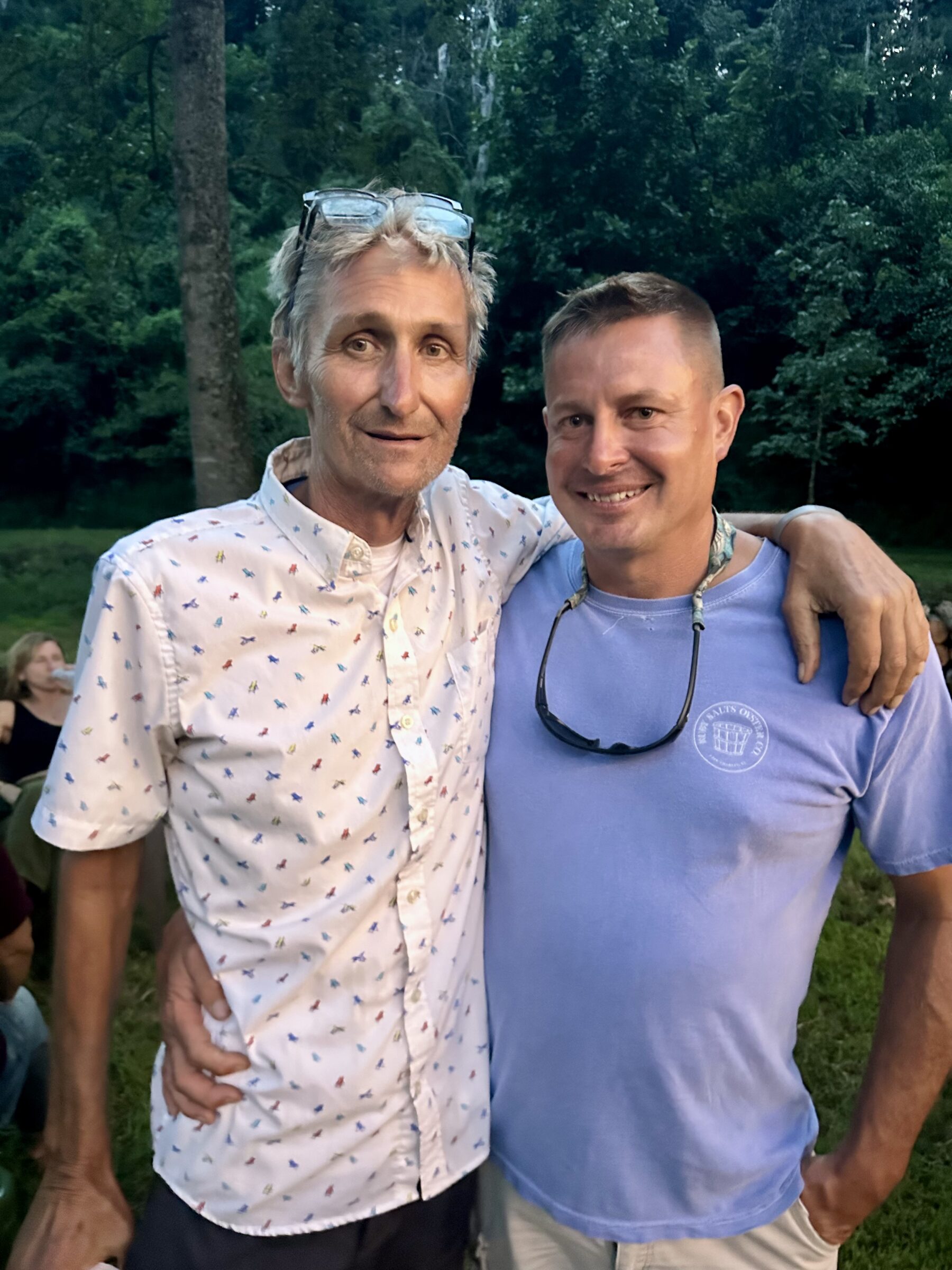
If you’ve been in Nelson any length of time, you’d be hard pressed to forget Jimmy. He will be easy to remember. Many of us have a piece of his and his family’s craftsmanship left behind as a legacy. Just this past summer Jimmy oversaw the construction of a marvelous wooden bridge that crosses our creek. We wanted it to look like it had been here for years and years. Not something that didn’t belong. He and his son made it happen. Ironically, that’s one of the last projects Jimmy was able somewhat be a part of before his health really started failing. We have, appropriately, named it The Jimmy Bridge. It will have a bronze placard put on it in his memory.

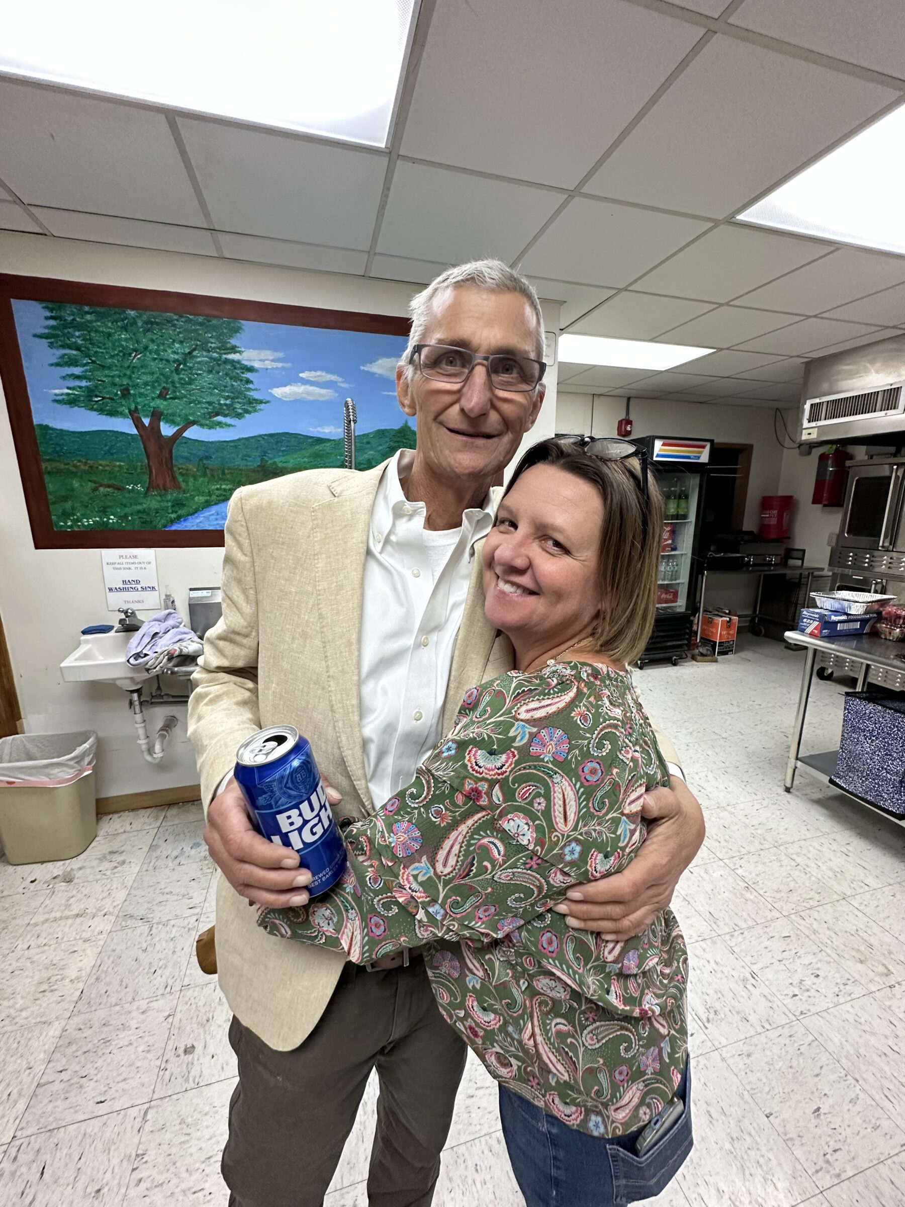
We got the call Sunday morning December 7th that Jimmy probably wouldn’t make it. Yvette rushed to go see him one last time. Just a couple of weeks before Christmas his tired body fighting cancer gave up. Jimmy crossed over his own bridge just like the countless ones he’d built for so many other people during the years.
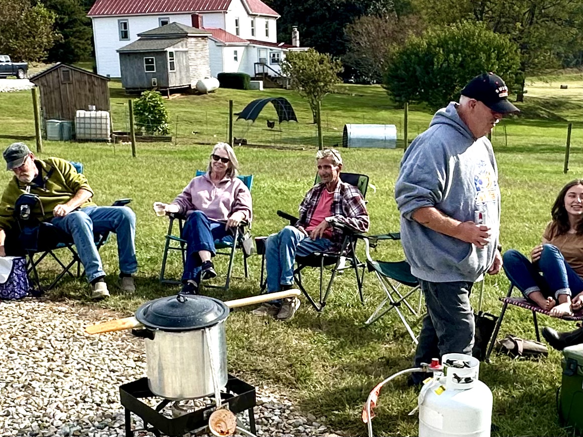
The last time I saw Jimmy in person was in the early fall of this year. We’d put together a little Brunswick stew cookout in front of the barn here on the farm. Jimmy wasn’t moving well and was pretty sick and beat up from treatments, but he drove out for a little while. He wanted to see friends. This was but a handful of them, but good ones. I didn’t even get to say goodbye that afternoon. Peyton and I had taken the side by side to go get some firewood. We waved at Jimmy as he was headed down the driveway to go back home and rest. That was my last time to see Jimmy. Sort of apropos, one final wave.
Oddly, I think Jimmy might have known that was the last time we’d see each other. He would always bring his very fancy camp chair to the farm anytime we’d have a get together. He left it that day and later told me by phone, “You keep that chair in the barn. It belongs there now.”
I got some texts back and forth from Jimmy over the next few weeks, but they became more infrequent. The last one he sent was, “One day at a day at a time Tommy. I miss y’all.”
We miss you already Jimmy. Still have that restaurant gift card you gave us from last Christmas. Think we might just use that in the coming days, in your memory.
Ride high my friend, you’re pain free now.
I’m sure there will be a remembrance for Jimmy in the coming weeks. Once I know more and have additional obit info, I’ll update it here.

Central Virginia Blue Ridge
Nelson County, Virginia
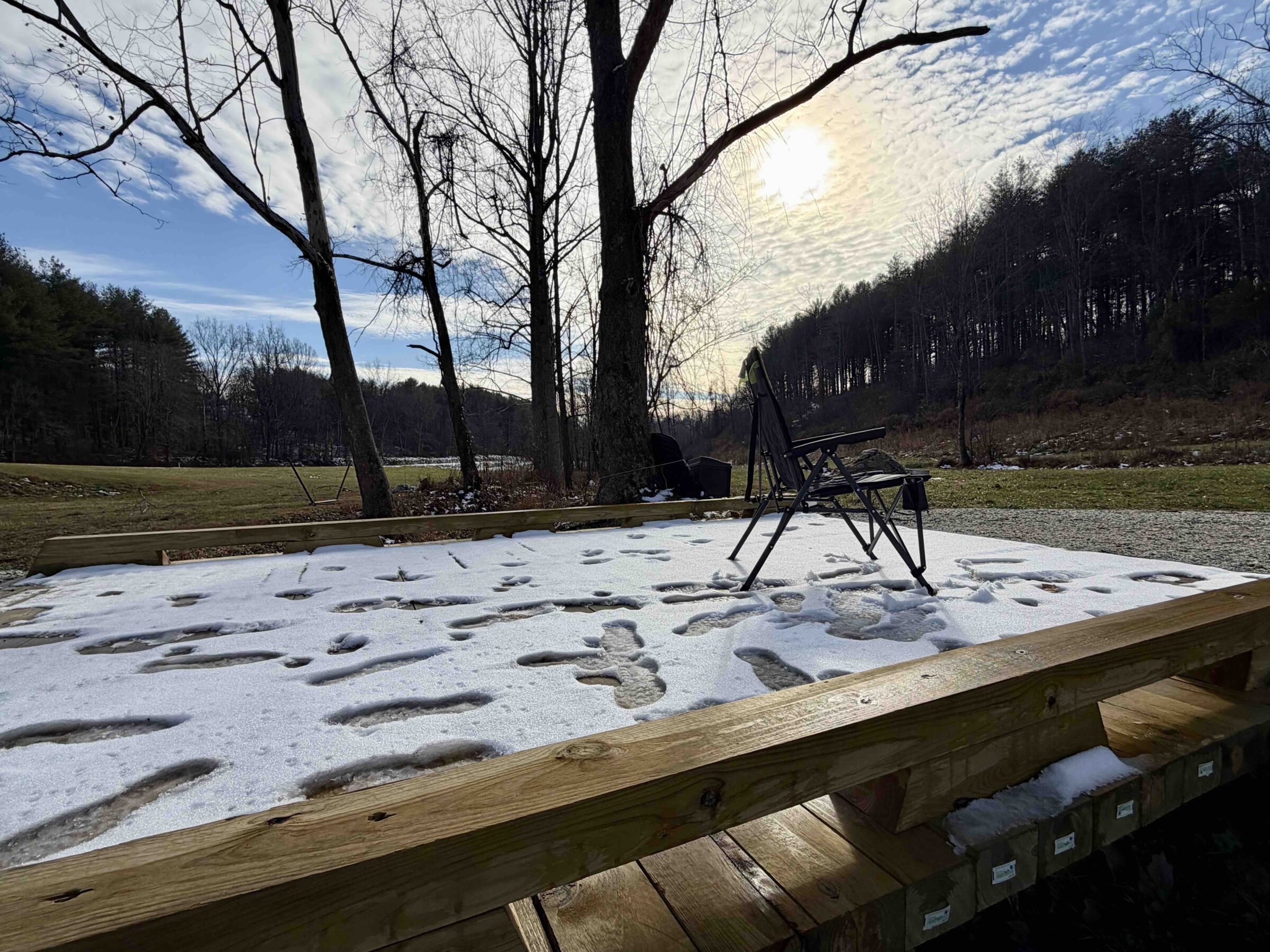
As expected, the first legitimate snow of the coming winter season began falling during the early morning hours Friday. Accumulations were a touch higher than anticipated. Not a terrible snow to travel in, but enough to make it challenging and cause a few accidents across the area. Most people are reporting between 3 to 4 inches of snow with locally higher amounts especially in the mountains.
Ironically the first snow for the season fell on the exact day Wintergreen Resort opens for the 2025-2026 ski and boarding season.
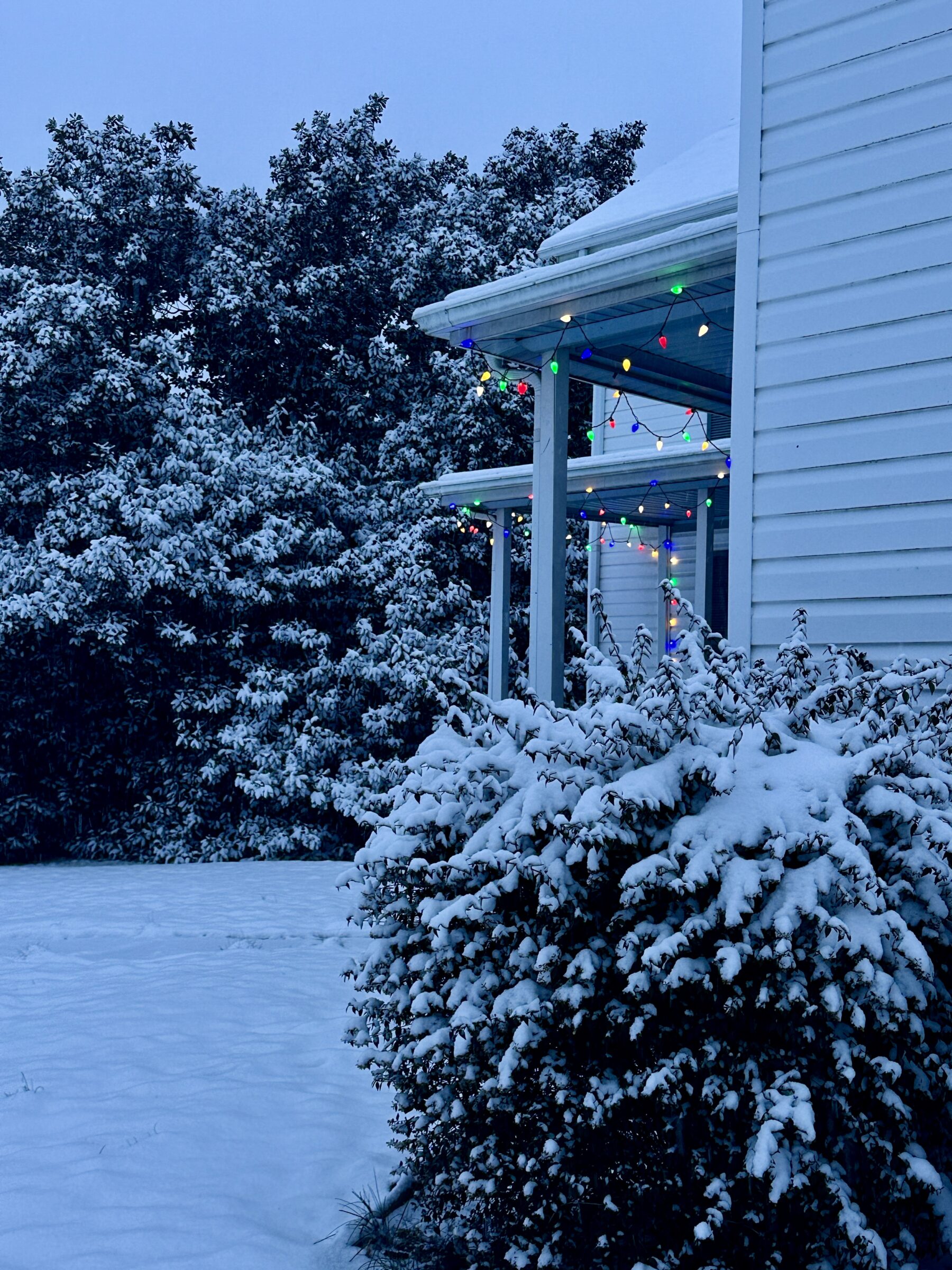
Most schools across the area closed and even some universities closed or modified their schedules.
Though it feels like winter with all of the snow, winter doesn’t officially begin by the calendar for several more days. It officially starts on December 21st at 10:03 AM.

Central Virginia Blue Ridge
WINTER WEATHER ADVISOR
A winter storm system will be the first appreciable wintry weather to the area beginning in the morning hours on Friday. The precipitation will move in from the south to north throughout the morning. The best chances for significant accumulations are in the southern portions of the area and in the mountains, though everyone should see some snow along with other wintry mixes. Lesser amounts will be experienced to our north.
More details below.
URGENT – WINTER WEATHER MESSAGE
National Weather Service Baltimore MD/Washington DC
749 AM EST Thu Dec 4 2025
VAZ036-037-050-056-042100-
/O.CON.KLWX.WW.Y.0023.251205T0600Z-251205T2100Z/
Nelson-Albemarle-Orange-Spotsylvania-
749 AM EST Thu Dec 4 2025
…WINTER WEATHER ADVISORY REMAINS IN EFFECT FROM 1 AM TO 4 PM EST
FRIDAY…
* WHAT…Mixed precipitation expected. Total snow accumulations of 1
to 2 inches, with localized totals to 3 inches possible. Ice
accumulations around a light glaze possible.
* WHERE…Albemarle, Nelson, Orange, and Spotsylvania Counties.
* WHEN…From 1 AM to 4 PM EST Friday.
* IMPACTS…Plan on slippery road conditions. The hazardous
conditions will impact the Friday morning commute.
* ADDITIONAL DETAILS…Given temperatures will be in the 20s, snow
is expected to accumulate on all untreated surfaces. A light snow
will overspread the advisory area, with slightly higher amounts
possible in any banding features. As snow winds down, a light
freezing drizzle is possible into Friday evening.
PRECAUTIONARY/PREPAREDNESS ACTIONS…
Slow down and use caution while traveling. The latest road
conditions for the state you are calling from can be obtained by
calling 5 1 1.
&&
$$
DHOF
URGENT – WINTER WEATHER MESSAGE
National Weather Service Baltimore MD/Washington DC
749 AM EST Thu Dec 4 2025
VAZ025-038-057-042100-
/O.EXA.KLWX.WW.Y.0023.251205T0600Z-251205T2100Z/
Augusta-Greene-King George-
749 AM EST Thu Dec 4 2025
…WINTER WEATHER ADVISORY IN EFFECT FROM 1 AM TO 4 PM EST FRIDAY…
* WHAT…Snow expected. Total snow accumulations of 1 to 2 inches,
with localized totals to 3 inches possible.
* WHERE…Greene, King George, and Augusta Counties.
* WHEN…From 1 AM to 4 PM EST Friday.
* IMPACTS…Plan on slippery road conditions. The hazardous
conditions will impact the Friday morning commute.
* ADDITIONAL DETAILS…Given temperatures will be in the 20s, snow
is expected to accumulate on all untreated surfaces. A light snow
will overspread the advisory area, with slightly higher amounts
possible in any banding features. As snow winds down, a light
freezing drizzle is possible into Friday evening.
PRECAUTIONARY/PREPAREDNESS ACTIONS…
Slow down and use caution while traveling. The latest road
conditions for the state you are calling from can be obtained by
calling 5 1 1.
&&
$$
URGENT – WINTER WEATHER MESSAGE
National Weather Service Baltimore MD/Washington DC
749 AM EST Thu Dec 4 2025
VAZ507-508-042100-
/O.EXA.KLWX.WW.Y.0023.251205T0600Z-251205T2100Z/
Northern Virginia Blue Ridge-Central Virginia Blue Ridge-
749 AM EST Thu Dec 4 2025
…WINTER WEATHER ADVISORY IN EFFECT FROM 1 AM TO 4 PM EST FRIDAY…
* WHAT…Snow expected. Total snow accumulations 2 to 3 inches, with
localized totals to 4 inches possible.
* WHERE…Central Virginia Blue Ridge and Northern Virginia Blue
Ridge.
* WHEN…From 1 AM to 4 PM EST Friday.
* IMPACTS…Plan on slippery road conditions. The hazardous
conditions will impact the Friday morning commute.
* ADDITIONAL DETAILS…Given temperatures will be in the 20s, snow
is expected to accumulate on all untreated surfaces. A light snow
will overspread the advisory area, with slightly higher amounts
possible in any banding features. As snow winds down, a light
freezing drizzle is possible into Friday evening.
PRECAUTIONARY/PREPAREDNESS ACTIONS…
Slow down and use caution while traveling. The latest road
conditions for the state you are calling from can be obtained by
calling 5 1 1.
&&
$$
URGENT – WINTER WEATHER MESSAGE
National Weather Service Blacksburg VA
326 AM EST Thu Dec 4 2025
.An area of low pressure will bring snow to the region tonight and
Friday.
VAZ010>014-016>020-022>024-032>035-WVZ042>044-507-508-041630-
/O.NEW.KRNK.WW.Y.0019.251205T0500Z-251206T0000Z/
Bland-Giles-Wythe-Pulaski-Montgomery-Carroll-Floyd-Craig-
Alleghany VA-Bath-Roanoke-Botetourt-Rockbridge-Patrick-Franklin-
Bedford-Amherst-Mercer-Summers-Monroe-Eastern Greenbrier-Western
Greenbrier-
Including the cities of Covington, Hinton, Blacksburg, Bedford,
Fincastle, Buena Vista, Stuart, Hix, Alderson, White Sulphur
Springs, Floyd, Amherst, Lewisburg, Rocky Mount, Radford,
Rainelle, Roanoke, Galax, Hot Springs, Duo, Wytheville, Flat Top,
Bland, Quinwood, New Castle, Lexington, Union, Clifton Forge,
Pulaski, Salem, Bluefield, and Pearisburg
326 AM EST Thu Dec 4 2025
…WINTER WEATHER ADVISORY IN EFFECT FROM MIDNIGHT TONIGHT TO 7 PM
EST FRIDAY…
* WHAT…Snow expected. Total snow accumulations between 2 to 4
inches.
* WHERE…Portions of central, south central, southwest, and west
central Virginia and southeast West Virginia…including
Bluefield, Lewisburg, Blacksburg, Lexington, Roanoke and adjacent
counties along the Blue Ridge.
* WHEN…From midnight tonight to 7 PM EST Friday.
* IMPACTS…Plan on slippery road conditions. The hazardous
conditions may impact both the Friday morning and evening commutes.
PRECAUTIONARY/PREPAREDNESS ACTIONS…
Prepare for snow covered roads. Slow down and use caution while
traveling. The latest road conditions for the state you are calling
from can be obtained by calling 5 1 1.
&&
$$
URGENT – WINTER WEATHER MESSAGE
National Weather Service Blacksburg VA
326 AM EST Thu Dec 4 2025
.An area of low pressure will bring snow to the region tonight and
Friday.
VAZ043>047-058-059-041630-
/O.NEW.KRNK.WW.Y.0019.251205T0600Z-251206T0000Z/
Henry-Pittsylvania-Campbell-Appomattox-Buckingham-Halifax-
Charlotte-
Including the cities of Danville, South Boston, Lynchburg,
Keysville, Martinsville, and Appomattox
326 AM EST Thu Dec 4 2025
…WINTER WEATHER ADVISORY IN EFFECT FROM 1 AM TO 7 PM EST FRIDAY…
* WHAT…Snow expected. Total snow accumulations of 1 to 3 inches.
Snow may end as freezing drizzle Friday afternoon with potential
for a glaze of ice.
* WHERE…Portions of central and south central Virginia…includes
Lynchburg, Martinsville, Danville Appomattox and South Boston.
* WHEN…From 1 AM to 7 PM EST Friday.
* IMPACTS…Plan on slippery road conditions. The hazardous
conditions could impact the Friday morning and evening commutes.
PRECAUTIONARY/PREPAREDNESS ACTIONS…
Prepare for snow covered roads. Slow down and use caution while
traveling. The latest road conditions for the state you are calling
from can be obtained by calling 5 1 1.

URGENT – WINTER WEATHER MESSAGE
National Weather Service Baltimore MD/Washington DC
711 AM EST Mon Dec 1 2025
…FIRST WIDESPREAD WINTER EVENT OF THE SEASON…
.Precipitation is expected to overspread the area after midnight
tonight from southwest to northeast. While precipitation is likely
to start as snow areawide, it is expected to mix with and change to
sleet and freezing rain for most of the area. Locations along and
south of US-50/I-66 likely end the event as rain as temperatures
warm through the morning. Areas along the Mason-Dixon Line are most
likely to remain all snow through the event, but that remains
uncertain given exact low track. The Tuesday morning commute could
be impacted for all areas in the Winter Weather Advisory. Updates to
the forecast are likely, so please remain weather aware for the
first widespread winter event of the season.
Augusta-Rockingham-Shenandoah-Frederick VA-Page-Warren-Clarke-
Nelson-Albemarle-Greene-Madison-Rappahannock-Orange-Culpeper-
Northern Fauquier-Western Highland-Eastern Highland-Western
Loudoun-Northern Virginia Blue Ridge-Central Virginia Blue Ridge-
Hampshire-Hardy-Eastern Grant-Western Pendleton-Eastern Pendleton-
711 AM EST Mon Dec 1 2025
…WINTER WEATHER ADVISORY REMAINS IN EFFECT FROM 1 AM TO NOON EST
TUESDAY…
* WHAT…Mixed precipitation expected, with a majority of the
precipitation expected in the form of freezing rain. Total snow
and sleet accumulations up to one inch and ice accumulations
around one tenth of an inch, with upwards of two tenths of an inch
possible on the higher ridges.
* WHERE…Portions of central, northern, northwest, and western
Virginia and eastern West Virginia.
* WHEN…From 1 AM to noon EST Tuesday.
* IMPACTS…Plan on slippery road conditions. The hazardous
conditions could impact the Tuesday morning commute.
* ADDITIONAL DETAILS…Precipitation is expected to overspread the
area after midnight tonight. Precipitation is expected to start
briefly as snow before mixing with and changing over to sleet and
freezing rain.
PRECAUTIONARY/PREPAREDNESS ACTIONS…
Slow down and use caution while traveling. The latest road
conditions for the state you are calling from can be obtained by
calling 5 1 1.
URGENT – WINTER WEATHER MESSAGE
National Weather Service Blacksburg VA
1213 AM EST Mon Dec 1 2025
Ashe-Alleghany NC-Surry-Watauga-Wilkes-Tazewell-Smyth-Bland-Giles-
Wythe-Pulaski-Montgomery-Grayson-Carroll-Floyd-Craig-Alleghany VA-
Bath-Roanoke-Botetourt-Rockbridge-Patrick-Franklin-Bedford-
Amherst-Mercer-Summers-Monroe-Eastern Greenbrier-Western
Greenbrier-
Including the cities of Quinwood, Pearisburg, Union, Lexington,
Sparta, Bland, Tazewell, Pulaski, Floyd, Lewisburg, Wytheville,
Independence, Alderson, Rainelle, Galax, Wilkesboro, Amherst,
Boone, Clifton Forge, Salem, Radford, Hinton, Marion, Roanoke,
Stuart, Hot Springs, Buena Vista, Whitetop, Dobson, Fincastle,
New Castle, Volney, Bedford, Hix, West Jefferson, White Sulphur
Springs, Bluefield, Duo, Rocky Mount, Blacksburg, Troutdale, Flat
Top, and Covington
1213 AM EST Mon Dec 1 2025
…WINTER WEATHER ADVISORY IN EFFECT FROM 7 PM THIS EVENING TO NOON
EST TUESDAY…
* WHAT…Mixed precipitation expected, with a majority of the
precipitation expected in the form of freezing rain. Total snow
accumulations up to half an inch and ice accumulations around two
tenths of an inch.
* WHERE…Portions of north central and northwest North Carolina,
central, south central, southwest, and west central Virginia, and
southeast West Virginia.
* WHEN…From 7 PM this evening to noon EST Tuesday.
* IMPACTS…Some roads, especially bridges and overpasses, will
likely become slick and hazardous. Very slippery sidewalks are
also possible. The hazardous conditions could impact the Tuesday
morning commute.
PRECAUTIONARY/PREPAREDNESS ACTIONS…
Slow down and use caution while traveling. The latest road
conditions for the state you are calling from can be obtained by
calling 5 1 1.
Be prepared for slippery roads. Slow down and use caution while
driving. If you are going outside, watch your first few steps taken
on stairs, sidewalks, and driveways. These surfaces could be icy and
slippery, increasing your risk of a fall and injury.
 Thanksgiving Memory Of Schuyler, Virginia")
Schuyler
Nelson County, Virginia
For several years during the infancy of Blue Ridge Life Magazine (back then Nelson County Life) Earl Hamner wrote poems and stories for us that we luckily got to include in the pages of the magazine. We remained dear friends with Earl until his death back in March of 2016.
One of our favorites Earl shared with us back in 2006 was his Thanksgiving Memory. We share it with you this Thanksgiving 2025.
A THANKSGIVING MEMORY
By
Earl Hamner
In the beginning Schuyler was a company town, the home of The Alberene Stone Corporation, which quarried and milled soapstone. We lived in company built houses and bought our goods from the company store. Schuyler had been a prosperous little village but when the Great Depression came the mill closed. My father found work in Waynesboro and could only be home with his family on holidays and weekends.
I remember a Thanksgiving from those years. Mornings were strangely quiet because the whistle calling the workers to the mill no longer sounded. On this Thanksgiving morning the sound that woke us was that of my father, home for the holiday, building a fire in the wood-burning cook stove. He drenched the wood with kerosene and when he lit it with a match the flames mad a whooshing sound as they roared up the chimney.
Shortly, he called down the hall to my mother, “Sweetheart,” which was his name for her till his dying day. My mother answered, “I’m on my way,” and joined him in the kitchen. They spoke quietly to each other, sharing private moments. Soon the sound of coffee percolating and the aroma of sizzling bacon would drift up to our rooms.
We descended upon them, eight red headed brothers and sisters, crowding around the stove to warm up. Breakfast was served at a long wooden trestle table my father had built and while we ate he would admire his brood and call us his “thoroughbreds.”
Each of us was assigned chores. The girls helped our mother wash and dry the dishes, make the beds, washing and iron the clothes. The boys tended to outside chores. There was the cow to be milked. She was a brown and white Guernsey. My father had bought her from Miss Dolly Hall for forty dollars. Miss Dolly had named her Chance because she gave a “good chance” of butter. The chickens had been up before us and were waiting for the grain we tossed to them on the frosty ground. Feeding the pigs was a melancholy chore. They had intelligent eyes and looked up trustingly as we poured slops into their tough. I knew, and it pained me, but they were unaware that they did not have long to live.
Our Father had brought home the turkey the day before. He had shot it over on Wales Mountain and my mother was already preparing it for the oven when company began to arrive.
We were part of two great clans. In addition to my mother’s family, most of whom lived close by, my father’s people, aunts and uncles and cousins would arrive from Richmond and Petersburg. We were in awe of the city cousins. They used slang words that were new to us such as “guy” “jerk” or “kiddo” which made us feel naïve and countrified. We children would travel in packs, playing the old games of Hide and Go Seek, Olly, Olly Oxen Free, and in the nearby school yard we would shoot baskets or play baseball, or find a plowed fiend where we searched for arrowheads and fools gold.
At home the conversation grew in pitch and volume as everybody talked at once. Hardly anybody heard what the other was saying but everybody knew what was going on. We are a family of story tellers. No event is without significance to us, and all that happens becomes a part of our history. We keep and share every detail. Our reunions become a verbal history of birth and death, of failures and accomplishments, of hardships and good times and just celebrating the joy of being together again. Being an aspiring writer I kept notes!
At one point everybody piled into cars and went to the graveyard where we paid respects to our dead. The more recent graves were marked by stones with names and dates carved or engraved on them. In the older section we came to earlier graves marked simply by a single primitive stone with no lettering to tell the name of who rested beneath it.
On the way home one of the uncles made a detour down to Esmont to visit the Staples Sisters who made bootleg apple brandy. He brought a bottle back with him and it was surreptitiously passed from one of the uncles to the other. If she caught sight of it one of the wives would disapprove but her scolding did not last long for someone moved to the piano and soon all the grown ups had their arms around each other, swaying back and forth while singing “In the Garden” or “Down by The Old Mill Stream” or “Let Me Call You Sweetheart.”
In the late afternoon dinner was served. If my grandmother was there she would say a proper grace, but if she was not my father said, “Look out, Lord, we’re gonna eat!” What a feast ensued! The turkey, golden brown, had a minimum of birdshot left in it. The applesauce was made from fruit we had gathered from an abandoned orchard down on Mt. Alto. The butter beans, the corn, and the peas came come from our summer garden and canned by my mother. The potatoes flavored with Chance’s rich butter were not mashed but creamed. Finally desserts. The sweet potato pie, still warm from the oven, was encased in a crust so crumbly and sweet that it alone could have been a dessert. And then came the pumpkin pie, steaming aromas of brown sugar and nutmeg, and all laced with generous portions of whipped cream. All of it was accompanied by milk for the children, coffee for the adults and if requested iced tea as sweet as sugar cane.
At sundown out-of-town guests drifted off to whatever relative had taken them in for the night. Others, sated with food and companionship, gathered around the radio for Franklin D. Roosevelt’s Thanksgiving message. Sleepy, exhausted children were carted off to bed. It was a family custom that we would call goodnight to each other from room to room and finally, we would drowse off to sleep secure in the knowledge that we were home, safe and loved.
They were challenging times, those Depression Years. They seem so distant now. We thought we were poor, but in them we were richer than we knew.
The house where we lived is quiet now. No one lives there any more except for a family of dirt daubers and ghosts that move from room to room behind the empty windows.
In memory I go there each night. I stand beside the gate, look up to the house, and once again I hear the voices of my mother and father, my brothers and sisters as we call goodnight to each before we rest.

From Nelson County Sheriff’s Office:
Lovingston
Nelson County, Virginia
“In November 2025, Nelson County residents residing on Crystal Lane in the Faber, Virginia area have reported a series of larcenies (thefts). Several of these reports include the larceny (theft) of multiple firearms.
As a result of this investigation, the Nelson County Sheriff’s Office has charged Mr. Thomas
Matthew Benz in relation to these larcenies.
Pursuant to the recent execution of a search warrant, all reported missing property and firearms have been located and seized by the Nelson County Sheriff’s Office. This investigation will remain on-going.
Nelson County Sheriff Mark Embrey”

Wintergreen
Nelson County, Virginia
From WPOA:
“The US Army National Guard will be conducting annual helicopter hoist training tomorrow. Between the hours of 9AM and 3PM you may observe two Blackhawk helicopters flying low and slow, hovering, and raising/lowering personnel. There will be two landing zones used. The main zone is located on Beech Grove Road, and the second zone is on Laurel Springs Drive.
Please do not approach the aircraft at any time.
Laurel Springs Drive will experience approximately 12 closures, each lasting approximately 5 minutes. If you need to travel in that area, please allow extra time.
Wintergreen Fire & Rescue personnel will be cooperating throughout the day. If at any point an actual emergency occurs which requires the helicopters to vacate the area, a plan is in place to assure that will happen.
IMPORTANT – Please avoid the Blackrock Plunge trail and the Upper Shamokin Springs trail during the training hours. We will have spotters in place to make certain no hikers wander into a high-hazard area.
Thanks to all in the community for supporting this annual training event.”

RED FLAG WARNING – DANGEROUS FIRE WEATHER CONDITIONS POSSIBLE TODAY
Update at 10:30 AM
At least one brush / wildfire has been reported Sunday morning in Nelson along Rockfish River Rd. Conditions continue to be very dangerous for wildfires across the entire area.
URGENT – FIRE WEATHER MESSAGE
National Weather Service Baltimore MD/Washington DC
1205 AM EST Sun Nov 16 2025
District of Columbia-Prince Georges-Anne Arundel-Charles-
St. Marys-Calvert-Northwest Montgomery-
Central and Southeast Montgomery-Northwest Howard-
Central and Southeast Howard-Augusta-Rockingham-Shenandoah-
Frederick VA-Page-Warren-Clarke-Nelson-Albemarle-Greene-Madison-
Rappahannock-Orange-Culpeper-Fairfax-
Arlington/Falls Church/Alexandria-Stafford-Spotsylvania-
King George-Northern Fauquier-Southern Fauquier-Eastern Highland-
Western Loudoun-Eastern Loudoun-Northern Virginia Blue Ridge-
Central Virginia Blue Ridge-Northwest Prince William-
Central and Southeast Prince William/Manassas/Manassas Park-
Hampshire-Jefferson-Hardy-Eastern Grant-Eastern Pendleton-
1205 AM EST Sun Nov 16 2025
…RED FLAG WARNING IN EFFECT FROM 8 AM THIS MORNING TO 6 PM EST
THIS EVENING FOR STRONG WINDS AND LOW HUMIDITIES FOR CENTRAL AND
SOUTHERN MARYLAND…EASTERN WEST VIRGINIA…AND NORTHERN AND
CENTRAL VIRGINIA…
The National Weather Service in Baltimore MD/Washington DC has
issued a Red Flag Warning for the threat of rapid fire spread,
which is in effect from 8 AM this morning to 6 PM EST this
evening. The Fire Weather Watch is no longer in effect.
* TIMING…From 8 AM this morning to 6 PM EST this evening.
* WINDS…Northwest 20 to 30 mph with gusts up to 50 mph across
northern Maryland, eastern West Virginia, and northwestern
Virginia. Northwest 15 to 25 mph with gusts up to 40 mph across
the Washington DC metro, southern Maryland, and the central
Virginia piedmont.
* RELATIVE HUMIDITY…As low as around 20 percent.
* IMPACTS…Any fire that develops will catch and spread
quickly. Outdoor burning is not recommended.
* FUEL MOISTURE…10-hour fuel moisture around 7 or 8 percent.
PRECAUTIONARY/PREPAREDNESS ACTIONS…
A Red Flag Warning means that critical fire weather conditions
are either occurring now, or will shortly. A combination of
strong winds, low relative humidity, and warm temperatures can
contribute to extreme fire behavior.
URGENT – FIRE WEATHER MESSAGE
National Weather Service Blacksburg VA
232 AM EST Sun Nov 16 2025
…DANGEROUS FIRE WEATHER CONDITIONS POSSIBLE TODAY…
.Gusty winds combined with low relative humidity and dry fuels
will result in the potential for dangerous fire behavior this
afternoon and evening.
Surry-Stokes-Rockingham-Caswell-Wilkes-Yadkin-Tazewell-Smyth-
Bland-Giles-Wythe-Pulaski-Montgomery-Grayson-Carroll-Floyd-Craig-
Alleghany VA-Bath-Roanoke-Botetourt-Rockbridge-Patrick-Franklin-
Bedford-Amherst-Henry-Pittsylvania-Campbell-Appomattox-Buckingham-
Halifax-Charlotte-
232 AM EST Sun Nov 16 2025
…RED FLAG WARNING IN EFFECT FROM 11 AM THIS MORNING TO 6 PM EST
THIS EVENING FOR MUCH OF VIRGINIA AND NORTH CENTRAL NORTH CAROLINA…
The National Weather Service in Blacksburg has issued a Red Flag
Warning for gusty winds and low relative humidities, which is in
effect from 11 AM this morning to 6 PM EST this evening. The Fire
Weather Watch is no longer in effect.
* AFFECTED AREA…Central, western, and southwest Virginia, and
north central North Carolina
* TIMING…From late morning into the early evening.
* WINDS…Northwest 15 to 25 mph with gusts up to 45 mph.
* RELATIVE HUMIDITY…As low as 20 percent.
* TEMPERATURES…Up to 69.
* LIGHTNING…None.
* IMPACTS…Gusty winds, dry fuels, and low relative humidity
values will be favorable for rapid fire growth.
PRECAUTIONARY/PREPAREDNESS ACTIONS…
A Red Flag Warning means that critical fire weather conditions
are either occurring now….or will shortly. A combination of
strong winds…low relative humidity…and warm temperatures can
contribute to extreme fire behavior.
For more information from NOAA/National Weather Service visit
http://www.weather.gov/rnk/fire
