Home Blog Page 231

Buckingham / Nelson: 28th Annual James River Batteau Festival Underway – Photos Added – 6.18.13

0
Photo By Marcie Gates : Brian Roberts (L, formerly of Nelson County, Va) picks a tune with Stephen DeFranco during a rest Monday evening at Wingina Landing. June 17, 2013.

Wingina
Buckingham / Nelson County, VA

The 28th Annual James River Batteau River Festival is underway! For years, we’ve been telling you about the folks that take to the James around this time in the late spring and early summer. Here’s a cool video from 2010 our Norm Shafer did.

This past Monday afternoon BRLM Photographer / Writer Marcie Gates caught up with the crew as they pulled in for the evening at Wingina Landing on Route 56 East on the Nelson / Buckingham County line. On Tuesday they headed out for Howardsville.

™©2013 BlueRidgeLife : Photo By Marcie Gates : Marcie Gates , photographer / writer for Blue Ridge Life Magazine (L) & Brian Roberts, originally of Nelson County – now living in Williamsburg, VA – stop for a self shot as people participating in the 28th Annual James River Batteau Festival pull in for the evening at Wingina Landing on the Nelson / Buckingham County Line – Monday evening June 17, 2013.
L-to-R-Nathan-Roberts-younger-bro-Linda-Roberts-mother-Tommy-Brown-nelson-co-friend-Courtney-Harlowe-Emily-Raup-battaue-sisters-Brian-Roberts-Stephen-DeFranco-VT-roommate pose for a group shot on their batteau this past Monday evening on the shores of the James River in Wingina. June 17, 2013
L-to-R-Courtney-Harlowe-Tommy-Brown-Emily-Raup all take a break Monday afternoon – June 17, 2013 at Wingina Landing. They left Tuesday morning to head on downstream finishing up this coming weekend.
To see lots more photos that Marcie shot, head on over to our BRLM Facebook album by clicking on the image above.

The James River Batteau Festival will end on Saturday June 22nd, 2013 at Maiden’s Landing.

We’ll have more of Marcie’s pics on Tuesday!

The Big Green Egg Has Landed In Nellysford!

1
™©2013 BlueRidgeLife: Photos By Tyler Rich – Big Green Eggs are popping up everywhere across the country. They have become the latest outdoor cooking sensation, and Don Rich of Zestivities has been selling them like crazy.

Nellysford
Nelson County, VA

I must admit, I am in the minority. Until recently I’d never heard of a Big Green Egg. Living under a rock, apparently! But boy have I learned lots about them now. And just what a unique outdoor cooking experience they are. “They perfectly cook just about anything you can think of,” said Don Rich, owner of Zestivities in Nellysford in the Wild Wolf Shopping Plaza.

Don Rich, owner of Zestivities in Nellysford, recently cooked pizzas in a Big Green Egg as part of a demonstration for people at Wild Wolf Plaza.
Don Rich prepares steaks on a Big Green Egg. Zestivities now has a distributorship for the BGE.

“Recently I sold everyone of the largest I had in inventory because they saw them in your paper. Then on Friday I again sold over about 120 dollars in BGE accessories to a couple from Willamsburg. They were staying at Misty Mountain Campground and picked up Blue Ridge Life. It Works. BRLM has been the most productive advertising dollars we have spent,” Don continued.

If you think we are touting our horn a bit in this story, that’s true too. Once Don told us the feedback he was getting, we definitely wanted to share that. And not to worry, Don has replenished his inventory!

Back to the BGE. This is the most remarkable thing I have ever seen. Perfectly cooking anything you put in it. And not your typical grilling experience.

A finished pizza as it comes off the BGE, perfectly cooked! Yummo!

Want to check it out for yourself, go see Don at Zestivites in Nellysford. Right next door to Wild Wolf Brewing!

Blue Ridge Parkway: Wintergreen & Montebello Rope Teams Assist Park Service At 20 Minute Cliff

0
™©2013 BlueRidgeLife : Photos By BRLM Mountain Photographer Paul Purpura : Crews from Wintergreen Rescue & Montebello Rescue are on the Blue Ridge Parkway Thursday evening preparing for a possible rope rescue at 20 Minute Cliffs.

Blue Ridge Parkway
20 Minute Cliff
Nelson County, VA

Wintergreen Fire & Rescue Chief Curtis Sheets confirms to BRLM Thursday evening that his agency along with Montebello Fire & Rescue were called to 20 Minute Cliff along the Blue Ridge Parkway. “Montebello provided manpower and an ambulance, we provided a rope team & equipment,” Chief Sheets told us around 6PM Thursday evening.

Members of Wintergreen Fire & Rescue along with Montebello Fire & Rescue prepare ropes at 20 Minute Cliff along the BRP. Thursday Evening – June 13, 2013

“We were requested by the National Park Service. They were looking for a person. A vehicle was parked at that area. They needed help checking the base of the cliffs,” Chief Sheets continued.

Chief Sheets told us around 6:40 PM Thursday the person was found and okay elsewhere in the park.

Severe Thunderstorms Cause Moderate Power Line & Tree Damage Across Area

0
™2013 BlueRidgeLife : Photo By Buck Martin – This is one of numerous trees that fell Thursday afternoon – June 13, 2013 in East Nelson County after severe thunderstorms moved through the area. This is on Craigtown Road just north of Shipman before the Rockfish River.

East Nelson County, VA
As Tommy discussed might be the case in his Thursday weathercast, some severe thunderstorms moved through the area Thursday afternoon causing some dame, particularly in East Nelson County and in Buckingham County. “We have 13 spans of wire on the ground near the intersection of laurel road and rockfish river road affecting a good number of members. That will take some time to repair before service is restored to that area of the Martins Store substation. Other outages in that substation area are scattered,” Greg Kelly with CVEC told BRLM around 5PM Thursday – June 13, 2013 regarding damage in East Nelson County. Greg has additional widespread information in this other update post on our site.

By far the more violent storms were well east and north of the Blue Ridge east of I-95 toward the eastern shore.

Photo courtesy of Kevin Rose : Tree limbs fell power lines and the road in Rockfish near the old depot. Kevin tells us his house faired ok, and barely missed. A person living on nearby Willoughby Road wasn’t so lucky. A tree fell on that house with extensive damage.

“VDOT and Fire Members are working to clear the trees that are in the road in that area,” Jaime Miller, Nelson’s Emergency Services Director told us around 5:20 Thursday afternoon.

Photo By Buck Martin: This is one of numerous power lines down in East Nelson County, VA – This is Craigtown Rd. just before the Rockfish River north of Shipman.

Additional reports of trees down have been coming in from Gladstone in SE Nelson and Northern Appomattox.

More updates as we have them.

If you have pictures of storm damage, send them to us: info-at-blueridgelife.com

SEVERE THUNDERSTORM WATCH: ! CANCELED !

0

20130613-123946.jpg

Severe Thunderstorm Watch – canceled
Statement as of 4:23 PM EDT on June 13, 2013

The National Weather Service has cancelled Severe Thunderstorm
Watch 306 for the following areas

The District of Columbia

In Maryland this cancels 1 County

In central Maryland

Montgomery

In Virginia this cancels 22 counties

In central Virginia

Albemarle Greene Nelson
Orange Spotsylvania

In northern Virginia

Arlington Culpeper Fairfax
Fauquier Loudoun Prince William
Stafford

In northwest Virginia

Clarke Frederick Madison
Page Rappahannock Shenandoah
Warren

In western Virginia

Augusta Highland Rockingham

In West Virginia this cancels 6 counties

In northeast West Virginia

Grant Hampshire Hardy
Jefferson Mineral Pendleton

In Virginia this cancels 10 independent cities

In central Virginia

Charlottesville City of Fredericksburg

In northern Virginia

City of Fairfax City of Falls Church City of Manassas
City of Manassas Park

In northwest Virginia

City of Harrisonburg City of Winchester

In western Virginia

City of Staunton City of Waynesboro

This includes the cities of…Arlington…Bayard…Berryville…
Chantilly…Charles Town…Charlottesville…Culpeper…
Elk Garden…Falmouth…Fort Ashby…Franklin…Front Royal…
Gaithersburg…Greenfield…Harrisonburg…Keyser…Leesburg…
Luray…Madison…McLean…Monterey…Moorefield…Mount Storm…
Orange…Petersburg…Reston…Romney…Spotsylvania courthouse…
Stanardsville…Staunton…Sterling…Strasburg…Warrenton…
Washington…Washington…Waynesboro…Winchester…
Woodbridge and Woodstock.

URGENT – IMMEDIATE BROADCAST REQUESTED
SEVERE THUNDERSTORM WATCH NUMBER 306
NWS STORM PREDICTION CENTER NORMAN OK
1220 PM EDT THU JUN 13 2013

THE NWS STORM PREDICTION CENTER HAS ISSUED A

* SEVERE THUNDERSTORM WATCH FOR PORTIONS OF
DISTRICT OF COLUMBIA
WESTERN MARYLAND
EASTERN TENNESSEE
WESTERN VIRGINIA
EASTERN WEST VIRGINIA
COASTAL WATERS

* EFFECTIVE THIS THURSDAY AFTERNOON AND EVENING FROM 1220 PM
UNTIL 700 PM EDT.

* PRIMARY THREATS INCLUDE…
SEVERAL LARGE HAIL EVENTS WITH A FEW VERY LARGE HAIL EVENTS TO 2
INCHES IN DIAMETER POSSIBLE
A FEW DAMAGING WIND GUSTS TO 70 MPH POSSIBLE
A FEW TORNADOES POSSIBLE

THE SEVERE THUNDERSTORM WATCH AREA IS APPROXIMATELY ALONG AND 100
STATUTE MILES EAST AND WEST OF A LINE FROM 50 MILES NORTHWEST OF
WASHINGTON DISTRICT OF COLUM TO 30 MILES EAST SOUTHEAST OF
BRISTOL TENNESSEE. FOR A COMPLETE DEPICTION OF THE WATCH SEE THE
ASSOCIATED WATCH OUTLINE UPDATE (WOUS64 KWNS WOU6).

PRECAUTIONARY/PREPAREDNESS ACTIONS…

REMEMBER…A SEVERE THUNDERSTORM WATCH MEANS CONDITIONS ARE
FAVORABLE FOR SEVERE THUNDERSTORMS IN AND CLOSE TO THE WATCH
AREA. PERSONS IN THESE AREAS SHOULD BE ON THE LOOKOUT FOR
THREATENING WEATHER CONDITIONS AND LISTEN FOR LATER STATEMENTS
AND POSSIBLE WARNINGS. SEVERE THUNDERSTORMS CAN AND OCCASIONALLY
DO PRODUCE TORNADOES.

&&

OTHER WATCH INFORMATION…CONTINUE…WW 305…

DISCUSSION…ORGANIZED LINE OF CONVECTION WILL CONTINUE TO TRACK
GENERALLY EAST ACROSS THE APPALACHIANS THROUGH THE AFTERNOON
SUSTAINED BY MODEST LARGE SCALE SUPPORT AND INCREASING
INSTABILITY…ESPECIALLY EAST OF THE MOUNTAINS AND SOUTH OF AN
OUTFLOW BOUNDARY ACROSS SCNTRL VA. PRIMARILY UNIDIRECTIONAL SHEAR
PROFILES WILL LIKELY MAINTAIN LINEAR STRUCTURE TO THE LINE WITH
BOWING/ACCELERATING SEGMENTS CAPABLE OF PRODUCING SEVERE WIND GUSTS
AND DAMAGE. SOME LOCALIZED TORNADO THREAT MAY EVOLVE WERE CONVECTION
INTERACTS WITH THE RESIDUAL BOUNDARY ACROSS VA…OR MORE ORGANIZED
SMALL SCALE BOWING SEGMENTS DEVELOP MESOVORTICES/BOW-HEAD
CIRCULATIONS.

AVIATION…A FEW SEVERE THUNDERSTORMS WITH HAIL SURFACE AND ALOFT
TO 2 INCHES. EXTREME TURBULENCE AND SURFACE WIND GUSTS TO 60
KNOTS. A FEW CUMULONIMBI WITH MAXIMUM TOPS TO 450. MEAN STORM
MOTION VECTOR 25040.

Blue Ridge Life Magazine Swag Is Coming Soon!

0
™2013 BlueRidgeLife : BRLM Photographer / Writer Marcie Gates of Faber, VA shows off one of the BRLM hats recently given away during a race at Devils Playground. The demand for the hats and other cool swag has been so great, we about to start an online store where you can get hats, sweatshirts, and so much more! Sorry, Marcie not included 😉

Nelson County, VA
We’re based in Nelson, but we are all about the Blue Ridge area these days! From Weyer’s Cave to Staunton, Waynesboro, Buckingham, Lexington, and beyond we are moving way beyond Nelson where we established our charter magazine Nelson County Life. Since 2005 we have been a mom & pop publication. Locally owned. We live, work and play, right here in the Blue Ridge with all of you!

Everyone has been asking for swag ever since we started offering it to the winners in recents races we sponsor at Devils Playground.

We heard ya!

In the coming weeks we’ll be rolling out our online store with hats, sweatshirts (for next fall) and so much more!

Be watching for Marcie wearing and showing off lots more of the neat stuff we’ll have in the coming months!

CVEC Storm Damage Update : 6:33 PM 6.13.13

1

Arrington
Nelson County, VA

Updated 6:33 PM 6-13-13
Update to the 6:15 Report:

Members in the Trevillians service area are without power due to a fire at a Dominion Power transmission line pole. Their line has been de-energized and one of their repair crews has been called in.

Dominion also has identified the issue with the transmission feed to the Mount Rush substation. Repairs are underway.

Updated 6:00 PM 6-13-13
As of 6:00 PM CVEC has 5500 members without service, with the majority located between Appomattox and Louisa Counties.

1425 members served by the Mount Rush substation in Buckingham County are without service and awaiting the restoration of power delivery to the substation by Dominion Power Transmission Services.

The areas served by the Palmyra office are making good progress in Fluvanna, Louisa, Orange, eastern Albemarle, western Goochland and in the Cartersville area. Crews anticipate completing repair work to a large portion of the members in that area in the next few hours. Once work is complete those crews will be redeployed to assist crews in other areas.

A number of other areas have sustained significant damage from the storm and will take longer before damages are repaired.
· For example, in Nelson County, there is a broken pole and 13 spans of wire on the ground along the Rockfish River Road on the Woods Mill circuit out of the Martins Store substation area.
· In the Pamplin Substation area in the South District, one circuit has two broken poles (on three-phase lines) and there is wire on the ground on the other circuit. A pole typically will take a minimum of 4-hours to replace.

While CVEC has a good damage assessment and has strong projections regarding the total number of outages, individual restoration estimates are not possible. Many, if not most of the 5500 members, will see service restoration this evening (If Dominion Power restores service to the Mount Rush substation) but it is possible that work will extend into tomorrow before all members see service restoration.

Members may report outages online at www.mycvec.com or by calling 800-367-2832 to use the automated outage reporting system. Members may also track restoration progress at www.mycvec.com using the online outage map, which will be updated once a crew completes repairs, re-energizes the line, then contacts the dispatcher to report the service restoration.

Updated 4:20 PM 6-13-13
CVEC currently has 4200 members without power with the majority of the outages occurring between Appomattox and Louisa counties including Cumberland and western Goochland counties.

CVEC began seeing storm damage mid-afternoon with two substations (Trevillians (728 members) along the i-64 corridor and Mount Rush (1425 members) in Buckingham) losing the power feed from the Transmission Delivery Company. Transmission services have been restored to Trevillians but CVEC is still awaiting the delivery of power to the Mount Rush Substation, leaving a little less than 3000 members affected in the remainder of the substation areas.

The Co-op will post regular updates on www.mycvec.com and members and media can track outage restoration on the CVEC Outage Map.
If the storms pass through and the outage totals do not rise, crews will have a good opportunity to knock down the outage totals.

Members should call report an outage through the CVEC Outage Map or by calling 800-367-2832 and using the automated outage reporting system.

Original post at 10:26 AM
Central Virginia Electric Cooperative Storm Preparations

With the forecasted arrival of severe weather in portions of Virginia, Central Virginia Electric Cooperative (CVEC) is preparing to respond to potential outages from downed trees due to high wind and earth saturating rain.

Field crews and equipment are ready to go if necessary.  Dispatchers and field supervisors are prepared to coordinate power restoration efforts.  Member service representatives are available to answer member calls and enter outage tickets.  Crews from adjoining cooperatives are standing by should their assistance be necessary.

CVEC members may report outages by calling 800-367-2832 and using the automated reporting system.  Cooperative members may also visit www.mycvec.com on a computer or a smart phone to report an outage online.  Each reported loss of power will be entered into the CVEC Outage Management System, where it will be combined with other reported outages to allow dispatchers to send crews to where they will do the most good.

Outage updates will be available through the local media, on the CVEC Facebook page, and at www.mycvec.com.  The Cooperative website also features an outage map with the number of members affected within each substation service area.

Co-op members are advised to take appropriate measures that include preparing for an outage and creating an outage kit.   CVEC also requests that members turn off major appliances after a loss of power, in order to help with cold load pick up…the point when power is restored and there is a major burden on the distribution system.

For safety sake, anyone that encounters a down-power line, please stay clear, even if there is no obvious sparking.   Do not attempt to cut trees on power lines.  The tree may be conducting electricity.  In addition, once cut, the power line may launch the tree in any direction.  Please leave restoration work for the trained linemen.

If the storm does result in significant power outages, CVEC crews will begin repairs along major lines closest to the local substation, then work their way out along the primary lines, clearing outages as they go in order to restore service to as many members as soon as possible.  Other personnel will be creating damage assessment, while other crews may be dedicated to service restoration in local neighborhoods or clusters of home.

Look for updates from CVEC if necessary and then on a regular basis.

Central Virginia Electric Cooperative is a member-owned, not-for-profit, electric utility serving the rural portions of 14 Virginia counties.

Flash Flood Watch: ! CANCELED !

0
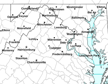
Via NWS : Click on image above for latest updates from NWS.

Flood Watch / Flood Statement
Statement as of 4:24 PM EDT on June 13, 2013

…Flash Flood Watch is cancelled…

The Flash Flood Watch for portions of Maryland…Virginia and
northeast West Virginia has been cancelled.

FLOOD WATCH
FLOOD WATCH
NATIONAL WEATHER SERVICE BALTIMORE MD/WASHINGTON DC
459 AM EDT THU JUN 13 2013

AUGUSTA-ROCKINGHAM-NELSON-ALBEMARLE-WESTERN HIGHLAND-
EASTERN HIGHLAND-WESTERN PENDLETON-EASTERN PENDLETON-
INCLUDING THE CITIES OF…STAUNTON…WAYNESBORO…HARRISONBURG…
CHARLOTTESVILLE…HIGHTOWN…MONTEREY…CIRCLEVILLE…FRANKLIN
459 AM EDT THU JUN 13 2013

…FLASH FLOOD WATCH REMAINS IN EFFECT THROUGH THIS AFTERNOON…

THE FLASH FLOOD WATCH CONTINUES FOR

* PORTIONS OF VIRGINIA AND NORTHEAST WEST VIRGINIA…INCLUDING
THE FOLLOWING AREAS…IN VIRGINIA…ALBEMARLE…AUGUSTA…
EASTERN HIGHLAND…NELSON…ROCKINGHAM AND WESTERN HIGHLAND.
IN NORTHEAST WEST VIRGINIA…EASTERN PENDLETON AND WESTERN
PENDLETON.

* THROUGH THIS AFTERNOON.

* SHOWERS AND THUNDERSTORMS MAY MOVE ACROSS THE REGION THIS
MORNING AND PRODUCE HEAVY DOWNPOURS. RAINFALL AMOUNTS IN
EXCESS OF 1 INCH ARE POSSIBLE. ANOTHER ROUND OF STORMS MAY BRING
HEAVY RAIN THIS AFTERNOON WITH AN ADDITIONAL 1 TO 2 INCHES
POSSIBLE.

* WITH THE GROUND ALREADY SATURATED FROM HEAVY RAINFALL DURING
THE PAST WEEK…ONLY AN INCH OF RAINFALL IN AN HOUR COULD
PRODUCE FLASH FLOODING OF STREAMS AND LOW LYING AREAS.

PRECAUTIONARY/PREPAREDNESS ACTIONS…

A FLASH FLOOD WATCH MEANS THAT CONDITIONS MAY DEVELOP THAT LEAD
TO FLASH FLOODING. FLASH FLOODING IS A VERY DANGEROUS SITUATION.

YOU SHOULD MONITOR LATER FORECASTS AND BE PREPARED TO TAKE ACTION
SHOULD FLASH FLOOD WARNINGS BE ISSUED.

TORNADO WATCH: ! CANCELED !

0

20130610-144339.jpg

Tornado Watch – Canceled
Statement as of 5:40 PM EDT on June 10, 2013

The National Weather Service has cancelled Tornado Watch 293 for
the following areas

In Virginia this cancels 8 counties

In central Virginia

Nelson

In northwest Virginia

Frederick Page Shenandoah
Warren

In western Virginia

Augusta Highland Rockingham

In Virginia this cancels 4 independent cities

In northwest Virginia

City of Harrisonburg City of Winchester

In western Virginia

City of Staunton City of Waynesboro

This includes the cities of…Front Royal…Greenfield…
Harrisonburg…Luray…Monterey…Staunton…Strasburg…
Waynesboro…Winchester and Woodstock.

Canceled
TORNADO WATCH
URGENT – IMMEDIATE BROADCAST REQUESTED
TORNADO WATCH NUMBER 293
NWS STORM PREDICTION CENTER NORMAN OK
200 PM EDT MON JUN 10 2013

THE NWS STORM PREDICTION CENTER HAS ISSUED A

* TORNADO WATCH FOR PORTIONS OF
DISTRICT OF COLUMBIA
DELAWARE
MUCH OF MARYLAND
NORTHERN NORTH CAROLINA
SOUTHERN NEW JERSEY
SOUTHEAST PENNSYLVANIA
MUCH OF VIRGINIA
THE EASTERN PANHANDLE OF WEST VIRGINIA
COASTAL WATERS

* EFFECTIVE THIS MONDAY AFTERNOON AND EVENING FROM 200 PM UNTIL
1000 PM EDT.

* PRIMARY THREATS INCLUDE…
SEVERAL TORNADOES LIKELY
NUMEROUS DAMAGING WIND GUSTS TO 70 MPH LIKELY

THE TORNADO WATCH AREA IS APPROXIMATELY ALONG AND 105 STATUTE
MILES EAST AND WEST OF A LINE FROM 40 MILES SOUTHWEST OF SOUTH
HILL VIRGINIA TO 30 MILES NORTHWEST OF WILMINGTON DELAWARE. FOR
A COMPLETE DEPICTION OF THE WATCH SEE THE ASSOCIATED WATCH
OUTLINE UPDATE (WOUS64 KWNS WOU3).

PRECAUTIONARY/PREPAREDNESS ACTIONS…

REMEMBER…A TORNADO WATCH MEANS CONDITIONS ARE FAVORABLE FOR
TORNADOES AND SEVERE THUNDERSTORMS IN AND CLOSE TO THE WATCH
AREA. PERSONS IN THESE AREAS SHOULD BE ON THE LOOKOUT FOR
THREATENING WEATHER CONDITIONS AND LISTEN FOR LATER STATEMENTS
AND POSSIBLE WARNINGS.

&&

OTHER WATCH INFORMATION…CONTINUE…WW 292…

DISCUSSION…TSTMS EXPECTED TO DEVELOP/PERSIST THROUGH THIS EVE
ALONG THE NRN EXTENSIONS OF THE SAME THE CONFLUENCE AXES RESPONSIBLE
FOR STORMS NOW IN THE CAROLINAS. WHILE MID-LVL LAPSE RATES WILL
REMAIN MODEST…SFC HEATING AND FAIRLY RICH LOW-LVL MOISTURE SHOULD
YIELD SUFFICIENT BUOYANCY FOR SUSTAINED STORMS AND POSSIBLE
SUPERCELLS GIVEN STRENGTHENING MID-LVL FLOW /WITH SWLY 500 MB FLOW
AROUND 50 KTS/ AND ASCENT EXPECTED WITH THE CONTINUED EWD MOVEMENT
OF TN VLY UPR TROUGH. POTENTIAL FOR LOW-LVL MESOCYCLONES MAY BE
ENHANCED NEAR DIFFUSE WARM FRONT IN SE PA/NE MD/DE.

AVIATION…TORNADOES AND A FEW SEVERE THUNDERSTORMS WITH HAIL
SURFACE AND ALOFT TO 1 INCH. EXTREME TURBULENCE AND SURFACE WIND
GUSTS TO 60 KNOTS. A FEW CUMULONIMBI WITH MAXIMUM TOPS TO 500.
MEAN STORM MOTION VECTOR 23030.

…

Flash Flood Watch – CANCELED

0
Via NWS: A Flash Flood Watch continues into Monday evening for most of the area. Click on the map image above for the latest from NWS.

Flood Watch / Flood Statement
Statement as of 5:44 PM EDT on June 10, 2013

…Flash Flood Watch is cancelled…

The Flash Flood Watch for portions of Virginia and northeast West
Virginia has been cancelled. One to three inches of rain have
fallen across the central Shenandoah Valley and southern Potomac
Highlands. Scattered showers and thunderstorms are possible
tonight…so please stay tuned for the potential for further
flooding.

FLOOD WATCH
NATIONAL WEATHER SERVICE BALTIMORE MD/WASHINGTON DC
953 AM EDT MON JUN 10 2013

AUGUSTA-ROCKINGHAM-SHENANDOAH-PAGE-WARREN-NELSON-ALBEMARLE-GREENE-
MADISON-RAPPAHANNOCK-ORANGE-CULPEPER-NORTHERN FAUQUIER-
SOUTHERN FAUQUIER-WESTERN HIGHLAND-EASTERN HIGHLAND-
WESTERN PENDLETON-EASTERN PENDLETON-
INCLUDING THE CITIES OF…STAUNTON…WAYNESBORO…HARRISONBURG…
FRONT ROYAL…CHARLOTTESVILLE…WASHINGTON…CULPEPER…
WARRENTON…HIGHTOWN…MONTEREY…CIRCLEVILLE…FRANKLIN
953 AM EDT MON JUN 10 2013

…FLASH FLOOD WATCH NOW IN EFFECT UNTIL 9 PM EDT THIS EVENING…

THE FLASH FLOOD WATCH IS NOW IN EFFECT FOR

* PORTIONS OF VIRGINIA AND NORTHEAST WEST VIRGINIA…INCLUDING
THE FOLLOWING AREAS…IN VIRGINIA…ALBEMARLE…AUGUSTA…
CULPEPER…EASTERN HIGHLAND…GREENE…MADISON…NELSON…
NORTHERN FAUQUIER…ORANGE…PAGE…RAPPAHANNOCK…
ROCKINGHAM…SHENANDOAH…SOUTHERN FAUQUIER…WARREN AND
WESTERN HIGHLAND. IN NORTHEAST WEST VIRGINIA…EASTERN
PENDLETON AND WESTERN PENDLETON.

* UNTIL 9 PM EDT THIS EVENING

* AFTER A SOAKING RAIN THIS MORNING…SHOWERS AND THUNDERSTORMS
WILL PRODUCE HEAVY RAIN THIS AFTERNOON AND EARLY EVENING.
ADDITIONAL RAINFALL AMOUNTS OF 1 TO 3 INCHES CAN BE EXPECTED.
WITH THE GROUND ALREADY SATURATED FROM PREVIOUS RAINFALL…IT
WILL NOT TAKE MUCH RAIN TO PRODUCE FLASH FLOODING OF STREAMS
AND LOW LYING AREAS.

PRECAUTIONARY/PREPAREDNESS ACTIONS…

A FLASH FLOOD WATCH MEANS THAT CONDITIONS MAY DEVELOP THAT LEAD
TO FLASH FLOODING. FLASH FLOODING IS A VERY DANGEROUS SITUATION.

YOU SHOULD MONITOR LATER FORECASTS AND BE PREPARED TO TAKE ACTION
SHOULD FLASH FLOOD WARNINGS BE ISSUED.

FLOOD WATCH
NATIONAL WEATHER SERVICE BLACKSBURG VA
718 AM EDT MON JUN 10 2013

…PERIODS OF HEAVY RAIN THROUGH THIS EVENING…

.A COLD FRONT IS APPROACHING THE AREA FROM THE WEST AND WILL
CROSS THE REGION THIS AFTERNOON AND EVENING. NUMEROUS SHOWERS AND
THUNDERSTORMS ARE EXPECTED AHEAD OF AND ALONG THE FRONT. THE
THUNDERSTORMS WILL PRODUCE VERY HEAVY RAIN.

ASHE-ALLEGHANY NC-SURRY-WATAUGA-WILKES-YADKIN-TAZEWELL-SMYTH-
BLAND-GILES-WYTHE-PULASKI-MONTGOMERY-GRAYSON-CARROLL-FLOYD-CRAIG-
ALLEGHANY VA-BATH-ROANOKE-BOTETOURT-ROCKBRIDGE-PATRICK-FRANKLIN-
BEDFORD-AMHERST-MERCER-SUMMERS-MONROE-GREENBRIER-
INCLUDING THE CITIES OF…WEST JEFFERSON…SPARTA…DOBSON…
BOONE…WILKESBORO…YADKINVILLE…TAZEWELL…MARION…BLAND…
PEARISBURG…WYTHEVILLE…RADFORD…PULASKI…BLACKSBURG…
INDEPENDENCE…WHITETOP…TROUTDALE…VOLNEY…GALAX…FLOYD…
NEW CASTLE…CLIFTON FORGE…COVINGTON…HOT SPRINGS…ROANOKE…
SALEM…FINCASTLE…LEXINGTON…BUENA VISTA…STUART…
ROCKY MOUNT…BEDFORD…AMHERST…BLUEFIELD…FLAT TOP…HINTON…
HIX…UNION…LEWISBURG…QUINWOOD…DUO…RAINELLE
718 AM EDT MON JUN 10 2013

…FLASH FLOOD WATCH REMAINS IN EFFECT UNTIL 6 PM EDT THIS
EVENING…

THE FLASH FLOOD WATCH CONTINUES FOR

* PORTIONS OF NORTH CAROLINA…VIRGINIA AND SOUTHEAST WEST
VIRGINIA…INCLUDING THE FOLLOWING AREAS…IN NORTH CAROLINA…
ALLEGHANY NC…ASHE…SURRY…WATAUGA…WILKES AND YADKIN. IN
VIRGINIA…ALLEGHANY VA…AMHERST…BATH…BEDFORD…BLAND…
BOTETOURT…CARROLL…CRAIG…FLOYD…FRANKLIN…GILES…
GRAYSON…MONTGOMERY…PATRICK…PULASKI…ROANOKE…
ROCKBRIDGE…SMYTH…TAZEWELL AND WYTHE. IN SOUTHEAST WEST
VIRGINIA…GREENBRIER…MERCER…MONROE AND SUMMERS.

* UNTIL 6 PM EDT THIS EVENING.

* NUMEROUS SHOWERS AND THUNDERSTORMS…SOME WITH VERY HEAVY
RAIN…ARE EXPECTED.

* FLASH FLOODING IS POSSIBLE…IF REPETITIVE HEAVY RAINFALL OCCURS
OVER THE SAME AREA…OR IF VERY HEAVY RAINFALL RATES OCCUR.
RAINFALL RATES BETWEEN 3 AND 4 INCHES PER HOUR ARE POSSIBLE IN
ANY OF THE STRONG THUNDERSTORMS. WITH THESE CONDITIONS…DUE TO
ALREADY SATURATED GROUND…FLASH FLOODING OF SMALL STREAMS WILL
BECOME LIKELY.

PRECAUTIONARY/PREPAREDNESS ACTIONS…

A FLASH FLOOD WATCH MEANS THAT CONDITIONS MAY DEVELOP THAT LEAD
TO FLASH FLOODING. FLASH FLOODING IS A VERY DANGEROUS SITUATION.
YOU SHOULD MONITOR LATER FORECASTS AND BE PREPARED TO TAKE ACTION
SHOULD FLASH FLOOD WARNINGS BE ISSUED.

- Advertisement -