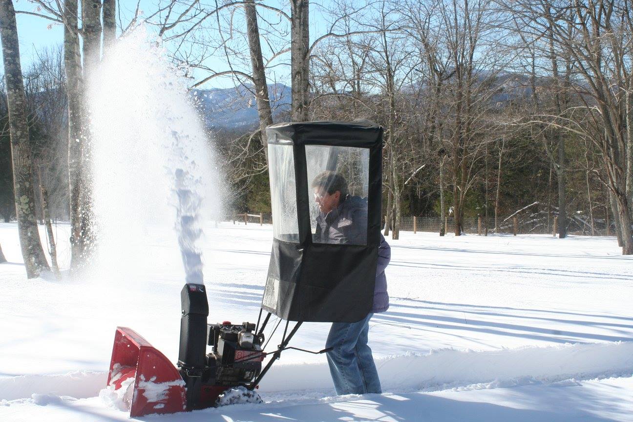
Photo By Marion Kanour : Steve Aldefer of Faber, Virginia clears the way with his snowblower for nearby neighbors this past Sunday afternoon – January 24, 2016
Central Virginia Blue Ridge
For the first time since the heavy snow fell across the area on Friday and Saturday, the sunshine came out on Sunday. That allowed people to begin digging out.
Photo By Marion Kanour : Barbara Heyl of Faber, Virginia gives her snazzy snowblower a run this past Sunday afternoon – January 24, 2016
Great progress was being made on area roadways by Sunday. Though many roads were still snow packed, folks were able to start getting around.
Photo By Heidi Crandall : Obviously it will be days if not weeks before the Blue Ridge Parkway is reopen. Many areas at that elevation got upwards to near 3 feet of snow in the highest of elevations.
Digging out up top. Thanks to Tori Mininger for the photos. The Nature Foundation at Wintergreen
There's no easy way to say this. Waynesboro's beloved Wayne Lanes bowling alley has collapsed under the weight of the snow and has been condemned.Photo courtesy: Lisa Davis Lotts
Though some rain and snow showers are in the forecast over the coming days, much milder temps are headed our way by the end of the week. That combined with lots of sunshine should allow for good melting of snow for several days.
Photo Courtesy of Sheriff David Hill Nelson County : Route 29 Northbound in Arrington near Tye River Elementary was snow covered and hazardous early Friday afternoon as snow started across the area. – January 22, 2016
Central Virginia Blue Ridge
By late morning Friday snow started falling over most of Central Virginia with many roads covered across the area. Winds also added a mix of blowing snow in.
Gusty winds blow snow in Roseland of Nelson County on Friday afternoon just before dark.
By Friday evening around 8″ if snow had fallen in the lower elevation of Nelson County with locally higher amounts. On the mountain at Wintergreen, around 10″ had fallen by 7PM.
By 10 PM Friday night CVEC’s automated reporting system showed only a handfull of outage across their system. High winds overnight may drive those numbers up.
More snow is likely through Saturday with the heaviest falling by noon Saturday and then tapering off with some clearing likely by the predawn hours on Sunday. And sunny skies on Sunday. Temps will climb to the upper 30’s and even middle 40’s in the coming days.
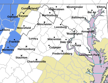
Via NWS Sterling / DC : Winter Storm & Blizzard Warnings have now been hoisted across the area. The brunt of the winter storms will affect the area by noon Saturday.
Central Virginia Blue Ridge Area
URGENT – WINTER WEATHER MESSAGE
NATIONAL WEATHER SERVICE BALTIMORE MD/WASHINGTON DC
738 PM EST FRI JAN 22 2016
LOW PRESSURE ALONG THE SOUTH CAROLINA COAST WILL TRACK NORTH WHILE
CONTINUING TO INTENSIFY…MOVING OFF THE SOUTHERN DELMARVA COAST
BY SATURDAY MORNING.
VAZ025-026-036>038-503-504-WVZ505-506-230900-
/O.CON.KLWX.WS.W.0001.000000T0000Z-160124T1100Z/
AUGUSTA-ROCKINGHAM-NELSON-ALBEMARLE-GREENE-WESTERN HIGHLAND-
EASTERN HIGHLAND-WESTERN PENDLETON-EASTERN PENDLETON-
738 PM EST FRI JAN 22 2016
…WINTER STORM WARNING REMAINS IN EFFECT UNTIL 6 AM EST SUNDAY…
* HAZARD TYPES…HEAVY SNOW AND WIND WITH BLOWING AND DRIFTING
SNOW THROUGH SATURDAY NIGHT.
* ACCUMULATIONS…SNOW ACCUMULATIONS 24 TO 30 INCHES.
* TIMING…HEAVY SNOW WILL CONTINUE THROUGH SATURDAY NIGHT. THE
COMBINATION OF HEAVY SNOW… STRONG WINDS…AND POTENTIAL LIFE
THREATENING CONDITIONS ARE EXPECTED THROUGH SATURDAY.
* IMPACTS…HEAVY SNOW AND BLOWING SNOW WILL CAUSE DANGEROUS
CONDITIONS AND WILL BE A THREAT TO LIFE AND PROPERTY. TRAVEL
IS EXPECTED TO BE SEVERELY LIMITED IF NOT IMPOSSIBLE DURING
THE HEIGHT OF THE STORM FRIDAY AFTERNOON THROUGH SATURDAY.
VISIBILITY WILL BE REDUCED TO NEAR ZERO AT TIMES IN WHITEOUT
CONDITIONS.
* WINDS…NORTHEAST 10 TO 20 MPH WITH GUSTS UP TO 30 MPH…
BECOMING NORTH SATURDAY AND NORTHWEST SATURDAY NIGHT.
* TEMPERATURES…LOWER TO MIDDLE 20S.
PRECAUTIONARY/PREPAREDNESS ACTIONS…
A WINTER STORM WARNING FOR HEAVY SNOW MEANS SEVERE WINTER WEATHER
CONDITIONS ARE EXPECTED. DO NOT TRAVEL. IF YOU MUST TRAVEL…HAVE
A WINTER SURVIVAL KIT WITH YOU. IF YOU GET STRANDED…STAY WITH
YOUR VEHICLE. PREPARE FOR THE POSSIBILITY OF POWER OUTAGES DURING
SNOWY AND COLD CONDITIONS.
VAZ508-231000-
CENTRAL VA BLUE RIDGE-
INCLUDING THE CITY OF…WINTERGREEN
927 PM EST FRI JAN 22 2016
…BLIZZARD WARNING IN EFFECT UNTIL 6 AM EST SUNDAY…
.REST OF TONIGHT…SNOW. ISOLATED THUNDERSTORMS. BLOWING SNOW.
SNOW MAY BE HEAVY AT TIMES. ADDITIONAL SNOW ACCUMULATION OF 12 TO
18 INCHES. WINDY WITH LOWS AROUND 18. NORTH WINDS 20 TO 30 MPH.
GUSTS UP TO 40 MPH…INCREASING TO 50 MPH. CHANCE OF SNOW NEAR
100 PERCENT. WIND CHILL VALUES AS LOW AS ZERO.
.SATURDAY…SNOW WITH ISOLATED THUNDERSTORMS. BLOWING SNOW. SNOW
MAY BE HEAVY AT TIMES. VISIBILITY ONE QUARTER MILE OR LESS AT
TIMES. TOTAL SNOW ACCUMULATION MORE THAN 2 FEET. WINDY WITH HIGHS
IN THE MID 20S. NORTH WINDS 20 TO 30 MPH. GUSTS UP TO 50 MPH…
DECREASING TO 40 MPH IN THE AFTERNOON. CHANCE OF SNOW NEAR
100 PERCENT.
.SATURDAY NIGHT…SNOW…MAINLY IN THE EVENING. BLOWING SNOW.
SNOW MAY BE HEAVY AT TIMES. VISIBILITY ONE QUARTER MILE OR LESS
AT TIMES. ADDITIONAL SNOW ACCUMULATION UP TO 1 INCH. BLUSTERY
WITH LOWS AROUND 19. NORTH WINDS 15 TO 25 MPH WITH GUSTS UP TO
40 MPH. CHANCE OF SNOW NEAR 100 PERCENT.
.SUNDAY…SUNNY. HIGHS IN THE UPPER 30S. NORTHWEST WINDS 10 TO
15 MPH. GUSTS UP TO 30 MPH IN THE MORNING.
.SUNDAY NIGHT…MOSTLY CLEAR IN THE EVENING…THEN BECOMING
PARTLY CLOUDY. LOWS IN THE LOWER 20S. WEST WINDS 5 TO 10 MPH.
.MONDAY…MOSTLY SUNNY. HIGHS IN THE LOWER 40S.
.MONDAY NIGHT…MOSTLY CLOUDY. LOWS IN THE LOWER 30S.
.TUESDAY…MOSTLY CLOUDY WITH A 40 PERCENT CHANCE OF RAIN
SHOWERS. HIGHS IN THE MID 40S.
.TUESDAY NIGHT…MOSTLY CLOUDY. LOWS IN THE MID 20S.
.WEDNESDAY…PARTLY SUNNY. HIGHS IN THE MID 30S.
.WEDNESDAY NIGHT…PARTLY CLOUDY. LOWS AROUND 20.
.THURSDAY…MOSTLY SUNNY. HIGHS IN THE MID 30S.
.THURSDAY NIGHT…MOSTLY CLOUDY WITH A 30 PERCENT CHANCE OF SNOW
SHOWERS. LOWS IN THE MID 20S.
.FRIDAY…PARTLY SUNNY. HIGHS IN THE UPPER 30S.
Earlier Post
As I have been discussing for days, a major winter storm is about upon us. By Friday evening heavy snow should be well underway. We will get a brief break in the snow toward Saturday, then additional heavy snow will begin falling. Ending late Saturday. (given current projections)
Numerous watches and warnings will go into effect over the next several hours. By Friday everyone will be under warnings.
Below our media partners over at CBS-19 The Newsplex go into more detail on the impacts.
*UPDATED* Video forecast here with new snowfall forecast and timing! -James
Via NWS Sterling / Baltimore : A WINTER STORM WATCH will go into effect for most of the area from Friday morning until late Saturday. This storm has the potential of MAJOR impact to our area.
WINTER STORM WATCH URGENT – WINTER WEATHER MESSAGE
NATIONAL WEATHER SERVICE BALTIMORE MD/WASHINGTON DC
1114 AM EST WED JAN 20 2016
AUGUSTA-ROCKINGHAM-SHENANDOAH-PAGE-WARREN-NELSON-ALBEMARLE-GREENE-
MADISON-RAPPAHANNOCK-ORANGE-CULPEPER-NORTHERN FAUQUIER-
SOUTHERN FAUQUIER-WESTERN HIGHLAND-EASTERN HIGHLAND-
NORTHERN VA BLUE RIDGE-CENTRAL VA BLUE RIDGE-HARDY-WESTERN GRANT-
EASTERN GRANT-WESTERN PENDLETON-EASTERN PENDLETON-
1114 AM EST WED JAN 20 2016
…WINTER STORM WATCH REMAINS IN EFFECT FROM FRIDAY MORNING
THROUGH LATE SATURDAY NIGHT…
* HAZARD TYPES…HEAVY SNOW AND WIND.
* ACCUMULATIONS…POTENTIAL FOR A FOOT OR MORE OF SNOW.
* TIMING…FRIDAY MORNING THROUGH SATURDAY NIGHT. THE HEAVIEST
SNOW AND STRONGEST WINDS WILL BE FRIDAY AFTERNOON THROUGH
SATURDAY NIGHT.
* IMPACTS…HEAVY SNOW AND BLOWING SNOW WILL CAUSE DANGEROUS
CONDITIONS AND WILL BE A THREAT TO LIFE AND PROPERTY. TRAVEL
IS EXPECTED TO BE SEVERELY LIMITED IF NOT IMPOSSIBLE DURING
THE HEIGHT OF THE STORM FRIDAY NIGHT AND SATURDAY.
* WINDS…NORTHEAST AROUND 10 MPH FRIDAY. NORTHEAST WINDS WILL
INCREASE TO 15 TO 20 MPH WITH GUSTS AROUND 30 MPH FRIDAY NIGHT
BEFORE SHIFTING TOWARD THE NORTH SATURDAY AND THEN TO THE
NORTHWEST SATURDAY NIGHT.
* TEMPERATURES…MID TO UPPER 20S. TEENS AND LOWER 20S IN THE
MOUNTAINS.
PRECAUTIONARY/PREPAREDNESS ACTIONS…
USE THIS ADVANCE NOTICE TO PLAN AHEAD! ADJUST TRAVEL PLANS…AND
PLANNED ACTIVITIES. STOCK UP ON NECESSITIES. MAKE PLANS FOR
ELDERLY FAMILY AND THOSE MOST AT RISK. PREPARE FOR THE
POSSIBILITY OF POWER OUTAGES DURING SNOWY AND COLD CONDITIONS.
USE THIS TIME TO MINIMIZE IMPACT ON YOU…YOUR FAMILY…AND YOUR
COMMUNITY.
Graphic via our media partners at CBS-19 The Newsplex : As of late Wednesday afternoon the estimates for a very significant snowfall are very good. Above shows the thinking of Meteorologist David at The Newsplex.
Central Virginia Blue Ridge
As of 7PM Wednesday evening, indications still are on track for a major winter storm. Above, the map Meteorologist David Reese over at CBS-19 prepared late afternoon Wednesday.
“Here’s the latest snowfall forecast map we put together. What we know for sure is a lot of snow is on the way. What we don’t know is who will see the heavy band of snow on the back end of the system. That will *greatly* determine who sees what by the time Sunday morning rolls around. Again, we’ll continue to fine tune this map over the coming day and a half,”
David posted in his Facebook update late Wednesday afternoon.
Original Post As I have been talking about for days, the prospects of a major winter storm continue to develop here in the Blue Ridge. The timing for the event looks to be late night Thursday into Friday (the heaviest of snow) and then tapering off on Saturday.
“Even if you accept the “best” model, the situation is still bad. The best scenario is basically a foot of
heavy snow with high winds. The “worst” model really does say “40-inches”.
WPOA and the Resort are staging heavy equipment to assist with keeping our roads clear,” Wintergreen Fire and Rescue Chief Curtis Sheets tells BRL.
“We are working with all agencies in preparation for the approaching storm. Later today we will have additional conference calls and briefings from the National Weather Service,” Nelson County Emergency Services Director Jaime Miller.
A major winter storm appears to be shaping up for the Mid-Atlantic area by the end of the week. Accuweather’s discussion here. Yes, snowfall amounts nearing 12+ inches are a possibility. Lots still in play and this isn’t in concrete. But now is the time to start some early preparation, should this develop.
More updates later on Wednesday when we are closer to the event.
Photo By Dima Holmes – Wintergreen Real Estate’s Mountain Office : Light snow began falling Sunday morning on Devils Knob in Nelson County, Virginia. The elevation there is around 3500 feet and is less than a mile from the Blue Ridge Parkway. January 17, 2016
Devils Knob
Wintergreen Resort
Nelson County, Virginia
As Tommy predicted in his weekend forecast, light snow began falling Sunday morning across the Central Virginia Blue Ridge. By far the greater accumulations (around an inch) fell in the higher elevations along the Blue Ridge Parkway, Skyline Drive and places like Wintergreen, Montebello, and Afton Mountain.
Passing through Brents Gap northbound on Sunday morning. #dashcam
The much bigger story for the next day or two is brutally cold temps that start settling in across the area by Sunday night. Wind Chill Advisories are already in effect for many counties nearby. Gusty winds that will develop drive wind chill readings well below zero at times.
The central part of Virginia stays below freezing until Wednesday when temps rise to the upper 30s.
Tommy says another round of wintry weather may develop by the end of the week. Listen to his forecast above.
Image courtesy: Friends Of 151 : Volunteers braved a chilly Saturday morning to launch their cleanup initiative along Route 151 in the Afton area of the Rockfish Valley. January 16, 2016
Afton
Nelson County, VA
A newly formed organization in Nelson County called Friends of 151 launched this past Saturday morning, cleaning along Route 151 in the Rockfish Valley of Nelson County.
We are officially launched at Blue Toad Afton! Please stop by and find out what we are up to today!
Within the past couple of hours reports of service being restored have popped up. Ntelos customers regained 3 & 4 G service and many landline telephone customers are back online. Lines at Wintergreen were reported to be working again as of roughly 1PM.
Verizon repair crews continue their work on Nellysford to finalize the restoration to everyone.
Original post
As BRL first told you in this story Thursday night, a major fiber cable has been cut that supplies telephone, 911, cell, internet and other data services to a large part of Western Nelson County including Wintergreen Resort. Other area businesses along Route 151 and in Beech Grove are without the capability to process credit cards as a result of the cut.
Wintergreen Fire & Rescue Chief Curtis Sheets told BRL Thursday night that most communication to the mountain resort is out including the main public switching network that supplies telephone service to the resort and homes there. He went on to say that some cell service is working marginally, but 911 service is out and calls are being transferred to the Lovingston Emergency Operations Center.
Many people across Nelson and at Wintergreen are reporting major outages Thursday evening due to a fiber cable cut.
Nelson County, Virginia 01.14.16 10:20 PM
Late Thursday evening BRL was contacted by Nelson County Emergency Service’s Director, Jaime Miller. She updated the situation and said Verizon would not have repairs done at least until sometime Friday. WF&R Chief Curtis Sheets echoed the same information within a couple of minutes.
BRL has learned the cut occurred on a major fiber circuit in Nellysford along Route 151 near Wells Fargo Bank. Contractor crews had been working in that area trenching conduit earlier in the day.
Until then the situation with outages will remain the same. See latest tweets below for updates.
Original post at 6:38 PM Sometime during the late afternoon hours on Thursday cell, internet and landline phone service started going out for many people living in Nelson County, particularly the western side of Nelson and at Wintergreen Resort. “We are being told there’s a major Verizon fiber cable cut somewhere. It’s left us without main switchboard service at Wintergreen and our 911 terminal is forwarding to the Nelson County Emergency Operations Center in Lovingston for the time being. Most of the normal phone service on the mountain is out. If someone has an emergency and cannot get a 911 call out by some other means, your best bet is to drive to our station if possible,” Wintergreen Fire & Rescue Chief Curtis Sheets tells BRL.
Sarah Holman with Nelson Cable Company says their circuits have not been affected and are working properly.
BRL is attempting to find where the cable was cut and how long the repair will take.
Our social media posts below:
Are others in the Rockfish Valley of Nelson experiencing cell and or internet problems this evening? What's your location / provider?