73 F
Nellysford
Friday, April 4, 2025
Home Blog Page 2

Wintergreen : So Long Gregg, RIP Our Friend

0

Wintergreen Resort
Nelson County, Virginia

By Tommy Stafford

Just shy of 20 years ago we told you about Gregory Bradly. (page 12) He was a ski patroller at Wintergreen Resort. Bigger than life, and that contagious smile!

Gregg Bradley in our January 2006 feature story about his time as a ski patroller at Wintergreen.

Gregg became one of our favorite people to see on the mountain over the years. He was just that sort of guy. So wonderfully likable from the minute you met him.

Sadly we learned recently that Gregg passed away. Just like that he was gone.

“The Wintergreen Ski Patrol recently lost a true hero, mentor, and friend—Greg Bradley. Though a physicist by profession, Greg’s love of skiing, passion for helping others, and warm heart made him the perfect ski patroller,” Judi Kay-Monaghan with Wintergreen Ski Patrol told us about his passing.

Photo by Tommy Stafford : In this December 2005 photo Gregg (far right) chats it up with fellow ski patrollers during a training session.

“Greg’s journey with the National Ski Patrol (NSP) began when he arrived at Wintergreen Resort as a recreational skier. Instantly captivated by the patrol’s mission, he dedicated nearly 40 years to serving the NSP and became one of its most respected members. The NSP, an organization 85 years strong with over 30,000 patrollers across 650 ski patrols nationwide, was more than a commitment for Greg—it was his calling.

Rising through the ranks, Greg achieved the prestigious status of Certified Alpine Patroller #449, one of the highest distinctions in the NSP. In 1996, he was awarded National Appointment #8292, a rare honor recognizing exceptional leadership and service. Only about 2% of NSP members earn the Certified Patroller title, a rigorous designation requiring expertise in avalanche rescue, outdoor emergency care, risk management, rope rescue, skiing, and toboggan handling. Greg not only met this elite standard—he excelled beyond it,” Judi Kay-Monaghan continued.

Photo from Gregg Bradley archives : Gregg’s leadership and knowledge reached beyond Wintergreen, even playing a pivotal role in developing a ski patrol for Dubai’s indoor ski facility. Greg’s ability to inspire others made him the ideal person for such a unique and challenging task.Here he’s seen in October 2005 instructing crew members in Dubai at their indoor skiing facility.

I can’t remember the last time I personally saw Gregg. As the years ticked on we lost touch. But he was one of the people, and the stories, I never forgot. He made that much of an impression still nearly 20 years later.

Judi with Ski Patrol went on to tell us, “Greg’s smile lit up every room he entered. His compassion, kindness, and love for people left an unforgettable impact on all who had the privilege of knowing him. As the Wintergreen Ski Patrol celebrates its 50th anniversary, Greg Bradley will forever be remembered for his dedication, leadership, and the lasting contributions he made to his beloved patrol family.”

Here’s a link to Gregg’s official obituary and information on the upcoming service in Norfolk honoring his life.

Fly high Gregg, you made the world such a better place with you in it!

Nelson : Nelson Sheriff Finds New Details In 1998 Missing Person Case Of Jeffery Quick

0

Lovingston
Nelson County, Virginia

Press release from Sheriff Mark Embrey:

The Nelson County Sheriff’s Office has re-opened a ‘Missing Persons’ case that was originally reported to this agency almost three decades ago.

Mr. Jeffrey Lee Quick, a Nelson County resident, was reported missing on May 23, 1998. To date, Mr. Quick has never been located, as leads surrounding his disappearance never materialized following the initial investigation.

Over the last several months, Investigators with the Nelson County Sheriff’s Office have re-conducted interviews with individuals associated with this case. As a result, new details have emerged surrounding Mr. Quick’s disappearance. These details suggest that Mr. Quick was the victim of a homicide, which occurred on or about May 22, 1998.

It is believed with high confidence that Mr. Quick’s remains are located in the Bassett, Virginia area of Henry County, based upon the new details received by our office. The Nelson County Sheriff’s Office is requesting assistance from anyone, particularly in the Henry County area, that may have knowledge of Mr. Quick’s disappearance dating back to 1998.

The Nelson County Sheriff’s Office would like to locate Mr. Quick’s remains, so that closure and comfort can be provided to Mr. Quick’s family. Anyone with information about this case can contact Investigator Chip Woody with the Nelson County Sheriff’s Office at (434) 263-7069.

Albemarle – Crozet : Number Dead From Monday’s Shooting Rises To Three

0

Crozet
Albemarle County, Virginia

As we first told you here in this Facebook Live video and in our previous story, Albemarle County Police continue their investigation into a shooting that took place on the Harris Teeter parking lot in Crozet Monday afternoon.

Tuesday morning police held another press conference and released more information, including the name of an Afton woman that later passed away from the shooting.


Above a replay from Tuesday morning’s press conference.

“The Albemarle County Police Department would like to provide an update on the shooting incident that occurred February 17, 2025, at the Harris Teeter located in Crozet.

Based on the preliminary investigation, investigators believe that the shooter entered the Harris Teeter parking lot and fired a rifle at the first victim, 43-year-old Peter L. Martin of Crozet, Va., who was exiting the store. Martin was pronounced deceased at the scene.

After shooting Martin, the suspect approached a second victim in their vehicle. That victim has been identified as Diane G. Spangler, 68, of Afton, Va. Spangler was transported to UVA Medical Center in critical condition and later succumbed to the injuries sustained during the shooting.

An off-duty federal law enforcement officer who heard the gunfire and was exiting the Harris Teeter engaged the shooter with their personal weapon. The shooter, identified as Justin M. Barbour, 28, of Crozet, was pronounced deceased at the scene. The off-duty officer was uninjured in the incident.

“Yesterday afternoon, a tragedy struck our community when a lone gunman opened fire in the parking lot of Harris Teeter in Crozet. My heart goes out to the families and loved ones of those who lost their lives in this senseless act of violence, as well as to the greater Crozet community,” said Colonel Sean Reeves, Chief of the Albemarle County Police Department. “We owe an immense debt of gratitude to an off-duty Federal Law Enforcement Professional who happened to be at the shopping center when the shooting occurred. This heroic individual selflessly placed themselves in harm’s way to stop the gunman and prevent further loss of life. Without their brave actions, the casualty count could have been much higher.”

Barbour did not have a criminal history but has had prior contact with law enforcement, with the most recent being in January 2025. At this point in the investigation, it is unknown if Barbour had any affiliation to Martin and Spangler prior to the incident.

We ask that anyone who was in the area of the Harris Teeter at the time of the shooting and has not yet spoken with investigators to please contact Detective Holmes at 434-296-5807 or Crime Stoppers at 434-977-4000. Even the smallest details may be helpful in our investigation.”

Albemarle : Two Dead After Shooting On Parking Lot In Crozet

0

Crozet
Albemarle County, Virginia

Two People are dead and another is injured after a shooting on the parking lot of Harris Teeter in Crozet around 1 PM Monday afternoon.


In the above Facebook live from Monday I talked about the official release from Albemarle County Police.

“Upon arrival, first responders located three adults suffering from gunshot wounds in the parking lot. Two of the gunshot victims were pronounced deceased at the scene. The third victim was transported to UVA Medical Center in critical condition. The identities of the deceased are being withheld pending notification of next of kin.

At this point in the investigation, officers believe that the suspect began shooting in the parking lot, striking two others. A good samaritan who was exiting Harris Teeter engaged the suspected shooter with their personal weapon. The suspected shooter was pronounced deceased at the scene. The good samaritan was uninjured in the shooting,” according to a release from the Albemarle County Police Department late Monday afternoon.

Police went on to say that two weapons were recovered from the scene, and they are still investigating the relation between the gunshot victims. Virginia State Police has also been called in to assist in the investigation.

More coverage here from our news colleagues over at CBS19 News in Charlottesville.

Another press conference is scheduled for late Tuesday morning.

Lovingston : Nelson High Fine Arts Department To Perform Disney Musical, Newsies

0

Lovingston
Nelson County, Virginia

Nelson County High School Fine Arts Department students will perform the beloved Disney musical, ” Newsies” this spring!

Nelson County High School takes great pride in its Fine Arts program, which nurtures creativity, teamwork, and dedication. This year’s production showcases the remarkable talent of their students, who have been working hard to bring this inspirational story to life on stage.

Show dates:

• Friday, March 7th – 7:30pm
• Saturday, March 8th – 7:30pm
• Sunday, March 9th – 2pm

Tickets:

• Adults – $12
• Students, Military, & First Responders – $7

Online tickets can be purchased here at this link, or they can be purchased at the door.

For complete information about the upcoming performances visit the production’s online info link here.

Large Power Outage Affecting Central Virginia As High Winds Move In (Update 7:30 AM – 2.18.25)

0

Central Virginia Blue Ridge

As of 7:30 AM (2.18.25) here the latest update from CVEC

As of 6:30 AM (2.17.25) here the latest update from CVEC

As of 7:30 PM (2.16.25) here the latest update from CVEC

“At this time, just over 7,873 CVEC members are still without power. We are still awaiting transmission lines to be repaired in many areas but our crews are working diligently to make repairs in other areas. With over 230 outage locations, members should prepare to be without power overnight and well into Monday evening. We know there is severe damage to the system, but we won’t know the full extent until daylight when our teams can scout and clear the trees and destruction to make way for power restoration.

As the wind gusts continue, members should prepare for additional outages.
✨Keep devices charged and flashlights nearby.
✨Stay warm with extra layers and blankets. If you are on a well, fill empty jugs with water.
✨Members should also monitor local news for weather updates and travel problems as many roads will likely be blocked by flooding, fallen trees, or downed power lines.
✨Remember to stay at least 30 feet away from downed lines and objects in contact with downed lines.

If you have a generator, make sure you are using it safely. Never operate it inside enclosed spaces or near windows and air vents. For more generator safety tips, visit: https://www.mycvec.com/outages-safety/safety/generators-storm-safety/

Mother nature is certainly making things challenging for our crews and our members, but we’ll push through this storm together. We are co-op strong . Please stay safe and rest assured that we will get every one back on as quickly and safely as possible.”

Original post:
Extremely high winds moved into the Central Virginia area Sunday afternoon as a cold front moved across the area.

As of 4:30 PM just over 16,000 customers were without power on the CVEC system. That doesn’t county other area systems that have large outages as well.

Our BRL station in Roseland / Bryant clocked a 40 MPH wind gust Sunday afternoon. February 16, 2025
Our other station, BRL-Ski Barn at Route 664 & 151 just south of Nellysford measured a 53 MPH wind gust Sunday afternoon. February 16, 2025

High winds, especially in the mountains, are expected to continue into the evening. Will will become less gusty later tonight on the east side of the Parkway and Skyline, but up top and on the west side High Wind Warnings will continue.


Weather Bulletin : Numerous Warnings & Advisories In Effect Sunday Into Monday

0

URGENT – WEATHER MESSAGE
National Weather Service Baltimore MD/Washington DC
1000 AM EST Sun Feb 16 2025

Nelson-Albemarle-Greene-Madison-Orange-Culpeper-Stafford-
Spotsylvania-King George-Southern Fauquier-
1000 AM EST Sun Feb 16 2025

WIND ADVISORY REMAINS IN EFFECT UNTIL 10 PM EST THIS EVENING…

* WHAT…South winds becoming west 20 to 30 mph with gusts up to 55
mph expected.

* WHERE…Albemarle, Greene, King George, Nelson, Orange,
Spotsylvania, Culpeper, Southern Fauquier, Stafford, and Madison
Counties.

* WHEN…Until 10 PM EST this evening.

* IMPACTS…Gusty winds will blow around unsecured objects. Tree
limbs could be blown down and a few power outages may result.

* ADDITIONAL DETAILS…The strongest winds will occur during the
afternoon hours.

PRECAUTIONARY/PREPAREDNESS ACTIONS…

Winds this strong can make driving difficult, especially for high
profile vehicles. Use extra caution.

URGENT – WEATHER MESSAGE
National Weather Service Baltimore MD/Washington DC
245 AM EST Sun Feb 16 2025

Washington-Augusta-Rockingham-Shenandoah-Frederick VA-Page-Warren-
Clarke-Hampshire-Morgan-Berkeley-Jefferson-Hardy-
245 AM EST Sun Feb 16 2025

HIGH WIND WARNING REMAINS IN EFFECT FROM NOON TODAY TO 1 AM EST
MONDAY…

* WHAT…West winds 20 to 30 mph with gusts of 50 to 60 mph expected.

* WHERE…Portions of north central Maryland, northwest and western
Virginia, and eastern West Virginia.

* WHEN…From noon today to 1 AM EST Monday.

* IMPACTS…Damaging winds will blow down trees and power lines.
Power outages are possible. Travel will be difficult, especially
for high profile vehicles.

* ADDITIONAL DETAILS…The strongest wind gusts are expected from
mid afternoon through mid evening. Wind gusts of 40 to 50 mph may
linger at times through Monday.

PRECAUTIONARY/PREPAREDNESS ACTIONS…

Remain in the lower levels of your home during the windstorm, and
avoid windows. Watch for falling debris and tree limbs. Use caution
if you must drive.

URGENT – WEATHER MESSAGE
National Weather Service Baltimore MD/Washington DC
245 AM EST Sun Feb 16 2025

(Link here to Wintergreen Resort, VA Specific Forecast)

Extreme Western Allegany-Central and Eastern Allegany-Western
Highland-Eastern Highland-Northern Virginia Blue Ridge-Central
Virginia Blue Ridge (included Wintergreen & Big Meadows)
-Eastern Grant-Western Mineral-Eastern Mineral-
Eastern Pendleton-
245 AM EST Sun Feb 16 2025

HIGH WIND WARNING REMAINS IN EFFECT FROM NOON TODAY TO NOON EST
MONDAY…

* WHAT…West winds 25 to 35 mph with gusts of 50 to 65 mph expected.

* WHERE…In Maryland, Allegany County. In Virginia, Central and
Northern Virginia Blue Ridge and Highland County. In West
Virginia, Eastern Grant, Eastern Pendleton, and Mineral Counties.

* WHEN…From noon today to noon EST Monday.

* IMPACTS…Damaging winds will blow down trees and power lines.
Power outages are possible. Travel will be difficult, especially
for high profile vehicles.

* ADDITIONAL DETAILS…The strongest wind gusts are expected this
afternoon through tonight.

PRECAUTIONARY/PREPAREDNESS ACTIONS…

Remain in the lower levels of your home during the windstorm, and
avoid windows. Watch for falling debris and tree limbs. Use caution
if you must drive.

URGENT – WEATHER MESSAGE
National Weather Service Blacksburg VA
300 AM EST Sun Feb 16 2025

Ashe-Alleghany NC-Watauga-Montgomery-Grayson-Carroll-Floyd-
Roanoke-Botetourt-Rockbridge-Patrick-Franklin-Bedford-Amherst-
Including the cities of Galax, Stuart, Whitetop, Independence,
Roanoke, Fincastle, Lexington, Salem, Volney, Rocky Mount, Buena
Vista, Amherst
, Sparta, Blacksburg, Boone, Floyd, Bedford, West
Jefferson, and Troutdale
300 AM EST Sun Feb 16 2025

HIGH WIND WARNING IN EFFECT FROM NOON TODAY TO 4 PM EST MONDAY…

* WHAT…West winds 20 to 30 mph with gusts up to 55 mph expected.
Locally higher gusts are possible at higher elevations.

* WHERE…Portions of northwest North Carolina and central, south
central, southwest, and west central Virginia.

* WHEN…From noon today to 4 PM EST Monday.

* IMPACTS…Gusty winds will blow around unsecured objects. Tree
limbs could be blown down and power outages may result. Many tree
limbs that were broken or partially broken during the freezing
rain earlier this week may be blown down resulting in debris on
roads and additional power outages.

PRECAUTIONARY/PREPAREDNESS ACTIONS…

Winds this strong can make driving difficult, especially for high
profile vehicles. Use caution parking or working around trees that
may have broken or weak branches. Be prepared for debris on roadways
and sidewalks.

URGENT – WEATHER MESSAGE
National Weather Service Blacksburg VA
300 AM EST Sun Feb 16 2025

Surry-Stokes-Rockingham-Caswell-Wilkes-Yadkin-Henry-Pittsylvania-
Campbell-Appomattox-Buckingham-Halifax-Charlotte-
Including the cities of Dobson, Yanceyville, Wilkesboro,
Danville, Lynchburg, South Boston, Keysville, Eden, Danbury,
Yadkinville, Martinsville, and Appomattox
300 AM EST Sun Feb 16 2025

…WIND ADVISORY REMAINS IN EFFECT FROM NOON TODAY TO 4 PM EST
MONDAY…

* WHAT…West winds 10 to 20 mph with gusts up to 45 mph expected.

* WHERE…Portions of north central and northwest North Carolina and
central and south central Virginia.

* WHEN…From noon today to 4 PM EST Monday.

* IMPACTS…Gusty winds will blow around unsecured objects. Tree
limbs could be blown down and a few power outages may result.

PRECAUTIONARY/PREPAREDNESS ACTIONS…

Winds this strong can make driving difficult, especially for high
profile vehicles. Use extra caution.

Winter Storm Creates Havoc Across Area

0

Central Virginia Blue Ridge

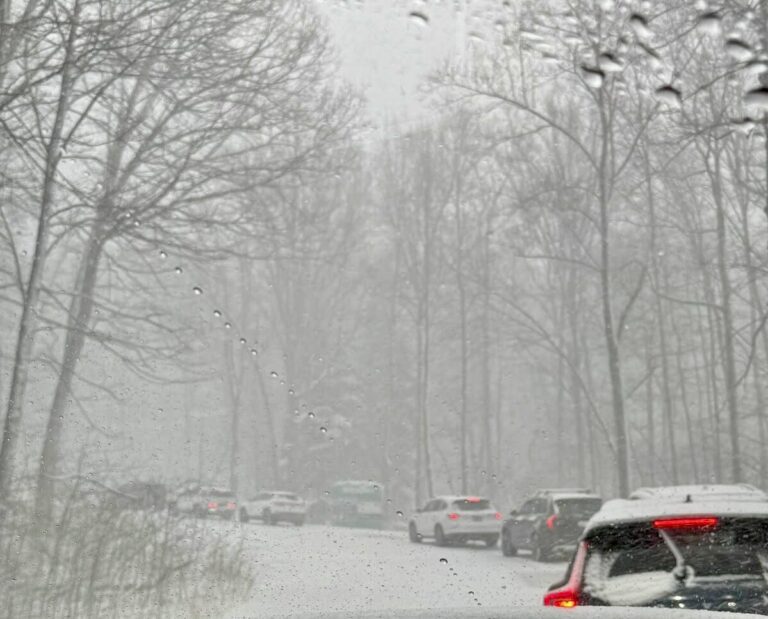
As predicted a major winter storm began moving though the area early Tuesday morning. Heavy snowfall combined with sleet and freezing rain made travel hazardous all across the area. To the south in in Southwestern Virginia a major ice storm plunged more than 100,000 people into the dark from downed trees and broken power poles.

A closer look at one of the semis that lost control attempting to go over the mountain and through Brents Gap Tuesday afternoon, February 11, 2025


Above, (updated) as of Thursday AEP crews were still dealing with extensive ice damage to the power grid in SW Virginia counties.

Of course with all of the snow and ice, Virginia State Police were busy working accidents.
“The winter storm that moved into Virginia Tuesday continues to impact the Commonwealth; however, the number of crashes has slowed this afternoon.

Since midnight on Feb. 11, 2025, (as of 4 p.m. on Feb. 12, 2025), there have been 951 crashes statewide, including 95 with reported injuries.  There have been no fatalities.

In the Virginia State Police’s Appomattox Division, covering much of central/western Virginia (Staunton, Charlottesville, Lynchburg, South Boston), there have been 121 crashes, eight of which had reported injuries.”

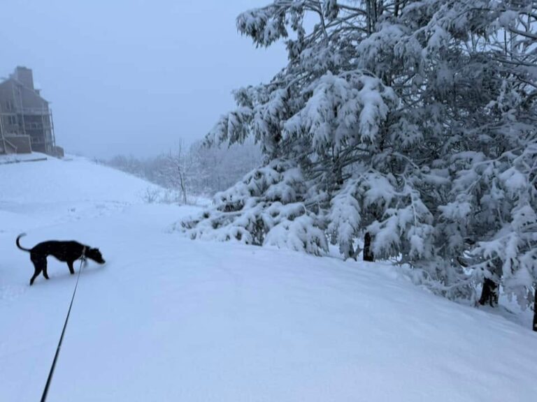
Varying amounts of snow fell but generally in the Central Virginia area amounts ranged from 8″ to around 1 foot.

Photo Bu Yvette Stafford : In spite of the headaches caused from the storm, it left some beautiful scenes across the area like this one in Roseland, Virginia of Nelson County.

Warmer temps are on the way that will melt a lot of the snow, followed by heavy rains over the coming weekend.

Another round of winter weather and cold temps are on the way for next week!

VSP : 11 AM Crash Update Across Area

0

From VSP Richmond:

“The winter storm that moved into Virginia overnight continues to impact the Commonwealth.
Since midnight tonight (as of 11 a.m. on Feb. 11, 2025), there have been 73 crashes, with a reported four injuries.  There have been no fatalities.
In the Virginia State Police’s Appomattox Division, covering much of western/central Virginia (including Charlottesville, Staunton, Lynchburg, and South Boston), there have been 7 crashes with no reported injuries.
Virginia State Police continue to encourage drivers to stay off the roads during the storm and allow the Virginia Department of Transportation and other emergency crews more space to work.

If you must travel, drivers are reminded to do the following:

• Use headlights. Increasing your visibility helps you to avoid slick and dangerous spots on the road, as well as helps other drivers see you better.
• Slow your speed. Though state police works closely with the Virginia Department of Transportation (VDOT) to identify problem areas on Virginia’s highways during a winter storm, drivers still must drive for conditions. Slowing your speed gives you more time to safely react and avoid a crash. Drive your vehicle based on your ability to properly maintain control of your vehicle.
• Don’t tailgate. You need increased stopping distance on slick road surfaces. Give yourself more space between vehicles traveling ahead of you to avoid rear end collisions.
• Buckle Up. Most crashes that occur during winter weather are caused by vehicles sliding into guardrails, off the road or other vehicles. Wearing your seat belt protects you from being thrown around the inside of your vehicle and suffering serious injury in a crash.
• Check Your Vehicle. Make sure your vehicle is in good working order for the conditions. Fill up the tank in advance. Check windshield wipers, windshield wiper fluid, tire tread, battery life, etc.
• Don’t leave home without a window scraper, blanket, bottled water, snack, cell phone charger and flashlight.

For the latest in road conditions and updates, please call 511 on a cell phone or go online to the VDOT Virginia Traffic Information Website at www.511virginia.org [511virginia.org].

Matthew Demlein
Public Relations Coordinator
Virginia State Police”

Weather Bulletin : Winter Storm Warning For Most Of Area Tuesday (2.11.25) Into Wednesday AM

0

Central Virginia Blue Ridge

WINTER STORM WARNING
URGENT – WINTER WEATHER MESSAGE
National Weather Service Baltimore MD/Washington DC
248 AM EST Mon Feb 10 2025

Augusta-Rockingham-Nelson-Albemarle-Greene-Madison-Orange-
Spotsylvania-Western Highland-Eastern Highland-Northern Virginia
Blue Ridge-Central Virginia Blue Ridge-Western Pendleton-Eastern
Pendleton-
248 AM EST Mon Feb 10 2025

…WINTER STORM WARNING IN EFFECT FROM 10 AM TUESDAY TO 7 AM EST
WEDNESDAY…

* WHAT…Heavy mixed precipitation expected. Total snow
accumulations between 4 and 6 inches and ice accumulations up to
two tenths of an inch.

* WHERE…Portions of central, northwest, and western Virginia and
eastern West Virginia.

* WHEN…From 10 AM Tuesday to 7 AM EST Wednesday.

* IMPACTS…Plan on slippery road conditions. The hazardous
conditions could impact the Tuesday evening and Wednesday morning
commutes.

PRECAUTIONARY/PREPAREDNESS ACTIONS…

If you must travel, keep an extra flashlight, food, and water in
your vehicle in case of an emergency. The latest road conditions for
the state you are calling from can be obtained by calling 5 1 1.

URGENT – WINTER WEATHER MESSAGE
National Weather Service Blacksburg VA
437 AM EST Mon Feb 10 2025

Botetourt-Rockbridge-Bedford-Amherst-Henry-Pittsylvania-Campbell-
Appomattox-Buckingham-Halifax-Charlotte-
Including the cities of Lexington, South Boston, Fincastle,
Bedford, Appomattox, Keysville, Buena Vista, Danville, Lynchburg,
Amherst, and Martinsville
437 AM EST Mon Feb 10 2025

…WINTER STORM WARNING REMAINS IN EFFECT FROM 6 AM TUESDAY TO NOON
EST WEDNESDAY…

* WHAT…Heavy mixed winter precipitation expected. Total snow and
sleet accumulations 3 to 6 inches and ice accumulations up to two
tenths of an inch possible. Locally higher ice amount along the
Blue Ridge.

* WHERE…Portions of southwest Virginia.

* WHEN…From 6 AM Tuesday to noon EST Wednesday.

* IMPACTS…Numerous power outages and tree damage are likely due to
the ice. Travel could be nearly impossible. Power outages may last
multiple days. The hazardous conditions could impact the Tuesday
morning and evening commutes and the Wednesday morning commute.

PRECAUTIONARY/PREPAREDNESS ACTIONS…

If you must travel, keep an extra flashlight, food, and water in
your vehicle in case of an emergency. The latest road conditions for
the state you are calling from can be obtained by calling 5 1 1.

Persons should delay all travel if possible. If travel is absolutely
necessary, drive with extreme caution and be prepared for sudden
changes in visibility. Leave plenty of room between you and the
motorist ahead of you, and allow extra time to reach your
destination. Avoid sudden braking or acceleration, and be especially
cautious on hills or when making turns. Make sure your car is
winterized and in good working order.

- Advertisement -