Home Blog Page 15

Increased Fire Danger For Part Of The Area : Tuesday 1.28.25 (EXPIRED)

0

INCREASED FIRE DANGER
Special Weather Statement
National Weather Service Baltimore MD/Washington DC
1014 AM EST Tue Jan 28 2025

Nelson-Albemarle-Greene-Madison-Orange-Culpeper-Stafford-
Spotsylvania-King George-Southern Fauquier-
Including the cities of Lovingston, Charlottesville,
Stanardsville, Madison, Orange, Gordonsville, Culpeper, Falmouth,
Fredericksburg, Dahlgren, and Turnbull
1014 AM EST Tue Jan 28 2025

…INCREASED FIRE DANGER FOR PORTIONS OF CENTRAL VIRGINIA
TODAY…

Relative humidities will drop to around 25 to 35 percent this
afternoon. Sustained west to northwest winds of 10 to 15 mph,
with gusts to 20 to 30 mph are expected. Due to dry conditions
from the lack of recent precipitation, there is an increased risk
for the spread of wildfires. Fuel moistures of 10 to 15 percent
can be expected.

Please refer to your local burn permitting authorities whether
you may burn outdoors. If you do burn outside, use extreme
caution. For Virginia, burning information can be found at
dof.virginia.gov.

Albemarle : VSP Investigating Fatal Plane Crash

0

Monocan Drive East
Albemarle County, Virginia

From Virginia State Police:

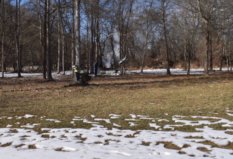
“Virginia State Police is investigating a small plane crash that occurred today (Jan. 25, 2025) at approximately 12:51 p.m. in a wooded area off of Monacan Drive East in Albemarle County.
There is one reported fatality.

State police are in the process of notifying next of kin.

The flight originated from Rockingham, N.C.

The Federal Aviation Administration and the National Transportation Safety Board have been notified.

Matthew Demlein
Public Relations Coordinator
Virginia State Police”

VDOT : Scheduled Construction & Maintenance Work – Week Of January 20th

0


CULPEPER DISTRICT: Jan. 20-24, 2025

CULPEPER — The following highway work is scheduled, weather permitting, in the Culpeper District during the next week. Traffic movements may be restricted, and speed limits may be reduced in work zones. (NEW) or (UPDATE) indicate revisions since last week’s report.

Culpeper District traffic information is also available on Twitter at @VaDOTCulp and on VDOT’s website at http://www.virginiadot.org/travel/travel_alerts/culpeper/default.asp.

Albemarle County 

(UPDATE) Tree trimming – Expect lane and shoulder closures in the following areas:

  • Interstate 64, left lane and left shoulder closures between mile marker 112 and mile marker 115 in the westbound lanes, daily through Friday, 6:30 a.m. to 3 p.m.
  • U.S. 29 (Seminole Trail), mobile work zone with right lane and right shoulder closures between Greene Edge Lane and Route 641 (Frays Mill Road) in the southbound lanes, daily through Friday, 9 a.m. to 3 p.m.

(UPDATE) Utility work under VDOT permit – Expect lane and shoulder closures in the following areas:

  • U.S. 250 (Rockfish Gap Turnpike), alternating lane closures between Route 240 (Crozet Avenue) and Route 797 (Hillsboro Lane) in the eastbound and westbound lanes, daily, 9 a.m. to 3:30 p.m.
  • Route 240 (Crozet Avenue), alternating lane closures between Route 691 (Jarmans Gap Road) and Route 240 (Three Notch’d Road) in the northbound and southbound lanes, daily, 9 a.m. to 3:30 p.m.
  • Route 240 (Three Notch’d Road), alternating lane closures between Route 240 (Crozet Avenue) and U.S. 250 (Rockfish Gap Turnpike) in the eastbound and westbound lanes, daily, 9 a.m. to 3:30 p.m.
  • Route 601 (Old Ivy Road), alternating lane closures between U.S. 29 (Bypass) and the Charlottesville city line in the northbound and southbound lanes, daily, 7 a.m. to 6 p.m.
  • Route 751 (Brownsville Road), both shoulders closed between Route 240 (Crozet Avenue) and U.S. 250 (Rockfish Gap Turnpike) in the eastbound and westbound lanes, daily, 9 a.m. to 1:30 p.m.
  • Route 797 (Hillsboro Lane), right shoulder closures between U.S. 250 (Rockfish Gap Turnpike) and Route 684 (Half Mile Branch Road) in the eastbound and westbound lanes, daily, 9 a.m. to 3:30 p.m.

Traffic engineering – Expect shoulder closures, 7 a.m. to 5 p.m., Monday through Friday in the following areas:

  • Route 20 (Scottsville Road), right shoulder closed at Route 708 (Red Hill Road) in the northbound lanes, 7 a.m. to 5 p.m.
  • Route 240 (Three Notch’D Road), both shoulder closed between Route 240 (Crozet Avenue) and Parkview Lane and Parkview Drive, 7 a.m. to 5 p.m.

(NEW) Interstate 64 – Maintenance. Expect right shoulder closure between mile marker 123 and mile marker 124 in the westbound lanes, Tuesday, 10 a.m. to 2 p.m.

Interstate 64 – Brush removal. Expect crews near the travel lanes from the Exit 124 ramp to U.S. 250 (Richmond Road) in the westbound lanes, daily through Friday, 8 a.m. to 4 p.m.

U.S. 29 (Seminole Trail) – Roadway improvements. Expect alternating lane closures between Route 3416 (Angus Road) and Seminole Court in the northbound and southbound lanes, nightly, Monday through Thursday, 9 p.m. to 6 a.m., 10 p.m. Friday to 9 a.m. Saturday, 9 p.m. Saturday to 10 a.m. Sunday, 8 p.m. Sunday to 6 a.m. Monday.

Route 797 (Hillsboro Lane) – Rehabilitation project. Expect alternating lane closures between Route 684 (Half Mile Branch Road) and U.S. 250 (Rockfish Gap Turnpike) in the eastbound and westbound lanes, daily, 9 a.m. to 3:30 p.m.

City of Charlottesville

Roadway improvements – Expect alternating lane closures Monday through Thursday, 9 p.m. to 6 a.m., 10 p.m. Friday to 9 a.m. Saturday, 9 p.m. Saturday to 10 a.m. Sunday, 8 p.m. Sunday to 6 a.m. Monday in the following areas:

  • U.S. 250 (Bypass), between Route 3412 (Dairy Road) and the ramp to U.S. 29 (Emmet Street) in the northbound and southbound lanes.
  • Route 743 (Hydraulic Road), between Route 3431 (Brandywine Drive) and U.S. 29 (Seminole Trail) in the eastbound and westbound lanes.

U.S. 29 Business (Fontaine Avenue) – Survey work. Expect a mobile work zone with right shoulder closures between Westerly Avenue and Observatory Avenue in the northbound and southbound lanes, daily, 7:30 a.m. to 4:30 p.m.

Culpeper County

(NEW) Construction – Expect right lane and right shoulder closures, daily, 9 a.m. to 3 p.m. in the following areas:

  • U.S. 15 (James Madison Highway), between Route 666 (Greens Corner Road) and U.S. 522 (Germanna Highway) in the southbound lanes.
  • U.S. 15 (James Madison Highway), between Route 665 (Inlet Road) and Route 674 (Kellys Ford Road) in the southbound lanes.
  • U.S. 29 (James Madison Highway), between Route 715 (Hubbards Road) and the Fauquier County line in the southbound lanes.

(UPDATE) Utility work under VDOT permit – Expect lane and shoulder closures in the following areas:

  • U.S. 15 (James Madison Highway), right shoulder closures between Route 684 (Bel Pre Road) and 2 miles south in the southbound lanes, daily, 9 a.m. to 3 p.m.
  • U.S. 15 (James Madison Highway), between Route 674 (Kellys Ford Road) and the Fauquier County line in the southbound lanes, daily, 9 a.m. to 3 p.m.
  • U.S. 522 (Germanna Highway), between U.S. 522 (Zachary Taylor Highway) and the Culpeper town line in the northbound and southbound lanes, 8 a.m. to 4 p.m.
  • U.S. 522 (Zachary Taylor Highway), between Route 652 (Cedar Grove Road) and Route 3 (Germanna Highway) in the northbound and southbound lanes, Monday through Friday, 8 a.m. to 4 p.m.

(NEW) U.S. 15 (James Madison Highway) – Tree trimming. Expect right lane and right shoulder closures between Route 715 (Hubbards Road) and Route 762 (Brandy Road) in the northbound lanes, daily, 9 a.m. to 4 p.m.

Fauquier County

Roadway improvements – Expect lane and shoulder closures in the following areas:

  • U.S. 17 Business (Broadview Avenue), alternating lane closures between Route 1893 (Winchester Street) and Hospital Drive in the northbound and southbound lanes, daily, 7 a.m. to 5 p.m.
  • U.S. 17 Business (Broadview Avenue), right lane and right shoulder closures between U.S. 211 (Frost Avenue) and U.S. 211 (West Lee Highway) in the northbound lanes, daily, 7 a.m. to 5 p.m.

(UPDATE) Tree trimming – Expect right lane and right shoulder closures, daily, in the following areas:

  • U.S. 15 (James Madison Highway), between Route 28 (Catlett Road) and the Culpeper County line in the northbound lanes, 7 a.m. to 2 p.m.
  • U.S. 29 (James Madison Highway), between the Culpeper County line and Route 687 (Opal Road) in the northbound lanes, 9 a.m. to 4 p.m.

Interstate 66 – Shoulder repairs. Expect alternating lane closures between mile marker 15 and mile marker 35 in the eastbound and westbound lanes, daily, through Friday, 7 a.m. to 3:30 p.m.

(NEW) U.S. 15 (James Madison Highway) – Construction. Expect right lane and right shoulder closures between Route 28 (Catlett Road) and the Culpeper County line in the northbound and southbound lanes, daily, 9 a.m. to 3 p.m.

U.S. 15 (West Lee Highway) – Utility work under VDOT permit. Expect right shoulder closure between Route 600 (Beverleys Mill Road) and Route 1405 (Nordix Drive) in the southbound lanes, daily, 9 a.m. to 3 p.m.

Greene County

(NEW) U.S. 29 (Seminole Trail) – Utility work under VDOT permit. Expect right lane and right shoulder closures at Route 607 (Cedar Grove Road) in the southbound lanes, daily, starting Tuesday, 9 a.m. to 3:30 p.m.

U.S. 33 (Spotswood Trail) – Traffic engineering. Expect both shoulders closed between Route 1105 (Advance Mills Road) and U.S. 29 (Seminole Trail) in the eastbound and westbound lanes, Monday through Friday, 7 a.m. to 5 p.m.

Louisa County

U.S. 15 (James Madison Highway) – Maintenance. Expect alternating lane closures between the Gordonsville town line and Zions Crossroads in the northbound and southbound lanes, daily, 8 a.m. to 4 p.m.

Route 208 (New Bridge Road) – Utility work under VDOT permit. Expect right shoulder closure between U.S. 522 (Zachary Taylor Highway) and Route 652 (Kentucky Springs Road) in the eastbound and westbound lanes, daily, 8:30 a.m. to 4 p.m.

Route 640 (East Jack Jouett Road) – Bridge repairs. Road closed between Route 613 (Poindexter Road) and Route 617 (Green Springs Road). Expected completion date is Jan. 17.

Madison County

(UPDATE) U.S. 29 (North Seminole Trail) – Pipe repairs/installation. Expect alternating lane closures between Route 612 (James City Road) and the Culpeper County line in the northbound and southbound lanes, daily through Friday, 9 a.m. to 3 p.m.

(NEW) Route 607 (Ridgeview Road) – Utility work under VDOT permit. Expect alternating lane closures between Route 609 (Hoover Road) and Route 606 (Novum Road) in the northbound and southbound lanes, daily, starting Wednesday, 9 a.m. to 3:30 p.m.

Orange County

U.S. 522 (Zachary Taylor Highway) – Utility work under VDOT permit. Expect alternating lane closures between Route 611 (Raccoon Ford Road) and the Culpeper County line in the northbound and southbound lanes, daily, 9 a.m. to 3:30 p.m.

Rappahannock County

Route 612 (Old Hollow Road) – Bridge superstructure repairs/replacement. Expect alternating lane closures between Route 600 (Thornton Gap Church Road) and Route 600 (Swindler Hollow Road) in the eastbound and westbound lanes, daily, 7 a.m. to 4 p.m.

(END)

VDOT’s nine-county Culpeper District includes the counties of Albemarle, Culpeper, Fauquier, Fluvanna, Greene, Louisa, Madison, Orange and Rappahannock. The independent city of Charlottesville maintains its own roads.

Weather Bulletin : Winter Weather Advisory For Parts Of Central Virginia

0

WINTER WEATHER ADVISORY
URGENT – WINTER WEATHER MESSAGE
National Weather Service Baltimore MD/Washington DC
342 AM EST Fri Jan 10 2025

VAZ036-037-508-101800-
/O.EXB.KLWX.WW.Y.0003.250111T0000Z-250111T0900Z/
Nelson-Albemarle-Central Virginia Blue Ridge-
342 AM EST Fri Jan 10 2025

…WINTER WEATHER ADVISORY IN EFFECT FROM 7 PM THIS EVENING TO 4 AM
EST SATURDAY…

* WHAT…Snow expected. Total snow accumulations up to 2 inches, and
isolated amounts up to 3 inches possible in southern Nelson county.

* WHERE…Albemarle and Nelson Counties, and Central Virginia Blue
Ridge.

* WHEN…From 7 PM this evening to 4 AM EST Saturday.

* IMPACTS…Roads, and especially bridges and overpasses, will
likely become slick and hazardous. Plan on slippery road
conditions.

* ADDITIONAL DETAILS…Light to moderate snow will overspread the
area this evening, then quickly come to an end early Saturday
morning.

PRECAUTIONARY/PREPAREDNESS ACTIONS…

Slow down and use caution while traveling. The latest road
conditions for the state you are calling from can be obtained by
calling 5 1 1.

Be prepared for slippery roads. Slow down and use caution while
driving. If you are going outside, watch your first few steps taken
on stairs, sidewalks, and driveways. These surfaces could be icy and
slippery, increasing your risk of a fall and injury.

Snow Day – Area Gets Hit With First Storm Of The Season

0

Central Virginia Blue Ridge
Nelson & Nearby Counties – Virginia

By Tommy Stafford

As predicted, a significant winter storm hit most of Virginia Sunday night into Monday morning shutting down roads, closing schools and causing wrecks all across the state.

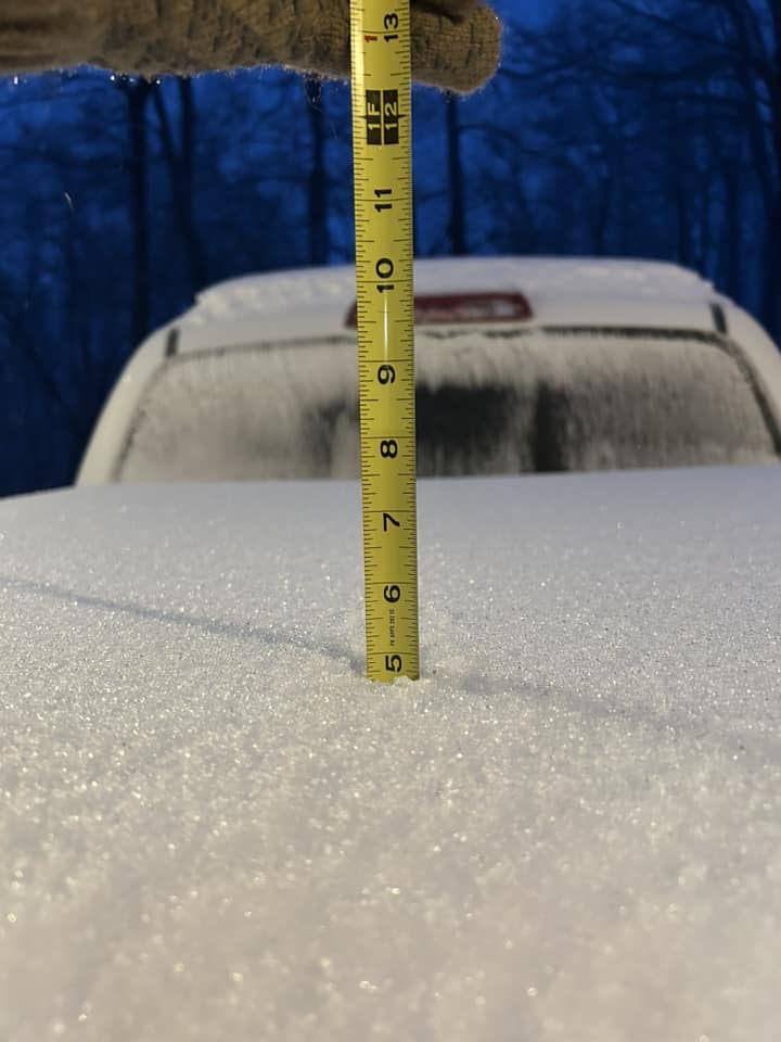
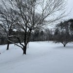
Photo By Michael Woolard – By early Monday morning around 5 inches of snow had fallen at Wintergreen. Most locations down below were seeing similar amounts with some locations in the nearby area reporting as much as 7 to 8 inches of snow. Monday – January 6, 2025

The snow began falling Sunday night and lasted for several hours but those, particularly, south of I-64 began seeing snow turn to heavy sleet that lasted overnight. The sleet compacted the snow down leaving an icy frozen mess on top.

From 4 AM Until 11 AM Monday, Virginia State Police reported numerous crashes already being worked.

“Div 1. (Richmond) –  Virginia State Police has responded to 96 crashes, four with reported injuries.

Div 2. (Culpeper – NWVA) – Virginia State Police has responded to 33 crashes, one with reported injuries.

Div 3. (Appomattox – Central/West Va.) –  Virginia State Police has responded to 22 crashes, one with reported injuries.

Div 4 (Wytheville – SWVA) –  VSP has responded to 11 crashes, none with reported injuries.

Div. 5 (Hampton Roads) – VSP has responded to 22 crashes, six with reported injuries.

Div. 6 (Salem – Western Va.) VSP has responded to 31 crashes, four with reported injuries.

Div. 7 (NOVA) –  VSP has responded to 33 crashes, three with reported injuries.”

As mentioned above, most schools (and many businesses) closed on Monday as snow wontinued to fall in the early morning hours.

Here’s a few more phots sent to us from across the area in our gallery below.


By Tuesday most of the primary roads has been cleared but many secondary roads remained impassable or slick and dangerous.

Very cold subfreezing temps will continue to stay in place across the area for the foreseeable future.

Another chance for moderate snowfall is in the forecast on Friday night.

Preps Underway For Approaching Winter Storm

0

Central Virginia Blue Ridge
Nelson County, Virginia

As we’ve been posting for the last two to three days, winter weather is on the way for just about all of Virginia. In advance of the storm, which is expected to have a significant impact across the state, crews have been pre-treating roads and prepping for snow removal when needed.

There are also planned closures of the Blue Ridge Parkway as well, here’s a link to their page that has the latest closures and at what milepost.

As shown in the graphic above, wintry precipitation will begin in Central Virginia in the evening and overnight hours Sunday, and continuing into Monday.

Winter Storm Warning : Sunday Evening Into Late Monday Night / Tuesday AM !!EXPIRED!!

1

WINTER STORM WARNING
URGENT – WINTER WEATHER MESSAGE
National Weather Service Baltimore MD/Washington DC
354 PM EST Sat Jan 4 2025

Nelson-Albemarle-Greene-Orange-Spotsylvania-Northern Virginia
Blue Ridge-Central Virginia Blue Ridge-
354 PM EST Sat Jan 4 2025

…WINTER STORM WARNING IN EFFECT FROM 6 PM SUNDAY TO 1 AM EST
TUESDAY…

* WHAT…Heavy mixed precipitation expected. Total snow and sleet
accumulations between 5 and 9 inches, with amounts of 10 to 12
inches possible in isolated spots if heavy banding sets up in this
area. Ice accumulations around a tenth to a quarter of an inch.

* WHERE…Portions of central and northwest Virginia.

* WHEN…From 6 PM Sunday to 1 AM EST Tuesday. Highest snowfall
rates occur overnight Sunday into early Monday morning. Snow will
mix with sleet and freezing rain Monday morning into the
afternoon, especially along and south of Interstate 66. A lull in
precipitation will occur sometime during the afternoon.

* IMPACTS…Roads, and especially bridges and overpasses, will
likely become slick and hazardous. Power outages and tree damage
are likely due to the ice. Travel could be nearly impossible. The
hazardous conditions could impact the Monday morning and evening
commutes.

* ADDITIONAL DETAILS…A second round of heavy snow is possible
Monday evening before precipitation ends.

PRECAUTIONARY/PREPAREDNESS ACTIONS…

If you must travel, keep an extra flashlight, food, and water in
your vehicle in case of an emergency. The latest road conditions for
the state you are calling from can be obtained by calling 5 1 1.

Persons should consider delaying all travel. If travel is absolutely
necessary, drive with extreme caution. Consider taking a winter
storm kit along with you, including such items as tire chains,
booster cables, flashlight, shovel, blankets and extra clothing.
Also take water, a first aid kit, and anything else that would help
you survive in case you become stranded.

URGENT – WINTER WEATHER MESSAGE
National Weather Service Baltimore MD/Washington DC
354 PM EST Sat Jan 4 2025

Augusta-Rockingham-Eastern Highland-Eastern Pendleton-
354 PM EST Sat Jan 4 2025

…WINTER STORM WARNING IN EFFECT FROM 6 PM SUNDAY TO 1 AM EST
TUESDAY…

* WHAT…Heavy mixed precipitation expected. Total snow and sleet
accumulations between 5 and 8 inches, with amounts of 9 to 11
inches possible in isolated spots if heavy banding sets up in this
area. Additionally, ice accumulations up to two tenths of an inch.

* WHERE…In Virginia, Augusta, Eastern Highland, and Rockingham
Counties. In West Virginia, Eastern Pendleton County.

* WHEN…From 6 PM Sunday to 1 AM EST Tuesday. Highest snowfall
rates occur overnight Sunday into early Monday morning. Snow will
mix with sleet and freezing rain Monday morning into the
afternoon. A lull in precipitation will occur sometime during the
afternoon.

* IMPACTS…Roads, and especially bridges and overpasses, will
likely become slick and hazardous. Travel could be very difficult.
The hazardous conditions could impact the Monday morning and
evening commutes.

* ADDITIONAL DETAILS…A second round of heavy snow is possible
Monday evening before precipitation ends.

PRECAUTIONARY/PREPAREDNESS ACTIONS…

If you must travel, keep an extra flashlight, food, and water in
your vehicle in case of an emergency. The latest road conditions for
the state you are calling from can be obtained by calling 5 1 1.

Persons should consider delaying all travel. If travel is absolutely
necessary, drive with extreme caution. Consider taking a winter
storm kit along with you, including such items as tire chains,
booster cables, flashlight, shovel, blankets and extra clothing.
Also take water, a first aid kit, and anything else that would help
you survive in case you become stranded.

URGENT – WINTER WEATHER MESSAGE
National Weather Service Blacksburg VA
231 PM EST Sat Jan 4 2025

Ashe-Alleghany NC-Watauga-Tazewell-Smyth-Bland-Giles-Wythe-
Pulaski-Montgomery-Grayson-Carroll-Floyd-Craig-Alleghany VA-Bath-
Roanoke-Botetourt-Rockbridge-Patrick-Franklin-Bedford-Amherst
Henry-Campbell-Appomattox-Buckingham-Mercer-Summers-Monroe-
Eastern Greenbrier-Western Greenbrier-
Including the cities of Hot Springs, White Sulphur Springs,
Blacksburg, Boone, Lewisburg, Marion, Rainelle, Tazewell,
Covington, Alderson, Roanoke, Quinwood, Clifton Forge, Stuart,
Independence, Volney, Appomattox, Pearisburg, Lynchburg, Salem,
Bluefield, Buena Vista, Whitetop, Pulaski, Fincastle, Flat Top,
Union, Radford, Floyd, Wytheville, Amherst, Duo, Galax, Bland,
Bedford, Hix, Hinton, West Jefferson, Troutdale, Lexington, New
Castle, Sparta, Rocky Mount, and Martinsville
231 PM EST Sat Jan 4 2025

…WINTER STORM WARNING IN EFFECT FROM NOON SUNDAY TO 7 PM EST
MONDAY…

* WHAT…Heavy mixed precipitation expected. Total snow
accumulations between 1 and 5 inches and ice accumulations up to
four tenths of an inch.

* WHERE…Portions of northwest North Carolina, central, south
central, southwest, and west central Virginia, and southeast West
Virginia.

* WHEN…From noon Sunday to 7 PM EST Monday.

* IMPACTS…Significant ice accumulation on power lines and tree
limbs may cause scattered and long-lasting power outages. Power
outages and tree damage are likely due to the ice. Travel could be
nearly impossible. The hazardous conditions could impact the
Monday morning and evening commutes.

PRECAUTIONARY/PREPAREDNESS ACTIONS…

If you must travel, keep an extra flashlight, food, and water in
your vehicle in case of an emergency. The latest road conditions for
the state you are calling from can be obtained by calling 5 1 1.

Do not touch downed lines and report any power outages to your
electric company. Travel is highly discouraged due to slick roadways
and the possibility of downed trees and power lines.

Significant Winter Storm Headed For Much Of Virginia Sunday / Monday !!EXPIRED!!

0

WINTER STORM WATCH
URGENT – WINTER WEATHER MESSAGE
National Weather Service Baltimore MD/Washington DC
1117 AM EST Sat Jan 4 2025

Augusta-Rockingham-Nelson-Albemarle-Greene-Orange-Spotsylvania-
Western Highland-Eastern Highland-Northern Virginia Blue Ridge-
Central Virginia Blue Ridge-Western Pendleton-Eastern Pendleton-
1117 AM EST Sat Jan 4 2025

…WINTER STORM WATCH REMAINS IN EFFECT FROM SUNDAY AFTERNOON
THROUGH MONDAY EVENING…

* WHAT…Heavy snow, sleet, and freezing rain possible. Total snow
and sleet accumulations of 5 inches or greater and ice
accumulations up to one quarter of an inch possible. A localized
band with up to 10 inches of snow is possible.

* WHERE…Portions of central, northwest, and western Virginia and
eastern West Virginia.

* WHEN…From Sunday afternoon through Monday evening.

* IMPACTS…Travel could be very difficult. The hazardous conditions
could impact the Monday morning and evening commutes.

PRECAUTIONARY/PREPAREDNESS ACTIONS…

Monitor the latest forecasts for updates on this situation.

URGENT – WINTER WEATHER MESSAGE
National Weather Service Blacksburg VA
714 AM EST Sat Jan 4 2025

Ashe-Alleghany NC-Watauga-Tazewell-Smyth-Bland-Giles-Wythe-
Pulaski-Montgomery-Grayson-Carroll-Floyd-Craig-Alleghany VA-Bath-
Roanoke-Botetourt-Rockbridge-Patrick-Franklin-Bedford-Amherst-
Henry-Campbell-Appomattox-Buckingham-Mercer-Summers-Monroe-
Eastern Greenbrier-
Including the cities of Hot Springs, White Sulphur Springs,
Blacksburg, Boone, Lewisburg, Marion, Tazewell, Covington,
Alderson, Roanoke, Clifton Forge, Stuart, Independence, Volney,
Appomattox, Pearisburg, Lynchburg, Salem, Bluefield, Buena Vista,
Whitetop, Pulaski, Fincastle, Flat Top, Union, Radford, Floyd,
Wytheville, Amherst, Galax, Bland, Bedford, Hix, Hinton, West
Jefferson, Troutdale, Lexington, New Castle, Sparta, Rocky Mount,
and Martinsville
714 AM EST Sat Jan 4 2025

…WINTER STORM WATCH REMAINS IN EFFECT FROM SUNDAY MORNING THROUGH
MONDAY EVENING…

* WHAT…Heavy mixed precipitation possible. Total snow
accumulations up to 3 inches and ice accumulations between one
tenth and three tenths of an inch possible.

* WHERE…Portions of northwest North Carolina, central, south
central, southwest, and west central Virginia, and southeast West
Virginia.

* WHEN…From Sunday morning through Monday evening.

* IMPACTS…Power outages and tree damage are likely due to the ice.
Travel could be nearly impossible. The hazardous conditions could
impact the Monday morning and evening commutes.

PRECAUTIONARY/PREPAREDNESS ACTIONS…

Monitor the latest forecasts for updates on this situation.

Freak New Year’s Eve Thunderstorms Hit Area Dropping Hail (Video)

0

Central Virginia Blue Ridge Area
Nelson County, Virginia

By Tommy Stafford 

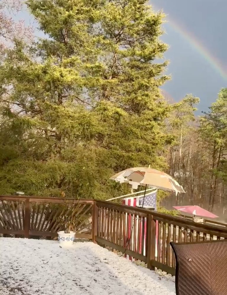
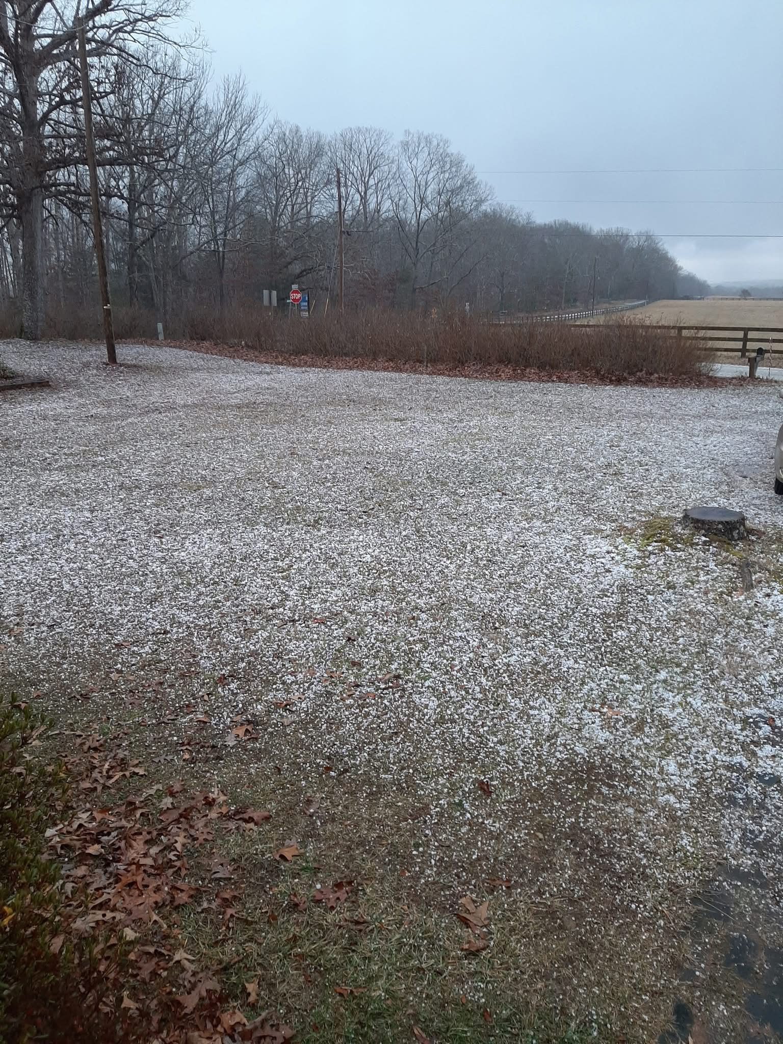
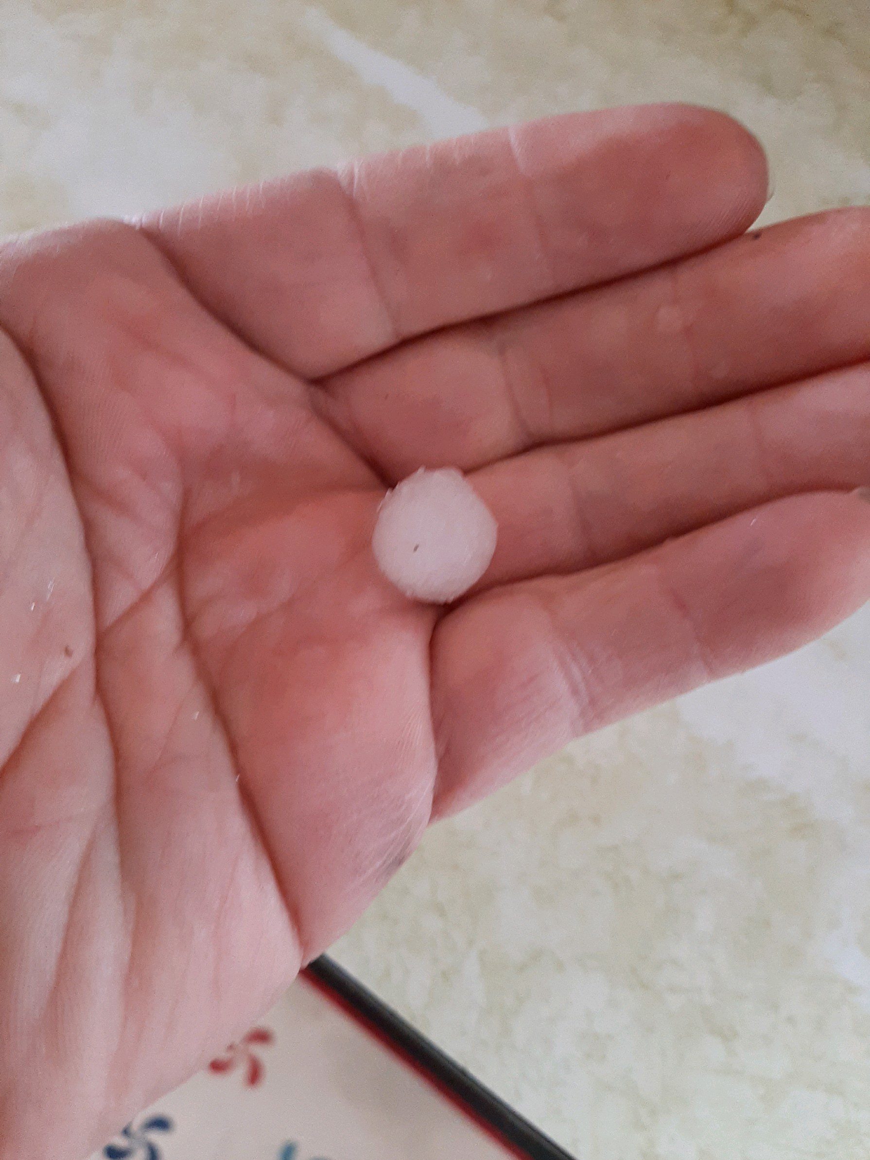
2024 isn’t going out easily! An unusual line of thunderstorms moved across the area between 2 and 4 PM Tuesday afternoon. The storms produced a lot of hail ranging in size from peas to dimes and even larger in some locations. We had reports from Arrington, Shipman, Schuyler, Tye River, Lovingston, Roseland and beyond.


Above Patricia Snapp describes the hail damage and a beautiful rainbow shortly afterwards in Schuyler. That’s a lot of hail!

Photo By Tom Holliday : Hail covers the yard of Tom Holliday in Arrington, Virginia of Nelson County after severe thunderstorms moved through Tuesday afternoon on the last day of 2024. December 31, 2024

Photo By Tom Holliday : Tom holds up a piece of the hail that fell on his property in Arrington Tuesday afternoon. He estimated the size to be between 1/4 to 1/2″ in diameter. He later found an even bigger one on a walk nearby. December 31, 2024

This is just a small sampling of the dozens of photos and videos we saw or had submitted Tuesday afternoon.

The storms moved out as quickly as they moved in.

Strong, gusty westerly winds will be the next thing we deal with overnight tonight and really for the next 2-3 days. Then eyes on the upcoming weekend during the Sunday-Monday time frame when there’s a hint at some wintry weather.

Weather Bulletin : Wind Advisory Along & West of BRP & Some Points South

0

WIND ADVISORY
URGENT – WEATHER MESSAGE
National Weather Service Blacksburg VA
118 PM EST Tue Dec 31 2024

Ashe-Alleghany NC-Surry-Watauga-Wilkes-Tazewell-Smyth-Bland-Giles-
Wythe-Pulaski-Montgomery-Grayson-Carroll-Floyd-Craig-Alleghany VA-
Bath-Roanoke-Botetourt-Rockbridge-Patrick-Franklin-Bedford-
Amherst-Mercer-Summers-Monroe-Eastern Greenbrier-Western
Greenbrier-
Including the cities of White Sulphur Springs, Lexington, Buena
Vista
, Rainelle, Troutdale, Stuart, Hot Springs, Wytheville, Hix,
Fincastle, Whitetop, Wilkesboro, Floyd, Marion, Bland, Quinwood,
Clifton Forge, Galax, Independence, Blacksburg, Covington, Union,
Alderson, Bluefield, Flat Top, Sparta, Dobson, Volney, Tazewell,
Hinton, Salem, Rocky Mount, Pearisburg, Pulaski, Lewisburg, Duo,
Roanoke, Boone, West Jefferson, Radford, Bedford, Amherst, and
New Castle
118 PM EST Tue Dec 31 2024

…WIND ADVISORY REMAINS IN EFFECT FROM 10 PM THIS EVENING TO NOON
EST WEDNESDAY…

* WHAT…West winds 15 to 30 mph with gusts up to 50 mph expected.

* WHERE…The mountains and foothills of northwest North Carolina,
southwest Virginia, and southeast West Virginia

* WHEN…From 10 PM this evening to noon EST Wednesday.

* IMPACTS…Gusty winds will blow around unsecured objects. Tree
limbs could be blown down and a few power outages may result.

PRECAUTIONARY/PREPAREDNESS ACTIONS…

Winds this strong can make driving difficult, especially for high
profile vehicles. Use extra caution.

Secure outdoor objects.

URGENT – WEATHER MESSAGE
National Weather Service Baltimore MD/Washington DC
115 PM EST Tue Dec 31 2024

District of Columbia-Washington-Frederick MD-Carroll-Northern
Baltimore-Cecil-Southern Baltimore-Prince Georges-Anne Arundel-
Central and Eastern Allegany-Northwest Montgomery-Central and
Southeast Montgomery-Northwest Howard-Central and Southeast
Howard-Northwest Harford-Southeast Harford-Augusta-Rockingham-
Shenandoah-Frederick VA-Page-Warren-Clarke-Rappahannock-Fairfax-
Arlington/Falls Church/Alexandria-Northern Fauquier-Eastern
Highland-Western Loudoun-Eastern Loudoun-Northern Virginia Blue
Ridge-Central Virginia Blue Ridge – (Includes Wintergreen)
Northwest Prince William-
Central and Southeast Prince William/Manassas/Manassas Park-
Hampshire-Morgan-Berkeley-Jefferson-Hardy-Eastern Grant-Eastern
Mineral-Eastern Pendleton-
115 PM EST Tue Dec 31 2024

…WIND ADVISORY IN EFFECT FROM 7 AM TO 7 PM EST WEDNESDAY…

* WHAT…West winds 15 to 25 mph with gusts around 50 mph.

* WHERE…Portions of DC, central, north central, northeast,
northern, and western Maryland, central, northern, northwest, and
western Virginia, and eastern and panhandle West Virginia.

* WHEN…From 7 AM to 7 PM EST Wednesday.

* IMPACTS…Gusty winds will blow around unsecured objects. Tree
limbs could be blown down and a few sporadic power outages may
result. Highest gusts will likely occur late Wednesday morning
through Wednesday mid-afternoon.

PRECAUTIONARY/PREPAREDNESS ACTIONS…

Winds this strong can make driving difficult, especially for high
profile vehicles. Use extra caution.

Secure outdoor objects.

- Advertisement -