Nelson County, Virginia
This story has been updated to reflect corrections. Apparently the helicopters seen on September 12, 2024 over Nelson were not USGS.
Here’s a link to the updated story.
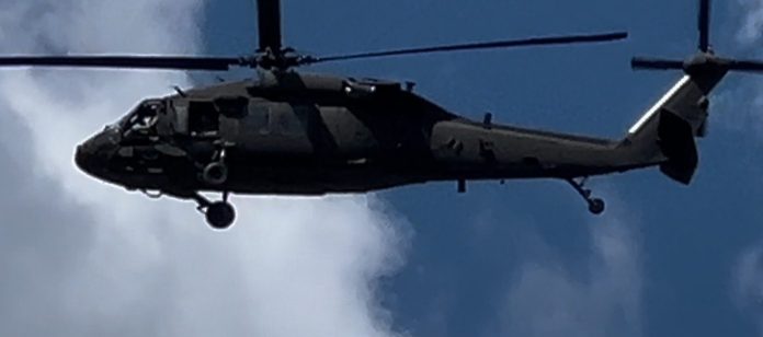
To say our inbox and messaging has been blowing up Thursday afternoon would be an understatement. People were sending us photos and videos of a low flying, military style helicopter over Afton and some other parts of the county.
Be sure and click through (above on the Facebook logo – lower right) and read the comments on Facebook page.
We checked with Nelson County Sheriff Mark Embrey to see if a search was ongoing or smething similar. The sheriff told us no.
After lots of checking and Facebook commenter, Travis Wheeler on our page, we have the answer.

On their site in the release they say, “Low-level airplane and helicopter flights are planned over broad regions of North Carolina, South Carolina, Virginia, and West Virginia to image geology using airborne geophysical technology. The airborne survey will be conducted from August of 2024 for approximately one year, weather and wildfire restrictions permitting.
The survey is being coordinated by the U.S. Geological Survey with the goal of providing images that expand the fundamental knowledge of geology across the region.
The survey will help map rocks and minerals at the surface across vast regions that may have limited outcrop due to vegetation and unconsolidated rock cover. It will also help map subsurface geology, where some rocks can be located hundred to thousands of meters (more than 3280 feet) below the surface based on their magnetic signature. Such mapping can improve the understanding of the geologic framework within which the potential mineral resource may occur.
The new geophysical data will be processed to develop high-resolution three-dimensional representations of bedrock composition and structure to depths more than 3,280 feet (1 kilometer) below the surface.”
So that’s what folks are seeing!
Here’s a link to the complete release.


[…] Last week we mistakenly thought we’d solved the mystery of the military style helicopters flying low over Nelson and other nearby counties. Here’s a link to that post. […]